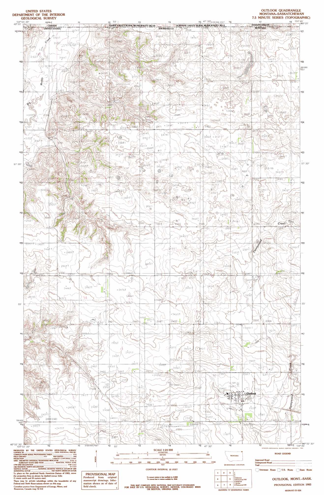
Outlook Topo Map Montana
To zoom in, hover over the map of Outlook
USGS Topo Quad 48104h7 - 1:24,000 scale
| Topo Map Name: | Outlook |
| USGS Topo Quad ID: | 48104h7 |
| Print Size: | ca. 21 1/4" wide x 27" high |
| Southeast Coordinates: | 48.875° N latitude / 104.75° W longitude |
| Map Center Coordinates: | 48.9375° N latitude / 104.8125° W longitude |
| U.S. State: | MT |
| Filename: | o48104h7.jpg |
| Download Map JPG Image: | Outlook topo map 1:24,000 scale |
| Map Type: | Topographic |
| Topo Series: | 7.5´ |
| Map Scale: | 1:24,000 |
| Source of Map Images: | United States Geological Survey (USGS) |
| Alternate Map Versions: |
Outlook MT 1983, updated 1983 Download PDF Buy paper map Outlook MT 2011 Download PDF Buy paper map Outlook MT 2014 Download PDF Buy paper map |
1:24,000 Topo Quads surrounding Outlook
Goodale Coulee |
Daleview |
Outlook |
Plentywood Nw |
Raymond |
Navajo |
Redstone |
Archer |
Plentywood Sw |
Plentywood |
Pleasant Prairie Ne |
Soo Nw |
Soo Ne |
Kisler Butte |
Shippe Canyon |
> Back to 48104e1 at 1:100,000 scale
> Back to 48104a1 at 1:250,000 scale
> Back to U.S. Topo Maps home
Outlook topo map: Gazetteer
Outlook: Dams
Miller Dam elevation 736m 2414′Outlook: Populated Places
Outlook elevation 716m 2349′Outlook: Post Offices
Outlook Post Office elevation 719m 2358′Outlook: Wells
37N52E26AA__01 Well elevation 729m 2391′Outlook digital topo map on disk
Buy this Outlook topo map showing relief, roads, GPS coordinates and other geographical features, as a high-resolution digital map file on DVD:
Eastern Montana & Western North Dakota
Buy digital topo maps: Eastern Montana & Western North Dakota