Flynn Creek North Topo Map Montana
To zoom in, hover over the map of Flynn Creek North
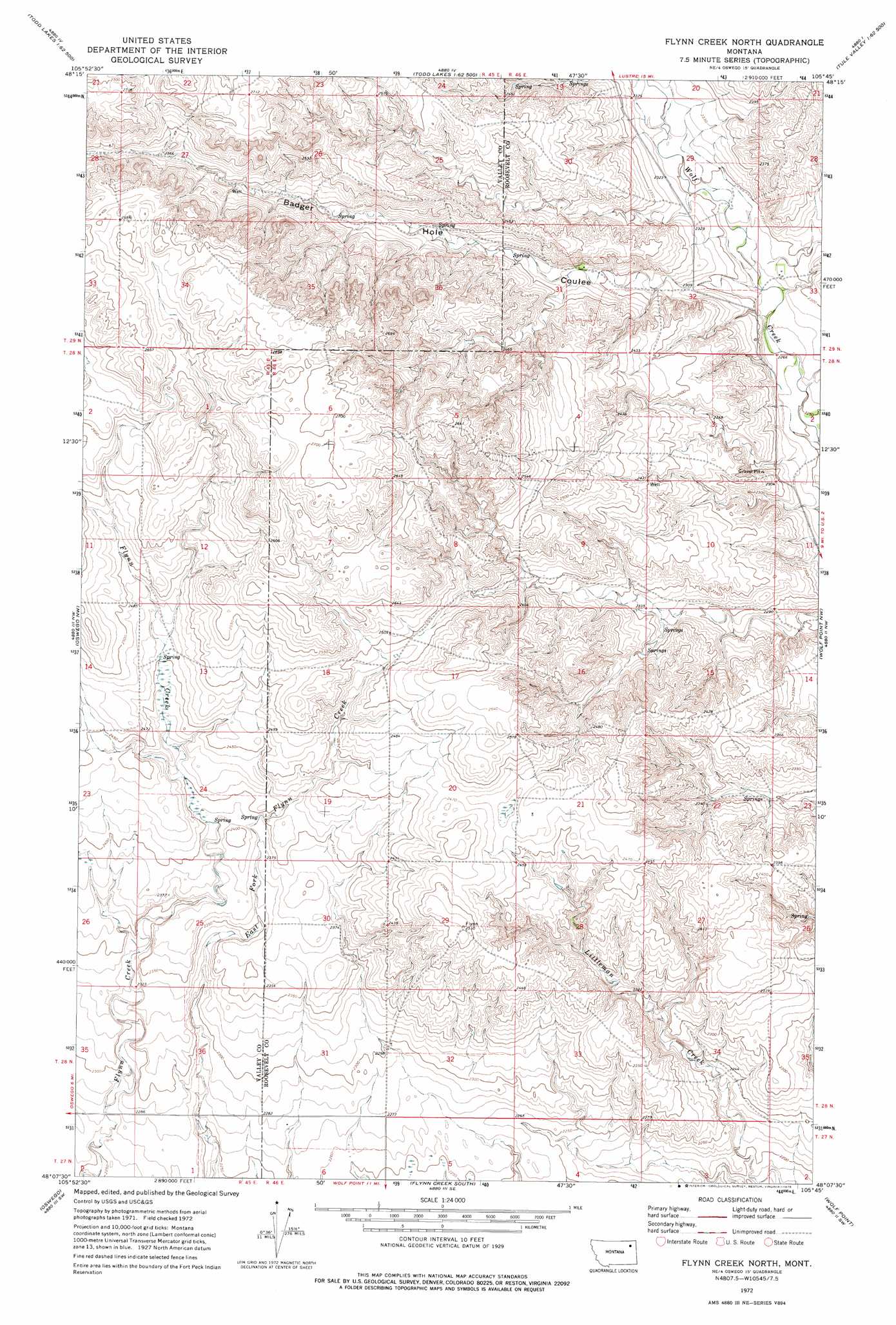
USGS Topo Quad 48105b7 - 1:24,000 scale
| Topo Map Name: | Flynn Creek North |
| USGS Topo Quad ID: | 48105b7 |
| Print Size: | ca. 21 1/4" wide x 27" high |
| Southeast Coordinates: | 48.125° N latitude / 105.75° W longitude |
| Map Center Coordinates: | 48.1875° N latitude / 105.8125° W longitude |
| U.S. State: | MT |
| Filename: | o48105b7.jpg |
| Download Map JPG Image: | Flynn Creek North topo map 1:24,000 scale |
| Map Type: | Topographic |
| Topo Series: | 7.5´ |
| Map Scale: | 1:24,000 |
| Source of Map Images: | United States Geological Survey (USGS) |
| Alternate Map Versions: |
Flynn Creek North MT 1972, updated 1975 Download PDF Buy paper map Flynn Creek North MT 2011 Download PDF Buy paper map Flynn Creek North MT 2014 Download PDF Buy paper map |
1:24,000 Topo Quads surrounding Flynn Creek North
Spring Valley East |
Lustre |
Todd Lakes Ne |
Volt |
Reed Springs |
Hauck Coulee |
Todd Lakes |
Todd Lakes Se |
Tule Valley West |
Tule Valley East |
Dubbe Reservoir |
Oswego Nw |
Flynn Creek North |
Wolf Point Nw |
Wolf Point Ne |
Frazer |
Oswego |
Flynn Creek South |
Wolf Point |
Macon |
Pasture Creek |
Turtle Creek |
Emily Coulee |
Antelope Creek Res. |
Rock Creek |
> Back to 48105a1 at 1:100,000 scale
> Back to 48104a1 at 1:250,000 scale
> Back to U.S. Topo Maps home
Flynn Creek North topo map: Gazetteer
Flynn Creek North: Springs
29N45E26DCDD01 Spring elevation 759m 2490′29N45E36BAAA01 Spring elevation 744m 2440′
Flynn Creek North: Valleys
Badger Hole Coulee elevation 695m 2280′Flynn Creek North: Wells
27N46E06BB__01 Well elevation 696m 2283′28N46E02BBCB01 Well elevation 674m 2211′
28N46E05CBCA01 Well elevation 809m 2654′
28N46E05DDAD01 Well elevation 784m 2572′
28N46E06BAAC01 Well elevation 822m 2696′
28N46E09ABBC01 Well elevation 758m 2486′
28N46E10BBBB01 Well elevation 739m 2424′
28N46E18AADD01 Well elevation 765m 2509′
28N46E32BCCC01 Well elevation 701m 2299′
Flynn Creek North digital topo map on disk
Buy this Flynn Creek North topo map showing relief, roads, GPS coordinates and other geographical features, as a high-resolution digital map file on DVD:
Eastern Montana & Western North Dakota
Buy digital topo maps: Eastern Montana & Western North Dakota