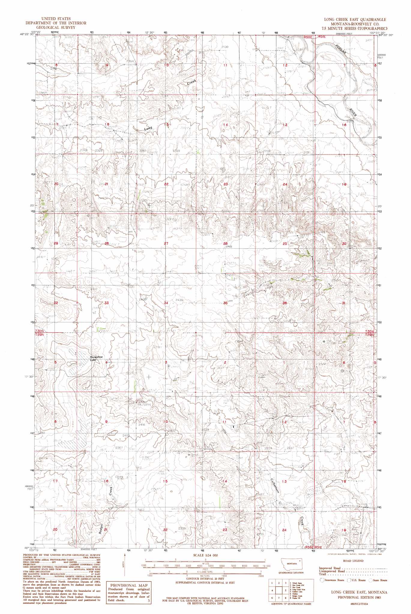
Long Creek East Topo Map Montana
To zoom in, hover over the map of Long Creek East
USGS Topo Quad 48105c2 - 1:24,000 scale
| Topo Map Name: | Long Creek East |
| USGS Topo Quad ID: | 48105c2 |
| Print Size: | ca. 21 1/4" wide x 27" high |
| Southeast Coordinates: | 48.25° N latitude / 105.125° W longitude |
| Map Center Coordinates: | 48.3125° N latitude / 105.1875° W longitude |
| U.S. State: | MT |
| Filename: | o48105c2.jpg |
| Download Map JPG Image: | Long Creek East topo map 1:24,000 scale |
| Map Type: | Topographic |
| Topo Series: | 7.5´ |
| Map Scale: | 1:24,000 |
| Source of Map Images: | United States Geological Survey (USGS) |
| Alternate Map Versions: |
Long Creek East MT 1983, updated 1983 Download PDF Buy paper map Long Creek East MT 2011 Download PDF Buy paper map Long Creek East MT 2014 Download PDF Buy paper map |
1:24,000 Topo Quads surrounding Long Creek East
Nielsen Coulee |
Bredette |
Pleasant Prairie Sw |
Pleasant Prairie |
Soo |
Bears Nest |
Windy Butte |
Hay Creek Nw |
Hay Creek |
Beam School |
Sims Spring |
Long Creek West |
Long Creek East |
Geddart Lake |
Smoke Creek Sw |
Chelsea Nw |
Chelsea |
Badger Creek |
Poplar Ne |
Brockton |
Chelsea Sw |
Nickwall |
Poplar |
Sprole |
Mortarstone Bluff |
> Back to 48105a1 at 1:100,000 scale
> Back to 48104a1 at 1:250,000 scale
> Back to U.S. Topo Maps home
Long Creek East topo map: Gazetteer
Long Creek East: Lakes
Horseshoe Lake elevation 724m 2375′Long Creek East: Streams
Long Creek elevation 636m 2086′Long Creek East: Wells
29N50E10CDCD01 Well elevation 731m 2398′29N50E14CDAD01 Well elevation 720m 2362′
29N50E14CDDD01 Well elevation 722m 2368′
29N50E15BB__01 Well elevation 727m 2385′
29N50E23BAAA01 Well elevation 723m 2372′
29N51E17CCCC01 Well elevation 630m 2066′
30N50E20ABAA01 Well elevation 706m 2316′
30N50E21CACA01 Well elevation 727m 2385′
30N50E35ABAC01 Well elevation 740m 2427′
30N51E30DDAB01 Well elevation 659m 2162′
35N50E19CCDB01 Well elevation 723m 2372′
Long Creek East digital topo map on disk
Buy this Long Creek East topo map showing relief, roads, GPS coordinates and other geographical features, as a high-resolution digital map file on DVD:
Eastern Montana & Western North Dakota
Buy digital topo maps: Eastern Montana & Western North Dakota