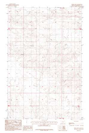
Bears Nest Topo Map Montana
To zoom in, hover over the map of Bears Nest
USGS Topo Quad 48105d4 - 1:24,000 scale
| Topo Map Name: | Bears Nest |
| USGS Topo Quad ID: | 48105d4 |
| Print Size: | ca. 21 1/4" wide x 27" high |
| Southeast Coordinates: | 48.375° N latitude / 105.375° W longitude |
| Map Center Coordinates: | 48.4375° N latitude / 105.4375° W longitude |
| U.S. State: | MT |
| Filename: | o48105d4.jpg |
| Download Map JPG Image: | Bears Nest topo map 1:24,000 scale |
| Map Type: | Topographic |
| Topo Series: | 7.5´ |
| Map Scale: | 1:24,000 |
| Source of Map Images: | United States Geological Survey (USGS) |
| Alternate Map Versions: |
Bears Nest MT 1983, updated 1983 Download PDF Buy paper map Bears Nest MT 1983, updated 1986 Download PDF Buy paper map Bears Nest MT 2011 Download PDF Buy paper map Bears Nest MT 2014 Download PDF Buy paper map |
1:24,000 Topo Quads surrounding Bears Nest
> Back to 48105a1 at 1:100,000 scale
> Back to 48104a1 at 1:250,000 scale
> Back to U.S. Topo Maps home
Bears Nest topo map: Gazetteer
Bears Nest: Dams
Fort Peck Reservation Number 21 Dam elevation 821m 2693′Bears Nest: Springs
Snell Spring elevation 775m 2542′Bears Nest: Summits
Bears Nest elevation 810m 2657′Bears Nest: Wells
30N48E02BBDA01 Well elevation 815m 2673′31N48E01ACCD02 Well elevation 751m 2463′
31N48E25BBCB01 Well elevation 818m 2683′
31N48E25BC__01 Well elevation 812m 2664′
31N48E26BCDA01 Well elevation 821m 2693′
31N48E28BABD01 Well elevation 827m 2713′
31N48E28BACB01 Well elevation 827m 2713′
32N48E27CACD01 Well elevation 767m 2516′
32N49E31DCBB01 Well elevation 727m 2385′
32N49E31DCDC01 Well elevation 727m 2385′
Bears Nest digital topo map on disk
Buy this Bears Nest topo map showing relief, roads, GPS coordinates and other geographical features, as a high-resolution digital map file on DVD:
Eastern Montana & Western North Dakota
Buy digital topo maps: Eastern Montana & Western North Dakota


