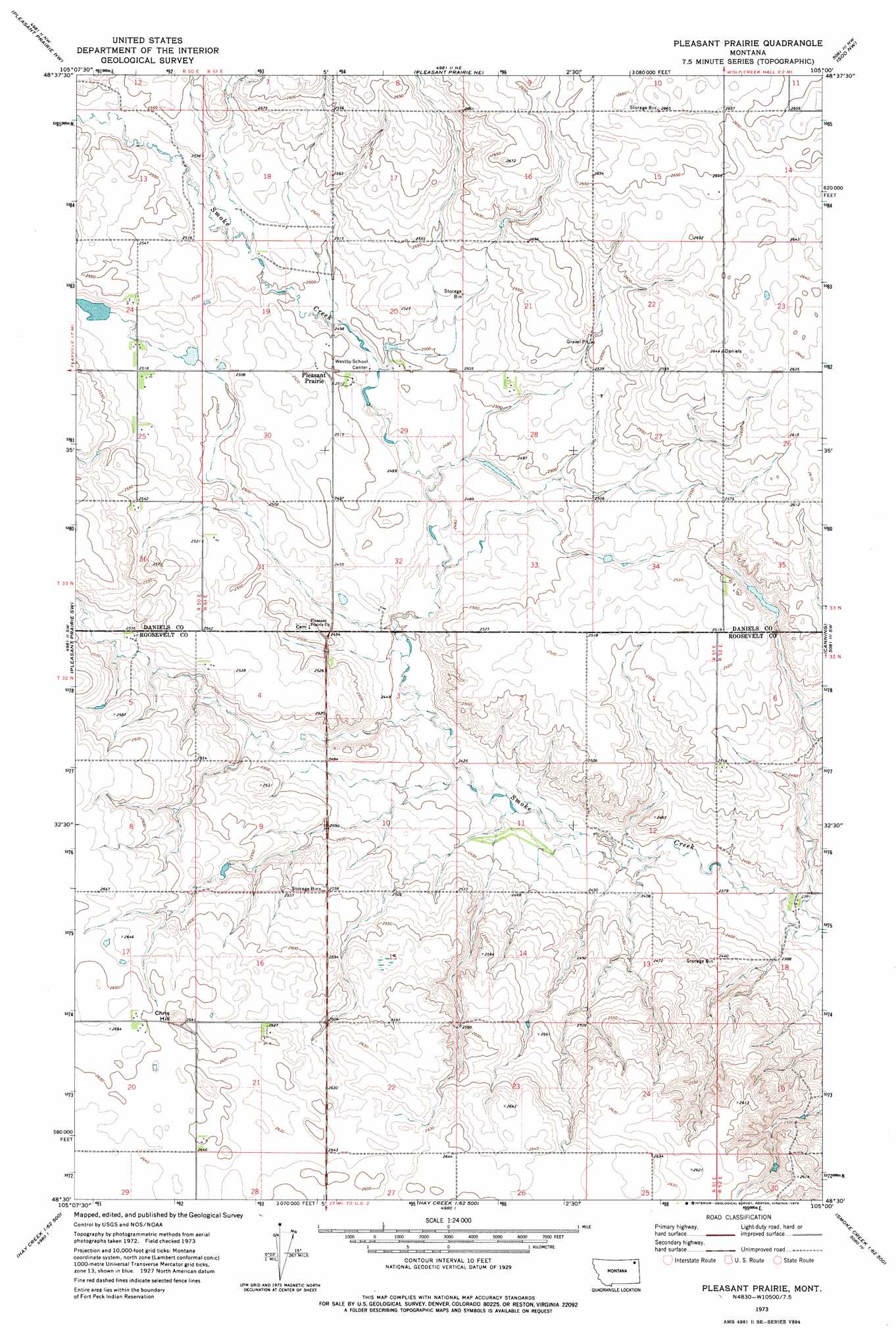
Pleasant Prairie Topo Map Montana
To zoom in, hover over the map of Pleasant Prairie
USGS Topo Quad 48105e1 - 1:24,000 scale
| Topo Map Name: | Pleasant Prairie |
| USGS Topo Quad ID: | 48105e1 |
| Print Size: | ca. 21 1/4" wide x 27" high |
| Southeast Coordinates: | 48.5° N latitude / 105° W longitude |
| Map Center Coordinates: | 48.5625° N latitude / 105.0625° W longitude |
| U.S. State: | MT |
| Filename: | o48105e1.jpg |
| Download Map JPG Image: | Pleasant Prairie topo map 1:24,000 scale |
| Map Type: | Topographic |
| Topo Series: | 7.5´ |
| Map Scale: | 1:24,000 |
| Source of Map Images: | United States Geological Survey (USGS) |
| Alternate Map Versions: |
Pleasant Prairie MT 1973, updated 1976 Download PDF Buy paper map Pleasant Prairie MT 2011 Download PDF Buy paper map Pleasant Prairie MT 2014 Download PDF Buy paper map |
1:24,000 Topo Quads surrounding Pleasant Prairie
Madoc |
Flaxville |
Navajo |
Redstone |
Archer |
Line Coulee |
Pleasant Prairie Nw |
Pleasant Prairie Ne |
Soo Nw |
Soo Ne |
Bredette |
Pleasant Prairie Sw |
Pleasant Prairie |
Soo |
Thornwood Ranch |
Windy Butte |
Hay Creek Nw |
Hay Creek |
Beam School |
Smoke Creek Ne |
Long Creek West |
Long Creek East |
Geddart Lake |
Smoke Creek Sw |
Coyote Coulee |
> Back to 48105e1 at 1:100,000 scale
> Back to 48104a1 at 1:250,000 scale
> Back to U.S. Topo Maps home
Pleasant Prairie topo map: Gazetteer
Pleasant Prairie: Dams
J Jacobsen Number 1 Dam elevation 771m 2529′J Jacobsen Number 2 Dam elevation 771m 2529′
Pleasant Prairie: Populated Places
Pleasant Prairie elevation 763m 2503′Pleasant Prairie: Summits
Chris Hill elevation 817m 2680′Pleasant Prairie: Wells
32N51E05BAAA01 Well elevation 772m 2532′32N51E05BAAB01 Well elevation 771m 2529′
32N51E05BAAB02 Well elevation 771m 2529′
32N51E17DCCC01 Well elevation 809m 2654′
32N51E20ABBA01 Well elevation 809m 2654′
33N50E24BDDC01 Well elevation 775m 2542′
33N50E24DCBB01 Well elevation 766m 2513′
33N50E25ABBC01 Well elevation 768m 2519′
33N51E20DCCC01 Well elevation 763m 2503′
33N51E28BAAC01 Well elevation 772m 2532′
33N51E29BBBA01 Well elevation 763m 2503′
33N51E35CBCA01 Well elevation 777m 2549′
Pleasant Prairie digital topo map on disk
Buy this Pleasant Prairie topo map showing relief, roads, GPS coordinates and other geographical features, as a high-resolution digital map file on DVD:
Eastern Montana & Western North Dakota
Buy digital topo maps: Eastern Montana & Western North Dakota