Bredette Topo Map Montana
To zoom in, hover over the map of Bredette
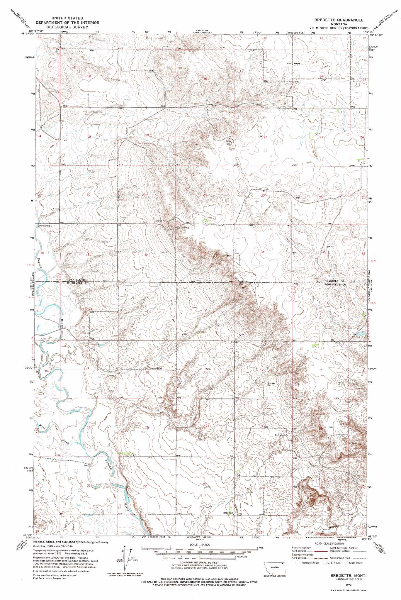
USGS Topo Quad 48105e3 - 1:24,000 scale
| Topo Map Name: | Bredette |
| USGS Topo Quad ID: | 48105e3 |
| Print Size: | ca. 21 1/4" wide x 27" high |
| Southeast Coordinates: | 48.5° N latitude / 105.25° W longitude |
| Map Center Coordinates: | 48.5625° N latitude / 105.3125° W longitude |
| U.S. State: | MT |
| Filename: | o48105e3.jpg |
| Download Map JPG Image: | Bredette topo map 1:24,000 scale |
| Map Type: | Topographic |
| Topo Series: | 7.5´ |
| Map Scale: | 1:24,000 |
| Source of Map Images: | United States Geological Survey (USGS) |
| Alternate Map Versions: |
Bredette MT 1973, updated 1976 Download PDF Buy paper map Bredette MT 2011 Download PDF Buy paper map Bredette MT 2014 Download PDF Buy paper map |
1:24,000 Topo Quads surrounding Bredette
Four Buttes |
Scobey |
Madoc |
Flaxville |
Navajo |
Peerless 4 Ne |
Cabarett Coulee |
Line Coulee |
Pleasant Prairie Nw |
Pleasant Prairie Ne |
Peerless 4 Se |
Nielsen Coulee |
Bredette |
Pleasant Prairie Sw |
Pleasant Prairie |
Reed Springs |
Bears Nest |
Windy Butte |
Hay Creek Nw |
Hay Creek |
Tule Valley East |
Sims Spring |
Long Creek West |
Long Creek East |
Geddart Lake |
> Back to 48105e1 at 1:100,000 scale
> Back to 48104a1 at 1:250,000 scale
> Back to U.S. Topo Maps home
Bredette topo map: Gazetteer
Bredette: Dams
Stentoft Dam elevation 776m 2545′Bredette: Populated Places
Bredette elevation 698m 2290′Bredette: Post Offices
Bredette Post Office elevation 698m 2290′Bredette: Streams
West Fork Poplar River elevation 667m 2188′Bredette: Wells
32N49E13DA__01 Well elevation 743m 2437′32N49E15CDCC01 Well elevation 687m 2253′
32N50E19BC__01 Well elevation 734m 2408′
33N49E15DDBA01 Well elevation 817m 2680′
33N49E24CCDA01 Well elevation 819m 2687′
33N49E24CCDC01 Well elevation 818m 2683′
33N49E26DAAA01 Well elevation 811m 2660′
33N49E34CB__01 Well elevation 822m 2696′
Bredette digital topo map on disk
Buy this Bredette topo map showing relief, roads, GPS coordinates and other geographical features, as a high-resolution digital map file on DVD:
Eastern Montana & Western North Dakota
Buy digital topo maps: Eastern Montana & Western North Dakota