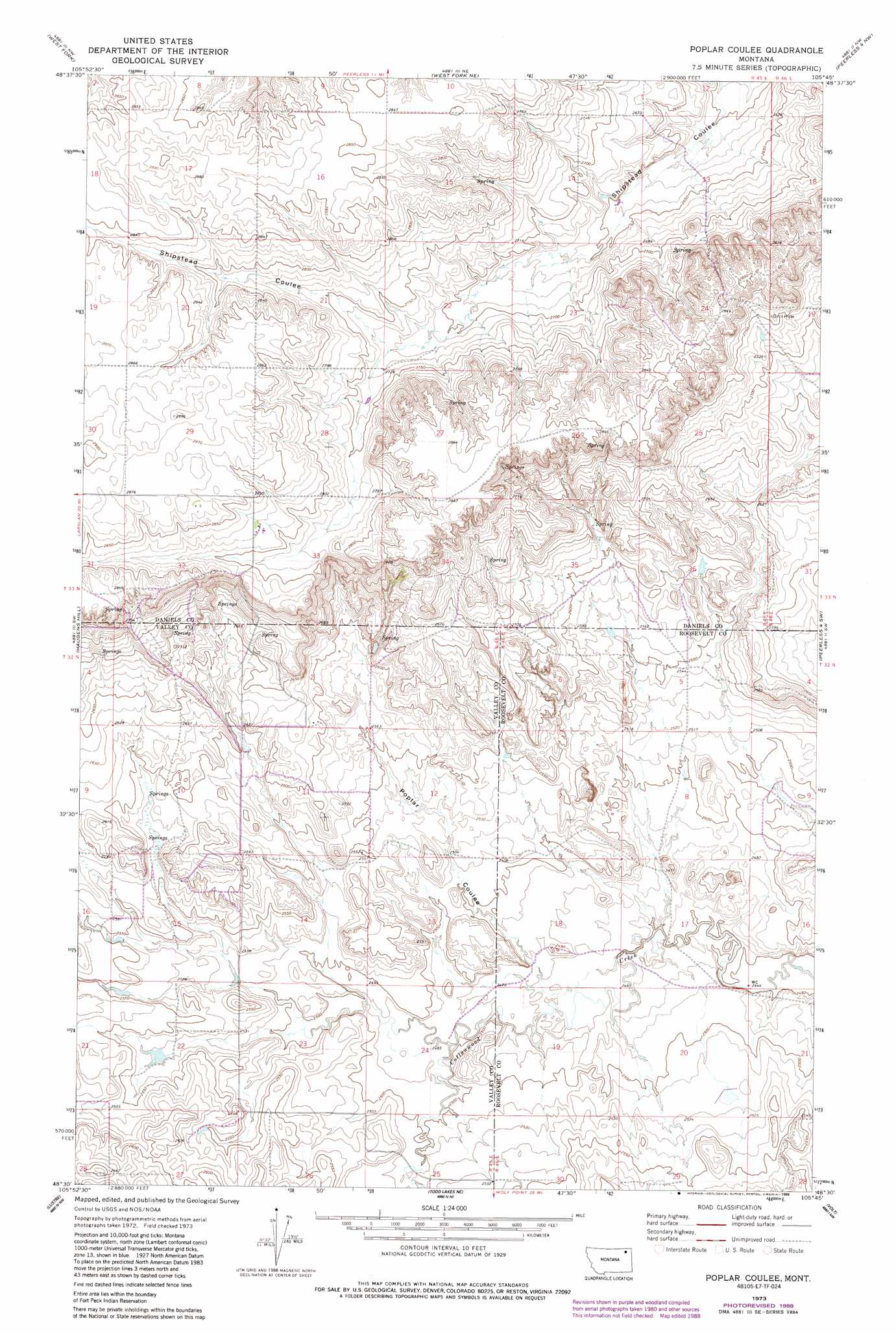
Poplar Coulee Topo Map Montana
To zoom in, hover over the map of Poplar Coulee
USGS Topo Quad 48105e7 - 1:24,000 scale
| Topo Map Name: | Poplar Coulee |
| USGS Topo Quad ID: | 48105e7 |
| Print Size: | ca. 21 1/4" wide x 27" high |
| Southeast Coordinates: | 48.5° N latitude / 105.75° W longitude |
| Map Center Coordinates: | 48.5625° N latitude / 105.8125° W longitude |
| U.S. State: | MT |
| Filename: | o48105e7.jpg |
| Download Map JPG Image: | Poplar Coulee topo map 1:24,000 scale |
| Map Type: | Topographic |
| Topo Series: | 7.5´ |
| Map Scale: | 1:24,000 |
| Source of Map Images: | United States Geological Survey (USGS) |
| Alternate Map Versions: |
Poplar Coulee MT 1973, updated 1976 Download PDF Buy paper map Poplar Coulee MT 1973, updated 1989 Download PDF Buy paper map Poplar Coulee MT 2011 Download PDF Buy paper map Poplar Coulee MT 2014 Download PDF Buy paper map |
1:24,000 Topo Quads surrounding Poplar Coulee
Richland |
Horseshoe Basin |
Peerless |
Killenbeck Reservoir |
Four Buttes |
Johnnys Hill |
West Fork |
West Fork Ne |
Peerless 4 Nw |
Peerless 4 Ne |
Blink Springs |
Haugens Hill |
Poplar Coulee |
Peerless 4 Sw |
Peerless 4 Se |
Spring Valley East |
Lustre |
Todd Lakes Ne |
Volt |
Reed Springs |
Hauck Coulee |
Todd Lakes |
Todd Lakes Se |
Tule Valley West |
Tule Valley East |
> Back to 48105e1 at 1:100,000 scale
> Back to 48104a1 at 1:250,000 scale
> Back to U.S. Topo Maps home
Poplar Coulee topo map: Gazetteer
Poplar Coulee: Springs
33N45E26DBAD01 Spring elevation 849m 2785′Poplar Coulee: Valleys
Poplar Coulee elevation 756m 2480′Poplar Coulee: Wells
33N45E10DCCC01 Well elevation 868m 2847′33N45E32ABBD01 Well elevation 877m 2877′
33N45E32ABBD02 Well elevation 877m 2877′
33N45E33BBCC01 Well elevation 860m 2821′
Poplar Coulee digital topo map on disk
Buy this Poplar Coulee topo map showing relief, roads, GPS coordinates and other geographical features, as a high-resolution digital map file on DVD:
Eastern Montana & Western North Dakota
Buy digital topo maps: Eastern Montana & Western North Dakota