Pleasant Prairie Ne Topo Map Montana
To zoom in, hover over the map of Pleasant Prairie Ne
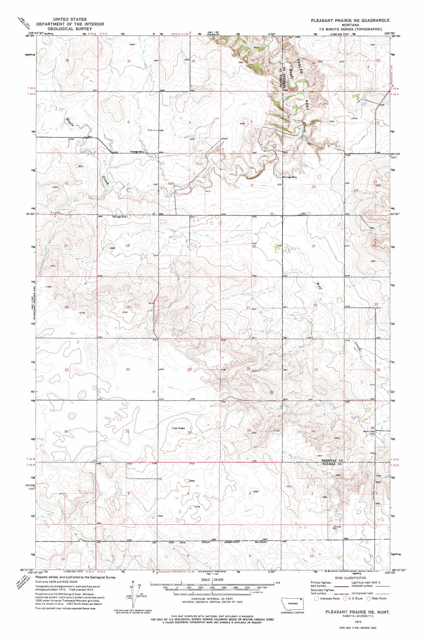
USGS Topo Quad 48105f1 - 1:24,000 scale
| Topo Map Name: | Pleasant Prairie Ne |
| USGS Topo Quad ID: | 48105f1 |
| Print Size: | ca. 21 1/4" wide x 27" high |
| Southeast Coordinates: | 48.625° N latitude / 105° W longitude |
| Map Center Coordinates: | 48.6875° N latitude / 105.0625° W longitude |
| U.S. State: | MT |
| Filename: | o48105f1.jpg |
| Download Map JPG Image: | Pleasant Prairie Ne topo map 1:24,000 scale |
| Map Type: | Topographic |
| Topo Series: | 7.5´ |
| Map Scale: | 1:24,000 |
| Source of Map Images: | United States Geological Survey (USGS) |
| Alternate Map Versions: |
Pleasant Prairie NE MT 1973, updated 1977 Download PDF Buy paper map Pleasant Prairie NE MT 2011 Download PDF Buy paper map Pleasant Prairie NE MT 2014 Download PDF Buy paper map |
1:24,000 Topo Quads surrounding Pleasant Prairie Ne
Si Merrell Slough |
Whitetail |
Goodale Coulee |
Daleview |
Outlook |
Madoc |
Flaxville |
Navajo |
Redstone |
Archer |
Line Coulee |
Pleasant Prairie Nw |
Pleasant Prairie Ne |
Soo Nw |
Soo Ne |
Bredette |
Pleasant Prairie Sw |
Pleasant Prairie |
Soo |
Thornwood Ranch |
Windy Butte |
Hay Creek Nw |
Hay Creek |
Beam School |
Smoke Creek Ne |
> Back to 48105e1 at 1:100,000 scale
> Back to 48104a1 at 1:250,000 scale
> Back to U.S. Topo Maps home
No gazetteer data is available for the Pleasant Prairie Ne topo map sheet.
Pleasant Prairie Ne digital topo map on disk
Buy this Pleasant Prairie Ne topo map showing relief, roads, GPS coordinates and other geographical features, as a high-resolution digital map file on DVD:
Eastern Montana & Western North Dakota
Buy digital topo maps: Eastern Montana & Western North Dakota