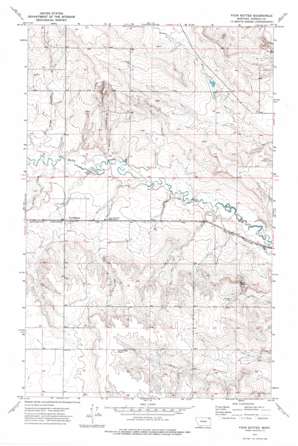
Four Buttes Topo Map Montana
To zoom in, hover over the map of Four Buttes
USGS Topo Quad 48105g5 - 1:24,000 scale
| Topo Map Name: | Four Buttes |
| USGS Topo Quad ID: | 48105g5 |
| Print Size: | ca. 21 1/4" wide x 27" high |
| Southeast Coordinates: | 48.75° N latitude / 105.5° W longitude |
| Map Center Coordinates: | 48.8125° N latitude / 105.5625° W longitude |
| U.S. State: | MT |
| Filename: | o48105g5.jpg |
| Download Map JPG Image: | Four Buttes topo map 1:24,000 scale |
| Map Type: | Topographic |
| Topo Series: | 7.5´ |
| Map Scale: | 1:24,000 |
| Source of Map Images: | United States Geological Survey (USGS) |
| Alternate Map Versions: |
Four Buttes MT 1973, updated 1976 Download PDF Buy paper map Four Buttes MT 2011 Download PDF Buy paper map Four Buttes MT 2014 Download PDF Buy paper map |
1:24,000 Topo Quads surrounding Four Buttes
> Back to 48105e1 at 1:100,000 scale
> Back to 48104a1 at 1:250,000 scale
> Back to U.S. Topo Maps home
Four Buttes topo map: Gazetteer
Four Buttes: Dams
Chabot Reservoir Dam elevation 757m 2483′Four Buttes: Populated Places
Four Buttes elevation 757m 2483′Four Buttes: Post Offices
Four Buttes Post Office (historical) elevation 757m 2483′Four Buttes: Streams
Spring Creek elevation 735m 2411′Four Buttes: Valleys
Audet Coulee elevation 738m 2421′La Pierre Coulee elevation 733m 2404′
Four Buttes: Wells
35N47E02CDDD01 Well elevation 734m 2408′35N47E03BBCC01 Well elevation 733m 2404′
35N47E05CCCD01 Well elevation 755m 2477′
35N47E05DCDD01 Well elevation 751m 2463′
35N47E05DDCC01 Well elevation 752m 2467′
35N47E06DDAC01 Well elevation 753m 2470′
35N47E06DDDA01 Well elevation 755m 2477′
35N47E08AABC01 Well elevation 754m 2473′
35N47E08BBAA01 Well elevation 757m 2483′
35N47E08BBAB01 Well elevation 757m 2483′
35N47E08BBBC01 Well elevation 758m 2486′
35N47E10BBCB01 Well elevation 745m 2444′
35N47E12CD__01 Well elevation 733m 2404′
35N47E13BDCC01 Well elevation 755m 2477′
35N47E14BBBB01 Well elevation 762m 2500′
35N47E17CCDA01 Well elevation 800m 2624′
35N47E17CCDD01 Well elevation 800m 2624′
35N47E20ACBD01 Well elevation 822m 2696′
35N47E20ACBD02 Well elevation 823m 2700′
35N47E21BADD01 Well elevation 817m 2680′
35N47E26BCCC01 Well elevation 784m 2572′
35N47E26BCCD01 Well elevation 784m 2572′
35N47E26CBAB01 Well elevation 781m 2562′
35N47E26CBAB02 Well elevation 782m 2565′
35N47E27BBDD01 Well elevation 805m 2641′
35N47E27CABD01 Well elevation 807m 2647′
35N47E30ADCB01 Well elevation 802m 2631′
35N47E30BABD01 Well elevation 806m 2644′
36N47E16DABB01 Well elevation 794m 2604′
36N47E19ACDB01 Well elevation 775m 2542′
36N47E19ACDD01 Well elevation 777m 2549′
36N47E20CCCC01 Well elevation 774m 2539′
36N47E21BDAC01 Well elevation 797m 2614′
36N47E30ABDC01 Well elevation 765m 2509′
36N47E30DCCB01 Well elevation 751m 2463′
Four Buttes digital topo map on disk
Buy this Four Buttes topo map showing relief, roads, GPS coordinates and other geographical features, as a high-resolution digital map file on DVD:
Eastern Montana & Western North Dakota
Buy digital topo maps: Eastern Montana & Western North Dakota


