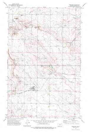
Peerless Topo Map Montana
To zoom in, hover over the map of Peerless
USGS Topo Quad 48105g7 - 1:24,000 scale
| Topo Map Name: | Peerless |
| USGS Topo Quad ID: | 48105g7 |
| Print Size: | ca. 21 1/4" wide x 27" high |
| Southeast Coordinates: | 48.75° N latitude / 105.75° W longitude |
| Map Center Coordinates: | 48.8125° N latitude / 105.8125° W longitude |
| U.S. State: | MT |
| Filename: | o48105g7.jpg |
| Download Map JPG Image: | Peerless topo map 1:24,000 scale |
| Map Type: | Topographic |
| Topo Series: | 7.5´ |
| Map Scale: | 1:24,000 |
| Source of Map Images: | United States Geological Survey (USGS) |
| Alternate Map Versions: |
Peerless MT 1973, updated 1976 Download PDF Buy paper map Peerless MT 2011 Download PDF Buy paper map Peerless MT 2014 Download PDF Buy paper map |
1:24,000 Topo Quads surrounding Peerless
> Back to 48105e1 at 1:100,000 scale
> Back to 48104a1 at 1:250,000 scale
> Back to U.S. Topo Maps home
Peerless topo map: Gazetteer
Peerless: Populated Places
Peerless elevation 869m 2851′Peerless: Post Offices
Peerless Post Office elevation 869m 2851′Tande Post Office (historical) elevation 851m 2791′
Peerless: Summits
Dighans Hill elevation 916m 3005′Jones Hill elevation 879m 2883′
Slaughter Hill elevation 843m 2765′
Sundby Hill elevation 886m 2906′
Wild Horse Butte elevation 882m 2893′
Peerless: Wells
35N45E02DAAA01 Well elevation 840m 2755′35N45E02DAAC01 Well elevation 840m 2755′
35N45E02DAAD01 Well elevation 839m 2752′
35N45E05DADB01 Well elevation 882m 2893′
35N45E05DADB02 Well elevation 882m 2893′
35N45E08ADDB01 Well elevation 881m 2890′
35N45E10AAAD01 Well elevation 871m 2857′
35N45E10AAAD02 Well elevation 871m 2857′
35N45E11DDAD01 Well elevation 833m 2732′
35N45E14ADAA01 Well elevation 846m 2775′
35N45E14ADAA02 Well elevation 848m 2782′
35N45E14ADAD01 Well elevation 845m 2772′
35N45E14CCCC01 Well elevation 858m 2814′
35N45E14CCCD01 Well elevation 858m 2814′
35N45E15AAAD01 Well elevation 853m 2798′
35N45E15DDAA01 Well elevation 861m 2824′
35N45E16DCDC01 Well elevation 863m 2831′
35N45E17DCCC01 Well elevation 867m 2844′
35N45E20BCAD01 Well elevation 859m 2818′
35N45E20DCCC01 Well elevation 848m 2782′
35N45E20DCCD01 Well elevation 847m 2778′
35N45E21ABAA01 Well elevation 863m 2831′
35N45E22ADAA01 Well elevation 854m 2801′
35N45E23CAAC01 Well elevation 855m 2805′
35N45E26DACA01 Well elevation 846m 2775′
35N45E26DADB01 Well elevation 845m 2772′
35N48E05DAAC01 Well elevation 882m 2893′
36N45E15CBDC01 Well elevation 800m 2624′
36N45E15CBDD01 Well elevation 800m 2624′
36N45E16CCCC01 Well elevation 824m 2703′
36N45E17CDDC01 Well elevation 827m 2713′
36N45E21AAAC01 Well elevation 808m 2650′
36N45E21CADA01 Well elevation 842m 2762′
36N45E21CADA02 Well elevation 843m 2765′
36N45E21CADB01 Well elevation 837m 2746′
36N45E21CADB02 Well elevation 843m 2765′
36N45E22BABB01 Well elevation 812m 2664′
36N45E27AADA01 Well elevation 831m 2726′
36N45E27CBDC01 Well elevation 856m 2808′
36N45E28DADD01 Well elevation 861m 2824′
36N45E28DADD02 Well elevation 860m 2821′
36N45E30DAAA01 Well elevation 895m 2936′
36N45E34BBAA01 Well elevation 866m 2841′
36N45E36CBAA01 Well elevation 846m 2775′
36N45E36CBAA02 Well elevation 845m 2772′
36N46E19BABD01 Well elevation 775m 2542′
Peerless digital topo map on disk
Buy this Peerless topo map showing relief, roads, GPS coordinates and other geographical features, as a high-resolution digital map file on DVD:
Eastern Montana & Western North Dakota
Buy digital topo maps: Eastern Montana & Western North Dakota


