Goodale Coulee Topo Map Montana
To zoom in, hover over the map of Goodale Coulee
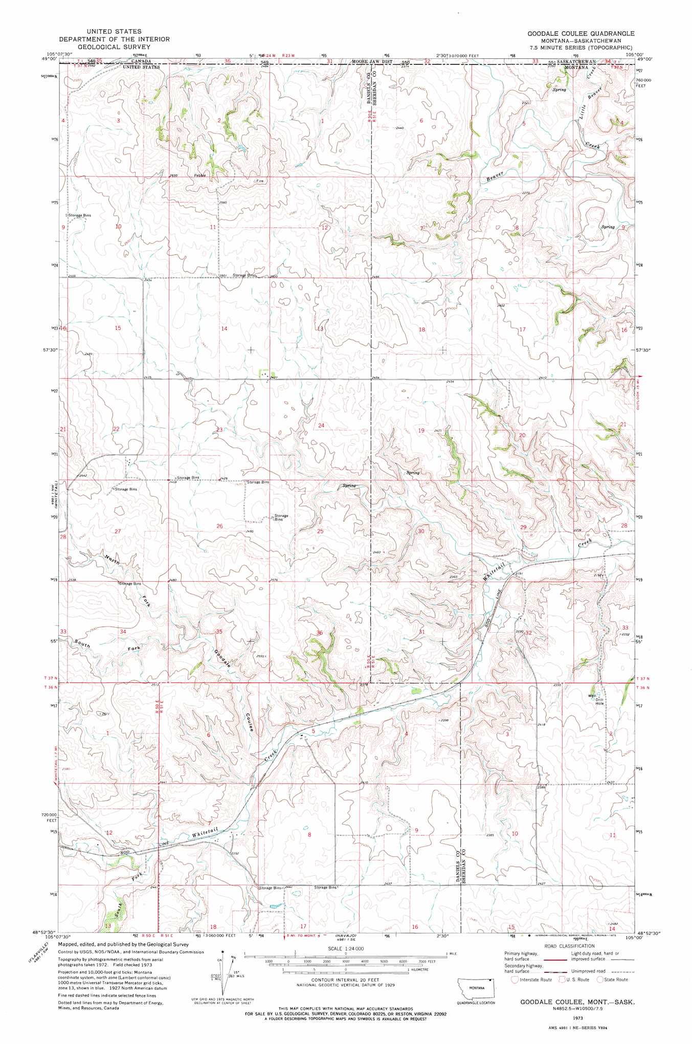
USGS Topo Quad 48105h1 - 1:24,000 scale
| Topo Map Name: | Goodale Coulee |
| USGS Topo Quad ID: | 48105h1 |
| Print Size: | ca. 21 1/4" wide x 27" high |
| Southeast Coordinates: | 48.875° N latitude / 105° W longitude |
| Map Center Coordinates: | 48.9375° N latitude / 105.0625° W longitude |
| U.S. State: | MT |
| Filename: | o48105h1.jpg |
| Download Map JPG Image: | Goodale Coulee topo map 1:24,000 scale |
| Map Type: | Topographic |
| Topo Series: | 7.5´ |
| Map Scale: | 1:24,000 |
| Source of Map Images: | United States Geological Survey (USGS) |
| Alternate Map Versions: |
Goodale Coulee MT 1973, updated 1976 Download PDF Buy paper map Goodale Coulee MT 2011 Download PDF Buy paper map Goodale Coulee MT 2014 Download PDF Buy paper map |
1:24,000 Topo Quads surrounding Goodale Coulee
Si Merrell Slough |
Whitetail |
Goodale Coulee |
Daleview |
Outlook |
Madoc |
Flaxville |
Navajo |
Redstone |
Archer |
Line Coulee |
Pleasant Prairie Nw |
Pleasant Prairie Ne |
Soo Nw |
Soo Ne |
> Back to 48105e1 at 1:100,000 scale
> Back to 48104a1 at 1:250,000 scale
> Back to U.S. Topo Maps home
Goodale Coulee topo map: Gazetteer
Goodale Coulee: Streams
Little Beaver Creek elevation 671m 2201′South Fork Whitetail Creek elevation 717m 2352′
Goodale Coulee: Valleys
Goodale Coulee elevation 701m 2299′North Fork Goodale Coulee elevation 727m 2385′
South Fork Goodale Coulee elevation 727m 2385′
Goodale Coulee: Wells
36N51E05CAAA01 Well elevation 693m 2273′36N51E09BABB01 Well elevation 727m 2385′
37N50E23BADC01 Well elevation 731m 2398′
Goodale Coulee digital topo map on disk
Buy this Goodale Coulee topo map showing relief, roads, GPS coordinates and other geographical features, as a high-resolution digital map file on DVD:
Eastern Montana & Western North Dakota
Buy digital topo maps: Eastern Montana & Western North Dakota