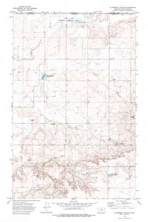
Si Merrell Slough Topo Map Montana
To zoom in, hover over the map of Si Merrell Slough
USGS Topo Quad 48105h3 - 1:24,000 scale
| Topo Map Name: | Si Merrell Slough |
| USGS Topo Quad ID: | 48105h3 |
| Print Size: | ca. 21 1/4" wide x 27" high |
| Southeast Coordinates: | 48.875° N latitude / 105.25° W longitude |
| Map Center Coordinates: | 48.9375° N latitude / 105.3125° W longitude |
| U.S. State: | MT |
| Filename: | o48105h3.jpg |
| Download Map JPG Image: | Si Merrell Slough topo map 1:24,000 scale |
| Map Type: | Topographic |
| Topo Series: | 7.5´ |
| Map Scale: | 1:24,000 |
| Source of Map Images: | United States Geological Survey (USGS) |
| Alternate Map Versions: |
Si Merrell Slough MT 1973, updated 1976 Download PDF Buy paper map Si Merrell Slough MT 2011 Download PDF Buy paper map Si Merrell Slough MT 2014 Download PDF Buy paper map |
1:24,000 Topo Quads surrounding Si Merrell Slough
Four Buttes Ne |
Scobey Nw |
Si Merrell Slough |
Whitetail |
Goodale Coulee |
Four Buttes |
Scobey |
Madoc |
Flaxville |
Navajo |
Peerless 4 Ne |
Cabarett Coulee |
Line Coulee |
Pleasant Prairie Nw |
Pleasant Prairie Ne |
> Back to 48105e1 at 1:100,000 scale
> Back to 48104a1 at 1:250,000 scale
> Back to U.S. Topo Maps home
Si Merrell Slough topo map: Gazetteer
Si Merrell Slough: Dams
Baby Blue Dam elevation 786m 2578′Si Merrell Slough: Lakes
Paradis Pond elevation 834m 2736′Si Merrell Slough: Parks
Jagiello Waterfowl Production Area elevation 749m 2457′Outlet Marsh Waterfowl Production Area elevation 750m 2460′
Si Merrell Slough: Populated Places
Julian (historical) elevation 745m 2444′Si Merrell Slough: Post Offices
Julian Post Office (historical) elevation 745m 2444′Si Merrell Slough: Summits
Square Butte elevation 883m 2896′Si Merrell Slough: Swamps
Si Merrell Slough elevation 749m 2457′Willard Slough elevation 740m 2427′
Si Merrell Slough: Wells
36N49E03CBBD01 Well elevation 816m 2677′36N49E04CCCD01 Well elevation 791m 2595′
36N49E05CCAD01 Well elevation 768m 2519′
36N49E07ACAC01 Well elevation 785m 2575′
36N49E07DDCB01 Well elevation 800m 2624′
36N49E09BDAA01 Well elevation 803m 2634′
37N48E23BBDC01 Well elevation 754m 2473′
37N48E23CDBB01 Well elevation 746m 2447′
37N48E23CDBB02 Well elevation 745m 2444′
37N48E25CBCD01 Well elevation 754m 2473′
37N48E26CBCA01 Well elevation 749m 2457′
37N48E26DAAC01 Well elevation 751m 2463′
37N48E35CBCD01 Well elevation 744m 2440′
37N49E04CCCB01 Well elevation 758m 2486′
37N49E05AAAA01 Well elevation 759m 2490′
37N49E05AAAB01 Well elevation 759m 2490′
37N49E10BCCC01 Well elevation 793m 2601′
37N49E16CDAA01 Well elevation 781m 2562′
37N49E16DCBB01 Well elevation 782m 2565′
37N49E16DDDD01 Well elevation 789m 2588′
37N49E17DDDD01 Well elevation 777m 2549′
37N49E18ABAD01 Well elevation 768m 2519′
37N49E18ABAD02 Well elevation 768m 2519′
37N49E18BCCC01 Well elevation 764m 2506′
37N49E18BCCC02 Well elevation 763m 2503′
37N49E19BCCC01 Well elevation 780m 2559′
37N49E19DD__01 Well elevation 770m 2526′
37N49E20AAAA01 Well elevation 778m 2552′
37N49E20CCCC01 Well elevation 785m 2575′
37N49E20CCCC02 Well elevation 785m 2575′
37N49E28DDAA01 Well elevation 834m 2736′
37N49E30CCDB01 Well elevation 765m 2509′
37N49E32DBBD01 Well elevation 777m 2549′
37N49E33DCBD01 Well elevation 800m 2624′
Si Merrell Slough digital topo map on disk
Buy this Si Merrell Slough topo map showing relief, roads, GPS coordinates and other geographical features, as a high-resolution digital map file on DVD:
Eastern Montana & Western North Dakota
Buy digital topo maps: Eastern Montana & Western North Dakota


