Four Buttes Nw Topo Map Montana
To zoom in, hover over the map of Four Buttes Nw
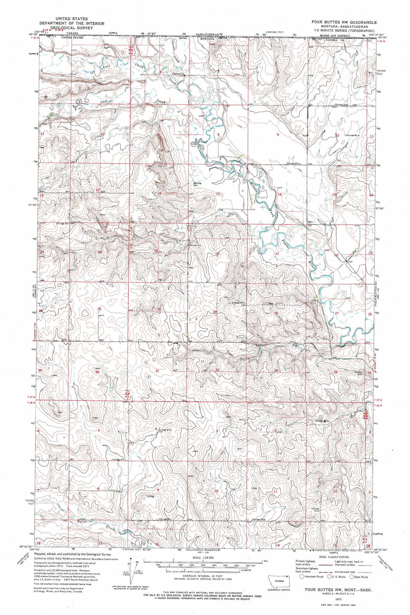
USGS Topo Quad 48105h6 - 1:24,000 scale
| Topo Map Name: | Four Buttes Nw |
| USGS Topo Quad ID: | 48105h6 |
| Print Size: | ca. 21 1/4" wide x 27" high |
| Southeast Coordinates: | 48.875° N latitude / 105.625° W longitude |
| Map Center Coordinates: | 48.9375° N latitude / 105.6875° W longitude |
| U.S. State: | MT |
| Filename: | o48105h6.jpg |
| Download Map JPG Image: | Four Buttes Nw topo map 1:24,000 scale |
| Map Type: | Topographic |
| Topo Series: | 7.5´ |
| Map Scale: | 1:24,000 |
| Source of Map Images: | United States Geological Survey (USGS) |
| Alternate Map Versions: |
Four Buttes NW MT 1973, updated 1976 Download PDF Buy paper map Four Buttes NW MT 2011 Download PDF Buy paper map Four Buttes NW MT 2014 Download PDF Buy paper map |
1:24,000 Topo Quads surrounding Four Buttes Nw
Flaherty Coulee |
Carbert |
Four Buttes Nw |
Four Buttes Ne |
Scobey Nw |
Horseshoe Basin |
Peerless |
Killenbeck Reservoir |
Four Buttes |
Scobey |
West Fork |
West Fork Ne |
Peerless 4 Nw |
Peerless 4 Ne |
Cabarett Coulee |
> Back to 48105e1 at 1:100,000 scale
> Back to 48104a1 at 1:250,000 scale
> Back to U.S. Topo Maps home
Four Buttes Nw topo map: Gazetteer
Four Buttes Nw: Springs
37N46E27BCDC01 Spring elevation 759m 2490′Four Buttes Nw: Streams
Coal Creek elevation 747m 2450′Goose Creek elevation 753m 2470′
Lost Child Creek elevation 750m 2460′
Four Buttes Nw: Wells
37N45E25ACCC01 Well elevation 799m 2621′37N45E35AAAD01 Well elevation 807m 2647′
37N45E36BBBC01 Well elevation 804m 2637′
37N46E08DDCA01 Well elevation 750m 2460′
37N46E08DDCA02 Well elevation 750m 2460′
37N46E08DDCA03 Well elevation 750m 2460′
37N46E19BADB01 Well elevation 775m 2542′
37N46E19BADD01 Well elevation 773m 2536′
37N46E22ADCA01 Well elevation 747m 2450′
37N46E22ADCD01 Well elevation 748m 2454′
37N46E27BCAB01 Well elevation 750m 2460′
37N46E27BCAD01 Well elevation 745m 2444′
Four Buttes Nw digital topo map on disk
Buy this Four Buttes Nw topo map showing relief, roads, GPS coordinates and other geographical features, as a high-resolution digital map file on DVD:
Eastern Montana & Western North Dakota
Buy digital topo maps: Eastern Montana & Western North Dakota