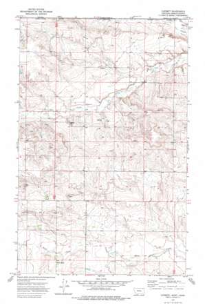
Carbert Topo Map Montana
To zoom in, hover over the map of Carbert
USGS Topo Quad 48105h7 - 1:24,000 scale
| Topo Map Name: | Carbert |
| USGS Topo Quad ID: | 48105h7 |
| Print Size: | ca. 21 1/4" wide x 27" high |
| Southeast Coordinates: | 48.875° N latitude / 105.75° W longitude |
| Map Center Coordinates: | 48.9375° N latitude / 105.8125° W longitude |
| U.S. State: | MT |
| Filename: | o48105h7.jpg |
| Download Map JPG Image: | Carbert topo map 1:24,000 scale |
| Map Type: | Topographic |
| Topo Series: | 7.5´ |
| Map Scale: | 1:24,000 |
| Source of Map Images: | United States Geological Survey (USGS) |
| Alternate Map Versions: |
Carbert MT 1973, updated 1976 Download PDF Buy paper map Carbert MT 2011 Download PDF Buy paper map Carbert MT 2014 Download PDF Buy paper map |
1:24,000 Topo Quads surrounding Carbert
> Back to 48105e1 at 1:100,000 scale
> Back to 48104a1 at 1:250,000 scale
> Back to U.S. Topo Maps home
Carbert topo map: Gazetteer
Carbert: Populated Places
Butte Creek elevation 819m 2687′Carbert elevation 810m 2657′
Carbert: Post Offices
Carbert Post Office (historical) elevation 810m 2657′Coalcreek Post Office (historical) elevation 859m 2818′
Carbert: Valleys
Lewarton Coulee elevation 822m 2696′Carbert: Wells
26N46E34ADDA01 Well elevation 801m 2627′36N45E03CDCB01 Well elevation 813m 2667′
36N45E05DCCC01 Well elevation 829m 2719′
36N45E08CCCA01 Well elevation 827m 2713′
36N45E08CCCC01 Well elevation 828m 2716′
36N45E08DDDD01 Well elevation 817m 2680′
36N45E15BBCD01 Well elevation 799m 2621′
37N44E01BCAA01 Well elevation 839m 2752′
37N44E02DDAD01 Well elevation 863m 2831′
37N44E13ACDC01 Well elevation 829m 2719′
37N44E36DCDA01 Well elevation 837m 2746′
37N45E03DCCC01 Well elevation 792m 2598′
37N45E06DDAC01 Well elevation 810m 2657′
37N45E07ADDA01 Well elevation 831m 2726′
37N45E08ACDC01 Well elevation 811m 2660′
37N45E09ACBD01 Well elevation 800m 2624′
37N45E09ACDB01 Well elevation 800m 2624′
37N45E09BCAD01 Well elevation 804m 2637′
37N45E14BCCC01 Well elevation 813m 2667′
37N45E19BADD01 Well elevation 810m 2657′
37N45E19BADD02 Well elevation 810m 2657′
37N45E19DCDB01 Well elevation 826m 2709′
37N45E20BCCD01 Well elevation 811m 2660′
37N45E23CCC_01 Well elevation 824m 2703′
37N45E27DCCD01 Well elevation 818m 2683′
37N45E28CDCA01 Well elevation 818m 2683′
37N45E29DDAC01 Well elevation 813m 2667′
37N45E31BDAD01 Well elevation 827m 2713′
37N45E33CBBD01 Well elevation 826m 2709′
Carbert digital topo map on disk
Buy this Carbert topo map showing relief, roads, GPS coordinates and other geographical features, as a high-resolution digital map file on DVD:
Eastern Montana & Western North Dakota
Buy digital topo maps: Eastern Montana & Western North Dakota


