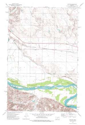
Kintyre Topo Map Montana
To zoom in, hover over the map of Kintyre
USGS Topo Quad 48106a2 - 1:24,000 scale
| Topo Map Name: | Kintyre |
| USGS Topo Quad ID: | 48106a2 |
| Print Size: | ca. 21 1/4" wide x 27" high |
| Southeast Coordinates: | 48° N latitude / 106.125° W longitude |
| Map Center Coordinates: | 48.0625° N latitude / 106.1875° W longitude |
| U.S. State: | MT |
| Filename: | o48106a2.jpg |
| Download Map JPG Image: | Kintyre topo map 1:24,000 scale |
| Map Type: | Topographic |
| Topo Series: | 7.5´ |
| Map Scale: | 1:24,000 |
| Source of Map Images: | United States Geological Survey (USGS) |
| Alternate Map Versions: |
Kintyre MT 1972, updated 1976 Download PDF Buy paper map Kintyre MT 2011 Download PDF Buy paper map Kintyre MT 2014 Download PDF Buy paper map |
1:24,000 Topo Quads surrounding Kintyre
> Back to 48106a1 at 1:100,000 scale
> Back to 48106a1 at 1:250,000 scale
> Back to U.S. Topo Maps home
Kintyre topo map: Gazetteer
Kintyre: Canals
Missouri Pump Canal elevation 630m 2066′Kintyre: Dams
Heifer Pen Dam elevation 645m 2116′Kintyre: Streams
Lost Creek elevation 625m 2050′West Fork Lost Creek elevation 643m 2109′
Kintyre: Valleys
Sarge Coulee elevation 639m 2096′Kintyre: Wells
26N42E01AA__01 Well elevation 623m 2043′26N43E03BD__01 Well elevation 621m 2037′
26N43E04AA__01 Well elevation 632m 2073′
26N43E04AC__01 Well elevation 621m 2037′
26N43E04AD__01 Well elevation 620m 2034′
26N43E04AD__02 Well elevation 620m 2034′
26N43E05AC__01 Well elevation 621m 2037′
26N43E05CAAB01 Well elevation 623m 2043′
26N43E05DB__01 Well elevation 623m 2043′
26N43E06AC__01 Well elevation 622m 2040′
26N43E06AC__02 Well elevation 622m 2040′
26N43E06BD__01 Well elevation 622m 2040′
26N43E08CBAB01 Well elevation 621m 2037′
26N43E09BACD01 Well elevation 622m 2040′
26N43E09BD__01 Well elevation 626m 2053′
26N43E09CA__01 Well elevation 619m 2030′
26N43E10BB__01 Well elevation 615m 2017′
26N43E10CC__01 Well elevation 617m 2024′
26N43E12BA__01 Well elevation 614m 2014′
27N42E24CA__01 Well elevation 625m 2050′
27N42E25AB__01 Well elevation 626m 2053′
27N42E25BA__01 Well elevation 626m 2053′
27N42E25CD__01 Well elevation 621m 2037′
27N42E25DC__01 Well elevation 620m 2034′
27N42E36BA__01 Well elevation 620m 2034′
27N42E36CD__01 Well elevation 625m 2050′
27N42E36DA__01 Well elevation 624m 2047′
27N43E22BD__01 Well elevation 644m 2112′
27N43E23CB__01 Well elevation 642m 2106′
27N43E23DA__01 Well elevation 638m 2093′
27N43E23DA__02 Well elevation 638m 2093′
27N43E26BB__01 Well elevation 637m 2089′
27N43E28AA__01 Well elevation 639m 2096′
27N43E31BB__01 Well elevation 620m 2034′
27N43E32BB__01 Well elevation 622m 2040′
27N43E32CB__01 Well elevation 623m 2043′
27N43E33CC__01 Well elevation 623m 2043′
27N43E34AD__01 Well elevation 646m 2119′
27N43E34BA__01 Well elevation 647m 2122′
Kintyre digital topo map on disk
Buy this Kintyre topo map showing relief, roads, GPS coordinates and other geographical features, as a high-resolution digital map file on DVD:
Eastern Montana & Western North Dakota
Buy digital topo maps: Eastern Montana & Western North Dakota


