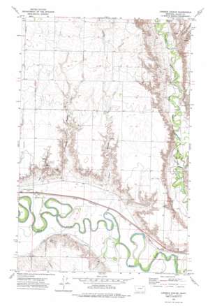
Lindeke Coulee Topo Map Montana
To zoom in, hover over the map of Lindeke Coulee
USGS Topo Quad 48106b4 - 1:24,000 scale
| Topo Map Name: | Lindeke Coulee |
| USGS Topo Quad ID: | 48106b4 |
| Print Size: | ca. 21 1/4" wide x 27" high |
| Southeast Coordinates: | 48.125° N latitude / 106.375° W longitude |
| Map Center Coordinates: | 48.1875° N latitude / 106.4375° W longitude |
| U.S. State: | MT |
| Filename: | o48106b4.jpg |
| Download Map JPG Image: | Lindeke Coulee topo map 1:24,000 scale |
| Map Type: | Topographic |
| Topo Series: | 7.5´ |
| Map Scale: | 1:24,000 |
| Source of Map Images: | United States Geological Survey (USGS) |
| Alternate Map Versions: |
Lindeke Coulee MT 1972, updated 1975 Download PDF Buy paper map Lindeke Coulee MT 2011 Download PDF Buy paper map Lindeke Coulee MT 2014 Download PDF Buy paper map |
1:24,000 Topo Quads surrounding Lindeke Coulee
> Back to 48106a1 at 1:100,000 scale
> Back to 48106a1 at 1:250,000 scale
> Back to U.S. Topo Maps home
Lindeke Coulee topo map: Gazetteer
Lindeke Coulee: Valleys
Espeil Coulee elevation 632m 2073′Hay Coulee elevation 639m 2096′
Lindeke Coulee elevation 634m 2080′
Lindeke Coulee: Wells
27N41E02BBDD01 Well elevation 629m 2063′28N41E20DBAB01 Well elevation 633m 2076′
28N41E30BBAA01 Well elevation 632m 2073′
28N41E32ABBD01 Well elevation 631m 2070′
28N41E35DCCC01 Well elevation 628m 2060′
Lindeke Coulee digital topo map on disk
Buy this Lindeke Coulee topo map showing relief, roads, GPS coordinates and other geographical features, as a high-resolution digital map file on DVD:
Eastern Montana & Western North Dakota
Buy digital topo maps: Eastern Montana & Western North Dakota


