Lookout Topo Map Montana
To zoom in, hover over the map of Lookout
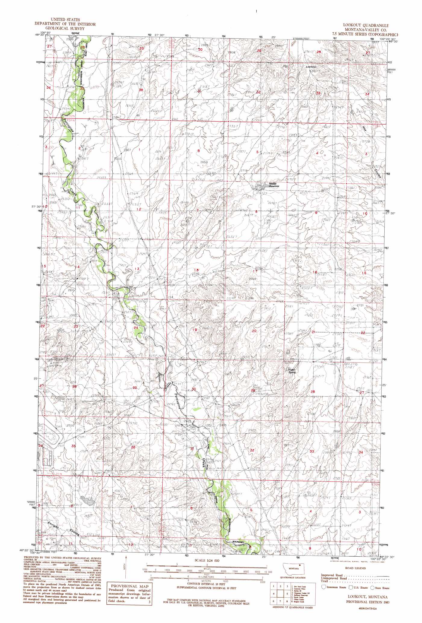
USGS Topo Quad 48106d4 - 1:24,000 scale
| Topo Map Name: | Lookout |
| USGS Topo Quad ID: | 48106d4 |
| Print Size: | ca. 21 1/4" wide x 27" high |
| Southeast Coordinates: | 48.375° N latitude / 106.375° W longitude |
| Map Center Coordinates: | 48.4375° N latitude / 106.4375° W longitude |
| U.S. State: | MT |
| Filename: | o48106d4.jpg |
| Download Map JPG Image: | Lookout topo map 1:24,000 scale |
| Map Type: | Topographic |
| Topo Series: | 7.5´ |
| Map Scale: | 1:24,000 |
| Source of Map Images: | United States Geological Survey (USGS) |
| Alternate Map Versions: |
Lookout MT 1983, updated 1983 Download PDF Buy paper map Lookout MT 2011 Download PDF Buy paper map Lookout MT 2014 Download PDF Buy paper map |
1:24,000 Topo Quads surrounding Lookout
Kerr Cow Camp |
Wards Dam |
Baylor |
Baylor Ne |
Larslan Nw |
Forsman Reservoir |
Dry Fork Creek |
Cameron Point |
Baylor Se |
Larslan |
Cornwell Reservoir |
Chapman Coulee Ne |
Lookout |
Bullhead Reservoir |
Spring Valley West |
Chapman Coulee |
Hawk Coulee |
Uhlan Coulee |
Sargent Creek |
Spring Creek Sw |
Glasgow |
Whately |
Lindeke Coulee |
Nashua |
Milk River Coulee |
> Back to 48106a1 at 1:100,000 scale
> Back to 48106a1 at 1:250,000 scale
> Back to U.S. Topo Maps home
Lookout topo map: Gazetteer
Lookout: Dams
Bobsland Dam elevation 800m 2624′Lookout: Ranges
Calderwood Hills elevation 853m 2798′Lookout: Reservoirs
Middle Reservoir elevation 814m 2670′Lookout: Springs
Olson Springs elevation 766m 2513′Potter Spring elevation 818m 2683′
Lookout: Streams
Dry Fork Creek elevation 787m 2582′Lookout: Summits
Lookout elevation 910m 2985′Lookout digital topo map on disk
Buy this Lookout topo map showing relief, roads, GPS coordinates and other geographical features, as a high-resolution digital map file on DVD:
Eastern Montana & Western North Dakota
Buy digital topo maps: Eastern Montana & Western North Dakota