Chapman Coulee Ne Topo Map Montana
To zoom in, hover over the map of Chapman Coulee Ne
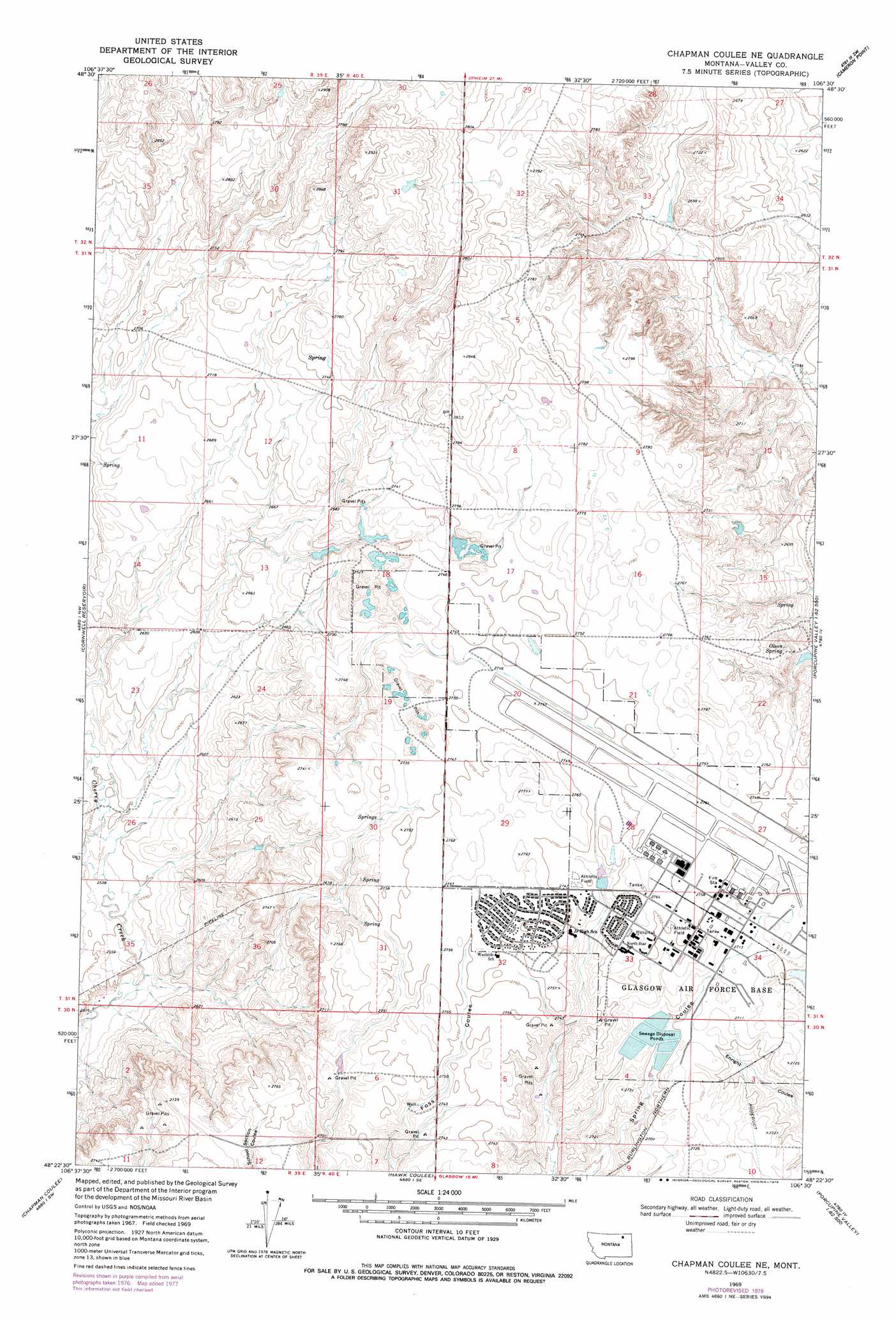
USGS Topo Quad 48106d5 - 1:24,000 scale
| Topo Map Name: | Chapman Coulee Ne |
| USGS Topo Quad ID: | 48106d5 |
| Print Size: | ca. 21 1/4" wide x 27" high |
| Southeast Coordinates: | 48.375° N latitude / 106.5° W longitude |
| Map Center Coordinates: | 48.4375° N latitude / 106.5625° W longitude |
| U.S. State: | MT |
| Filename: | o48106d5.jpg |
| Download Map JPG Image: | Chapman Coulee Ne topo map 1:24,000 scale |
| Map Type: | Topographic |
| Topo Series: | 7.5´ |
| Map Scale: | 1:24,000 |
| Source of Map Images: | United States Geological Survey (USGS) |
| Alternate Map Versions: |
Chapman Coulee NE MT 1969, updated 1972 Download PDF Buy paper map Chapman Coulee NE MT 1969, updated 1978 Download PDF Buy paper map Chapman Coulee NE MT 2011 Download PDF Buy paper map Chapman Coulee NE MT 2014 Download PDF Buy paper map |
1:24,000 Topo Quads surrounding Chapman Coulee Ne
Gay Dam |
Kerr Cow Camp |
Wards Dam |
Baylor |
Baylor Ne |
Laundry Hill |
Forsman Reservoir |
Dry Fork Creek |
Cameron Point |
Baylor Se |
Tampico Ne |
Cornwell Reservoir |
Chapman Coulee Ne |
Lookout |
Bullhead Reservoir |
Tampico |
Chapman Coulee |
Hawk Coulee |
Uhlan Coulee |
Sargent Creek |
Engstrom Ranch |
Glasgow |
Whately |
Lindeke Coulee |
Nashua |
> Back to 48106a1 at 1:100,000 scale
> Back to 48106a1 at 1:250,000 scale
> Back to U.S. Topo Maps home
Chapman Coulee Ne topo map: Gazetteer
Chapman Coulee Ne: Airports
Glasgow Industrial Airport elevation 840m 2755′Chapman Coulee Ne: Dams
Vip Sewage Disposal Lagoons Number 1 Dam elevation 822m 2696′Vip Sewage Disposal Lagoons Number 2 Dam elevation 840m 2755′
Chapman Coulee Ne: Populated Places
Saint Marie elevation 839m 2752′Chapman Coulee Ne: Springs
Olson Spring elevation 825m 2706′Chapman Coulee Ne: Wells
31N40E28BDAB01 Well elevation 839m 2752′31N40E33AAA_01 Well elevation 841m 2759′
Chapman Coulee Ne digital topo map on disk
Buy this Chapman Coulee Ne topo map showing relief, roads, GPS coordinates and other geographical features, as a high-resolution digital map file on DVD:
Eastern Montana & Western North Dakota
Buy digital topo maps: Eastern Montana & Western North Dakota