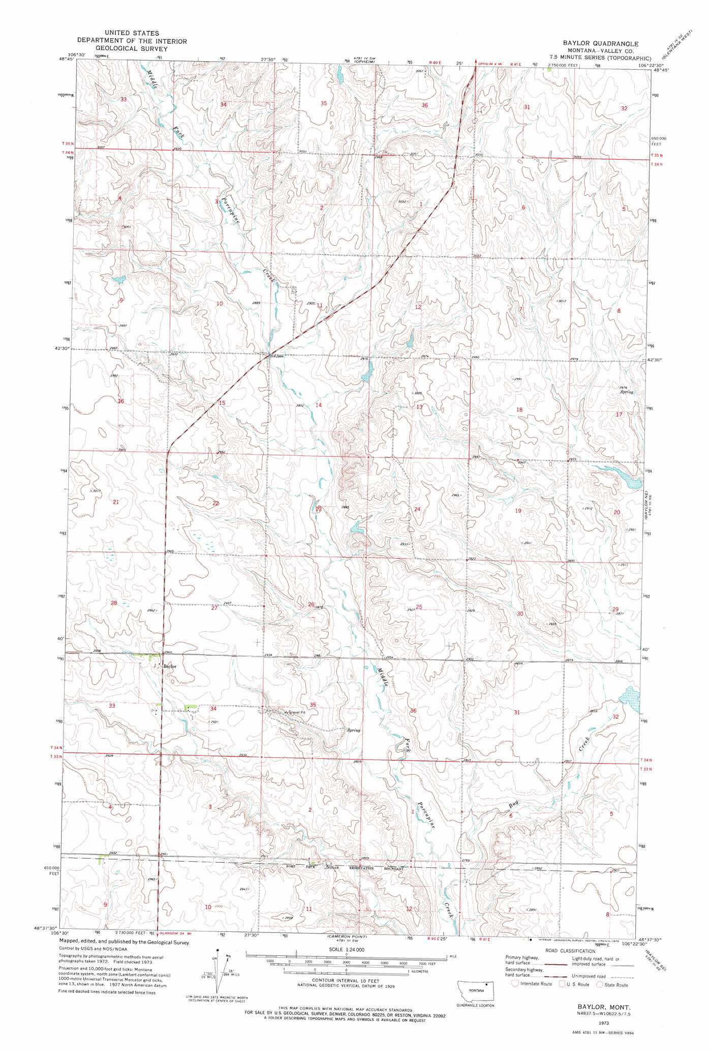
Baylor Topo Map Montana
To zoom in, hover over the map of Baylor
USGS Topo Quad 48106f4 - 1:24,000 scale
| Topo Map Name: | Baylor |
| USGS Topo Quad ID: | 48106f4 |
| Print Size: | ca. 21 1/4" wide x 27" high |
| Southeast Coordinates: | 48.625° N latitude / 106.375° W longitude |
| Map Center Coordinates: | 48.6875° N latitude / 106.4375° W longitude |
| U.S. State: | MT |
| Filename: | o48106f4.jpg |
| Download Map JPG Image: | Baylor topo map 1:24,000 scale |
| Map Type: | Topographic |
| Topo Series: | 7.5´ |
| Map Scale: | 1:24,000 |
| Source of Map Images: | United States Geological Survey (USGS) |
| Alternate Map Versions: |
Baylor MT 1973, updated 1976 Download PDF Buy paper map Baylor MT 2011 Download PDF Buy paper map Baylor MT 2014 Download PDF Buy paper map |
1:24,000 Topo Quads surrounding Baylor
Coal Mine Creek West |
Coal Mine Creek East |
Roanwood |
Glass Hill |
Kaminski Hill |
Dodge Reservoir |
O'Juel Lake |
Opheim |
Glentana West |
Glentana East |
Kerr Cow Camp |
Wards Dam |
Baylor |
Baylor Ne |
Larslan Nw |
Forsman Reservoir |
Dry Fork Creek |
Cameron Point |
Baylor Se |
Larslan |
Cornwell Reservoir |
Chapman Coulee Ne |
Lookout |
Bullhead Reservoir |
Spring Valley West |
> Back to 48106e1 at 1:100,000 scale
> Back to 48106a1 at 1:250,000 scale
> Back to U.S. Topo Maps home
Baylor topo map: Gazetteer
Baylor: Dams
Eddie Number 1 Dam elevation 922m 3024′Eddie Number 2 Dam elevation 908m 2979′
Long Horn Number 4 Dam elevation 887m 2910′
Neufeld Number 1 Dam elevation 895m 2936′
Neufeld Number 2 Dam elevation 868m 2847′
Baylor: Populated Places
Baylor elevation 901m 2956′Baylor: Post Offices
Baylor Post Office (historical) elevation 900m 2952′Baylor: Streams
Bog Creek elevation 846m 2775′Baylor: Wells
33N40E02CCC_02 Well elevation 885m 2903′34N40E01AAAB01 Well elevation 925m 3034′
34N40E28DAAD01 Well elevation 902m 2959′
Baylor digital topo map on disk
Buy this Baylor topo map showing relief, roads, GPS coordinates and other geographical features, as a high-resolution digital map file on DVD:
Eastern Montana & Western North Dakota
Buy digital topo maps: Eastern Montana & Western North Dakota