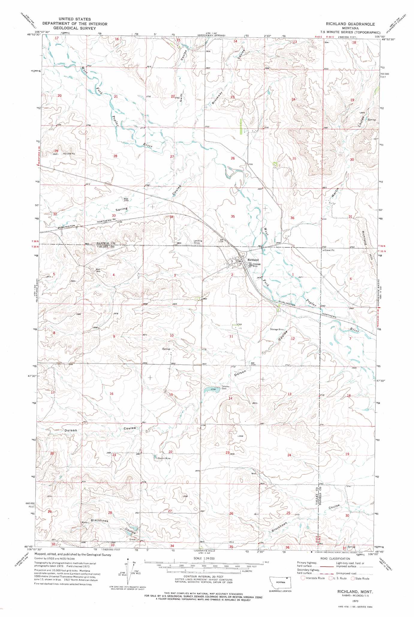
Richland Topo Map Montana
To zoom in, hover over the map of Richland
USGS Topo Quad 48106g1 - 1:24,000 scale
| Topo Map Name: | Richland |
| USGS Topo Quad ID: | 48106g1 |
| Print Size: | ca. 21 1/4" wide x 27" high |
| Southeast Coordinates: | 48.75° N latitude / 106° W longitude |
| Map Center Coordinates: | 48.8125° N latitude / 106.0625° W longitude |
| U.S. State: | MT |
| Filename: | o48106g1.jpg |
| Download Map JPG Image: | Richland topo map 1:24,000 scale |
| Map Type: | Topographic |
| Topo Series: | 7.5´ |
| Map Scale: | 1:24,000 |
| Source of Map Images: | United States Geological Survey (USGS) |
| Alternate Map Versions: |
Richland MT 1973, updated 1976 Download PDF Buy paper map Richland MT 2011 Download PDF Buy paper map Richland MT 2014 Download PDF Buy paper map |
1:24,000 Topo Quads surrounding Richland
Glass Hill |
Kaminski Hill |
Brockway Spring |
Flaherty Coulee |
Carbert |
Glentana West |
Glentana East |
Richland |
Horseshoe Basin |
Peerless |
Baylor Ne |
Larslan Nw |
Johnnys Hill |
West Fork |
West Fork Ne |
Baylor Se |
Larslan |
Blink Springs |
Haugens Hill |
Poplar Coulee |
> Back to 48106e1 at 1:100,000 scale
> Back to 48106a1 at 1:250,000 scale
> Back to U.S. Topo Maps home
Richland topo map: Gazetteer
Richland: Dams
Tarum Dam elevation 835m 2739′Tarums Dam elevation 834m 2736′
Richland: Mines
Battin Mine elevation 860m 2821′Richland: Populated Places
Richland elevation 823m 2700′Richland: Post Offices
Richland Post Office elevation 823m 2700′Richland: Summits
Richland Hill elevation 872m 2860′Richland: Valleys
Brockway Coulee elevation 830m 2723′Dolson Coulee elevation 816m 2677′
Martin Coulee elevation 822m 2696′
Spring Coulee elevation 825m 2706′
Swift Coulee elevation 829m 2719′
Richland: Wells
35N43E23DDAD01 Well elevation 853m 2798′35N44E06CBDB01 Well elevation 819m 2687′
36N43E15DBCA01 Well elevation 847m 2778′
36N43E15DBCA02 Well elevation 846m 2775′
36N43E15DBCA03 Well elevation 847m 2778′
36N43E26ABAD01 Well elevation 833m 2732′
36N43E33ABDC01 Well elevation 841m 2759′
Richland digital topo map on disk
Buy this Richland topo map showing relief, roads, GPS coordinates and other geographical features, as a high-resolution digital map file on DVD:
Eastern Montana & Western North Dakota
Buy digital topo maps: Eastern Montana & Western North Dakota