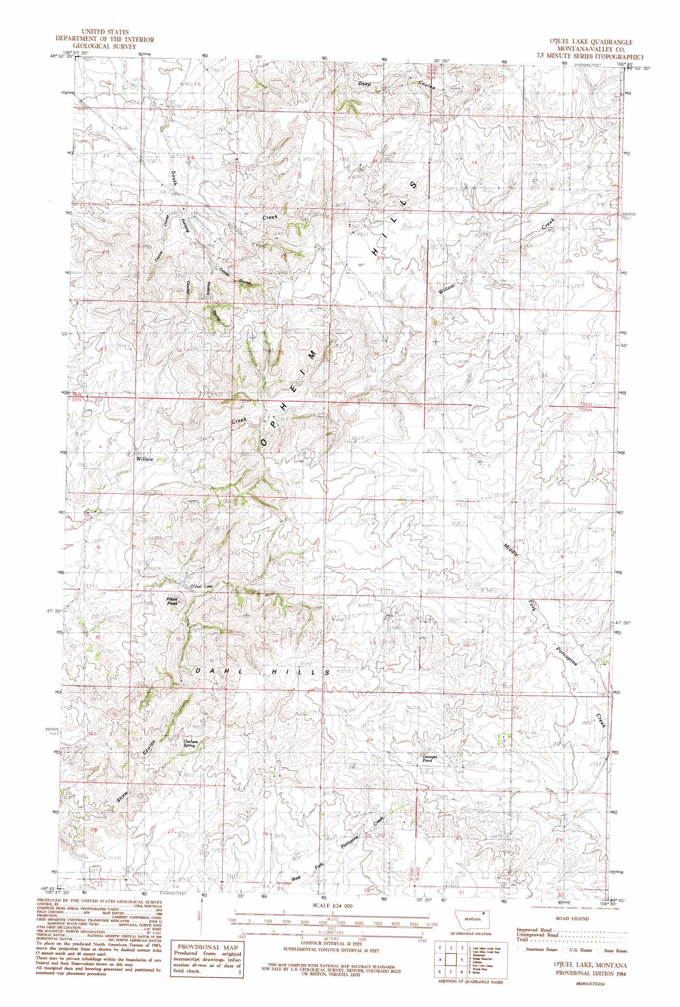
O'Juel Lake Topo Map Montana
To zoom in, hover over the map of O'Juel Lake
USGS Topo Quad 48106g5 - 1:24,000 scale
| Topo Map Name: | O'Juel Lake |
| USGS Topo Quad ID: | 48106g5 |
| Print Size: | ca. 21 1/4" wide x 27" high |
| Southeast Coordinates: | 48.75° N latitude / 106.5° W longitude |
| Map Center Coordinates: | 48.8125° N latitude / 106.5625° W longitude |
| U.S. State: | MT |
| Filename: | o48106g5.jpg |
| Download Map JPG Image: | O'Juel Lake topo map 1:24,000 scale |
| Map Type: | Topographic |
| Topo Series: | 7.5´ |
| Map Scale: | 1:24,000 |
| Source of Map Images: | United States Geological Survey (USGS) |
| Alternate Map Versions: |
O'Juel Lake MT 1984, updated 1984 Download PDF Buy paper map O'Juel Lake MT 2011 Download PDF Buy paper map O'Juel Lake MT 2014 Download PDF Buy paper map |
1:24,000 Topo Quads surrounding O'Juel Lake
Lighthouse Hill |
Coal Mine Creek West |
Coal Mine Creek East |
Roanwood |
Glass Hill |
Last Chance Res. |
Dodge Reservoir |
O'Juel Lake |
Opheim |
Glentana West |
Gay Dam |
Kerr Cow Camp |
Wards Dam |
Baylor |
Baylor Ne |
Laundry Hill |
Forsman Reservoir |
Dry Fork Creek |
Cameron Point |
Baylor Se |
> Back to 48106e1 at 1:100,000 scale
> Back to 48106a1 at 1:250,000 scale
> Back to U.S. Topo Maps home
O'Juel Lake topo map: Gazetteer
O'Juel Lake: Airports
Floyd Ranch Airport elevation 930m 3051′O'Juel Lake: Lakes
Georges Pond elevation 935m 3067′O'Juel Lake: Pillars
Pikes Peak elevation 944m 3097′O'Juel Lake: Post Offices
Tango Post Office (historical) elevation 940m 3083′O'Juel Lake: Ranges
Dahl Hills elevation 989m 3244′O'Juel Lake: Reservoirs
O'Juel Lake elevation 892m 2926′O'Juel Lake: Springs
Dashers Spring elevation 937m 3074′O'Juel Lake: Valleys
Combs Coulee elevation 890m 2919′Coyote Coulee elevation 871m 2857′
Deep Coulee elevation 892m 2926′
Furlong Coulee elevation 871m 2857′
Paudois Coulee elevation 890m 2919′
O'Juel Lake: Wells
36N39E26AAB_01 Well elevation 913m 2995′36N39E26BDB_01 Well elevation 894m 2933′
O'Juel Lake digital topo map on disk
Buy this O'Juel Lake topo map showing relief, roads, GPS coordinates and other geographical features, as a high-resolution digital map file on DVD:
Eastern Montana & Western North Dakota
Buy digital topo maps: Eastern Montana & Western North Dakota