Mitchell Corner Topo Map Montana
To zoom in, hover over the map of Mitchell Corner
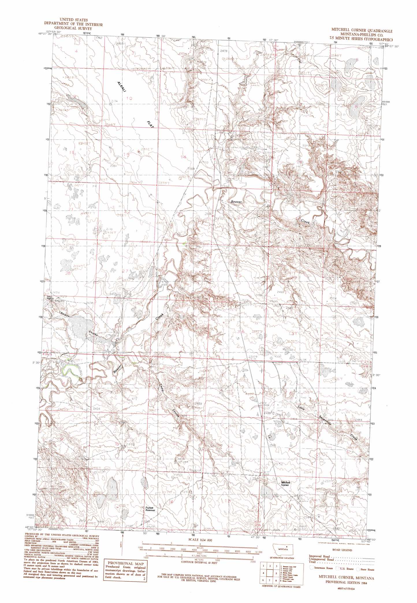
USGS Topo Quad 48107a7 - 1:24,000 scale
| Topo Map Name: | Mitchell Corner |
| USGS Topo Quad ID: | 48107a7 |
| Print Size: | ca. 21 1/4" wide x 27" high |
| Southeast Coordinates: | 48° N latitude / 107.75° W longitude |
| Map Center Coordinates: | 48.0625° N latitude / 107.8125° W longitude |
| U.S. State: | MT |
| Filename: | o48107a7.jpg |
| Download Map JPG Image: | Mitchell Corner topo map 1:24,000 scale |
| Map Type: | Topographic |
| Topo Series: | 7.5´ |
| Map Scale: | 1:24,000 |
| Source of Map Images: | United States Geological Survey (USGS) |
| Alternate Map Versions: |
Mitchell Corner MT 1984, updated 1984 Download PDF Buy paper map Mitchell Corner MT 2011 Download PDF Buy paper map Mitchell Corner MT 2014 Download PDF Buy paper map |
1:24,000 Topo Quads surrounding Mitchell Corner
Wagner |
Malta West |
Malta East |
Clanton Coulee |
Pinks |
West Alkali Reservoir |
Bennett Lake Nw |
Bennett Lake |
Content Nw |
Johnson Dam |
Seymour Reservoir |
Button Butte |
Mitchell Corner |
Horse Pasture Coulee |
Content |
Holzhey Reservoir |
Emond Ranch |
Whitcomb Lake |
Sheep Coulee |
Buckley Lake |
Barber Coulee |
Dione Reservoir |
Stratton Reservoir |
Sun Prairie |
Coal Mine Hill |
> Back to 48107a1 at 1:100,000 scale
> Back to 48106a1 at 1:250,000 scale
> Back to U.S. Topo Maps home
Mitchell Corner topo map: Gazetteer
Mitchell Corner: Dams
Nelson Dam elevation 732m 2401′Sunday Milk Dam elevation 725m 2378′
Westward Winds Dam elevation 754m 2473′
Mitchell Corner: Flats
Alkali Flat elevation 721m 2365′Mitchell Corner: Post Offices
Linair Post Office (historical) elevation 775m 2542′Mitchell Corner: Reservoirs
Puckett Reservoir elevation 774m 2539′Mitchell Corner: Valleys
Camp Coulee elevation 727m 2385′Nelson Coulee elevation 729m 2391′
Mitchell Corner: Wells
27N30E34CA__01 Well elevation 728m 2388′Mitchell Corner digital topo map on disk
Buy this Mitchell Corner topo map showing relief, roads, GPS coordinates and other geographical features, as a high-resolution digital map file on DVD:
Eastern Montana & Western North Dakota
Buy digital topo maps: Eastern Montana & Western North Dakota