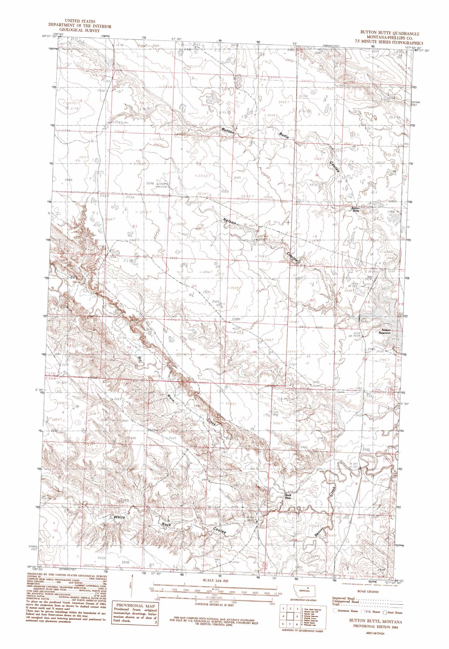
Button Butte Topo Map Montana
To zoom in, hover over the map of Button Butte
USGS Topo Quad 48107a8 - 1:24,000 scale
| Topo Map Name: | Button Butte |
| USGS Topo Quad ID: | 48107a8 |
| Print Size: | ca. 21 1/4" wide x 27" high |
| Southeast Coordinates: | 48° N latitude / 107.875° W longitude |
| Map Center Coordinates: | 48.0625° N latitude / 107.9375° W longitude |
| U.S. State: | MT |
| Filename: | o48107a8.jpg |
| Download Map JPG Image: | Button Butte topo map 1:24,000 scale |
| Map Type: | Topographic |
| Topo Series: | 7.5´ |
| Map Scale: | 1:24,000 |
| Source of Map Images: | United States Geological Survey (USGS) |
| Alternate Map Versions: |
Button Butte MT 1984, updated 1984 Download PDF Buy paper map Button Butte MT 2011 Download PDF Buy paper map Button Butte MT 2014 Download PDF Buy paper map |
1:24,000 Topo Quads surrounding Button Butte
Cow Creek |
Wagner |
Malta West |
Malta East |
Clanton Coulee |
Wild Horse Reservoir |
West Alkali Reservoir |
Bennett Lake Nw |
Bennett Lake |
Content Nw |
Phillips |
Seymour Reservoir |
Button Butte |
Mitchell Corner |
Horse Pasture Coulee |
Veseth Reservoir |
Holzhey Reservoir |
Emond Ranch |
Whitcomb Lake |
Sheep Coulee |
Dry Fork Ridge |
Barber Coulee |
Dione Reservoir |
Stratton Reservoir |
Sun Prairie |
> Back to 48107a1 at 1:100,000 scale
> Back to 48106a1 at 1:250,000 scale
> Back to U.S. Topo Maps home
Button Butte topo map: Gazetteer
Button Butte: Dams
Big Dam elevation 760m 2493′Big Rock Dam elevation 775m 2542′
Jordan Dam elevation 751m 2463′
Simanton Dam elevation 731m 2398′
Button Butte: Reservoirs
Nelson Reservoir elevation 737m 2417′Button Butte: Streams
Big Warm Creek elevation 736m 2414′Button Butte: Summits
Button Butte elevation 755m 2477′Button Butte: Valleys
Button Butte Coulee elevation 739m 2424′White Rock Coulee elevation 739m 2424′
Button Butte: Wells
27N29E28AC__01 Well elevation 750m 2460′Button Butte digital topo map on disk
Buy this Button Butte topo map showing relief, roads, GPS coordinates and other geographical features, as a high-resolution digital map file on DVD:
Eastern Montana & Western North Dakota
Buy digital topo maps: Eastern Montana & Western North Dakota