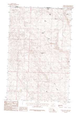
Gustin Coulee Topo Map Montana
To zoom in, hover over the map of Gustin Coulee
USGS Topo Quad 48107h6 - 1:24,000 scale
| Topo Map Name: | Gustin Coulee |
| USGS Topo Quad ID: | 48107h6 |
| Print Size: | ca. 21 1/4" wide x 27" high |
| Southeast Coordinates: | 48.875° N latitude / 107.625° W longitude |
| Map Center Coordinates: | 48.9375° N latitude / 107.6875° W longitude |
| U.S. State: | MT |
| Filename: | o48107h6.jpg |
| Download Map JPG Image: | Gustin Coulee topo map 1:24,000 scale |
| Map Type: | Topographic |
| Topo Series: | 7.5´ |
| Map Scale: | 1:24,000 |
| Source of Map Images: | United States Geological Survey (USGS) |
| Alternate Map Versions: |
Gustin Coulee MT 1984, updated 1984 Download PDF Buy paper map Gustin Coulee MT 2011 Download PDF Buy paper map Gustin Coulee MT 2014 Download PDF Buy paper map |
1:24,000 Topo Quads surrounding Gustin Coulee
Loring Nw |
Morgan |
Gustin Coulee |
Pea Lake |
Thoeny Hills West |
Martin Lake |
Loring |
Whitewater West |
Whitewater East |
Salsbery Reservoir |
Lovejoy |
Austin Coulee |
Austin Lake |
Tattnall |
Forks |
> Back to 48107e1 at 1:100,000 scale
> Back to 48106a1 at 1:250,000 scale
> Back to U.S. Topo Maps home
Gustin Coulee topo map: Gazetteer
Gustin Coulee: Dams
French Fry Number 2 Dam elevation 846m 2775′Split Rock Dam elevation 773m 2536′
Gustin Coulee: Reservoirs
3 Way Number 2 Reservoir elevation 816m 2677′Ada Reservoir elevation 781m 2562′
Hilo Reservoir elevation 802m 2631′
Kohola Reservoir elevation 793m 2601′
Palea Reservoir elevation 777m 2549′
Titan Reservoir elevation 787m 2582′
Tondra Reservoir elevation 809m 2654′
Waterfowl Reservoir elevation 810m 2657′
Gustin Coulee: Springs
Walchuk Spring elevation 775m 2542′Gustin Coulee: Wells
37N30E24CC__01 Well elevation 833m 2732′Gustin Coulee digital topo map on disk
Buy this Gustin Coulee topo map showing relief, roads, GPS coordinates and other geographical features, as a high-resolution digital map file on DVD:
Eastern Montana & Western North Dakota
Buy digital topo maps: Eastern Montana & Western North Dakota


