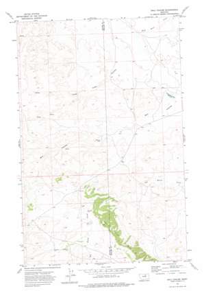
Ball Coulee Topo Map Montana
To zoom in, hover over the map of Ball Coulee
USGS Topo Quad 48108a4 - 1:24,000 scale
| Topo Map Name: | Ball Coulee |
| USGS Topo Quad ID: | 48108a4 |
| Print Size: | ca. 21 1/4" wide x 27" high |
| Southeast Coordinates: | 48° N latitude / 108.375° W longitude |
| Map Center Coordinates: | 48.0625° N latitude / 108.4375° W longitude |
| U.S. State: | MT |
| Filename: | o48108a4.jpg |
| Download Map JPG Image: | Ball Coulee topo map 1:24,000 scale |
| Map Type: | Topographic |
| Topo Series: | 7.5´ |
| Map Scale: | 1:24,000 |
| Source of Map Images: | United States Geological Survey (USGS) |
| Alternate Map Versions: |
Ball Coulee MT 1971, updated 1975 Download PDF Buy paper map Ball Coulee MT 2011 Download PDF Buy paper map Ball Coulee MT 2014 Download PDF Buy paper map |
1:24,000 Topo Quads surrounding Ball Coulee
> Back to 48108a1 at 1:100,000 scale
> Back to 48108a1 at 1:250,000 scale
> Back to U.S. Topo Maps home
Ball Coulee topo map: Gazetteer
Ball Coulee: Dams
Fort Belknap Number 6 Dam elevation 843m 2765′Fort Belknap Number 7 Dam elevation 854m 2801′
Fort Belknap Number 8 Dam elevation 983m 3225′
Government Field Reservoir Dam elevation 858m 2814′
Ball Coulee: Populated Places
Big Warm (historical) elevation 976m 3202′Ball Coulee: Reservoirs
Government Field Reservoir elevation 859m 2818′Ball Coulee: Ridges
Judith River Ridge elevation 1114m 3654′Ball Coulee: Valleys
Ball Coulee elevation 860m 2821′Lone Tree Coulee elevation 872m 2860′
Ball Coulee: Wells
26N25E01ACAB01 Well elevation 959m 3146′26N25E11CAC_01 Well elevation 995m 3264′
26N25E12CAC_01 Well elevation 977m 3205′
26N25E12CDC_01 Well elevation 980m 3215′
26N25E13BBA_01 Well elevation 983m 3225′
27N25E25DACC01 Well elevation 907m 2975′
27N25E25DADB01 Well elevation 909m 2982′
27N26E17CBCB01 Well elevation 860m 2821′
27N26E17CBCD01 Well elevation 861m 2824′
27N26E18CBAB01 Well elevation 878m 2880′
27N26E21ACB_01 Well elevation 857m 2811′
27N26E29BCAC01 Well elevation 882m 2893′
27N26E29BCBB01 Well elevation 880m 2887′
Ball Coulee digital topo map on disk
Buy this Ball Coulee topo map showing relief, roads, GPS coordinates and other geographical features, as a high-resolution digital map file on DVD:


