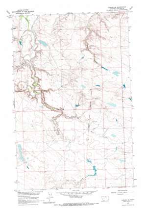
Coburg Se Topo Map Montana
To zoom in, hover over the map of Coburg Se
USGS Topo Quad 48108c3 - 1:24,000 scale
| Topo Map Name: | Coburg Se |
| USGS Topo Quad ID: | 48108c3 |
| Print Size: | ca. 21 1/4" wide x 27" high |
| Southeast Coordinates: | 48.25° N latitude / 108.25° W longitude |
| Map Center Coordinates: | 48.3125° N latitude / 108.3125° W longitude |
| U.S. State: | MT |
| Filename: | o48108c3.jpg |
| Download Map JPG Image: | Coburg Se topo map 1:24,000 scale |
| Map Type: | Topographic |
| Topo Series: | 7.5´ |
| Map Scale: | 1:24,000 |
| Source of Map Images: | United States Geological Survey (USGS) |
| Alternate Map Versions: |
Coburg SE MT 1964, updated 1967 Download PDF Buy paper map Coburg SE MT 2011 Download PDF Buy paper map Coburg SE MT 2014 Download PDF Buy paper map |
1:24,000 Topo Quads surrounding Coburg Se
> Back to 48108a1 at 1:100,000 scale
> Back to 48108a1 at 1:250,000 scale
> Back to U.S. Topo Maps home
Coburg Se topo map: Gazetteer
Coburg Se: Dams
Fort Belknap Number 1 Dam elevation 706m 2316′Fort Belknap Number 4 Dam elevation 791m 2595′
Rocky Number 1 Dam elevation 759m 2490′
Rocky Number 2 Dam elevation 784m 2572′
Coburg Se: Streams
Mud Creek elevation 716m 2349′North Fork Mud Creek elevation 733m 2404′
Coburg Se: Valleys
Box Elder Coulee elevation 707m 2319′Kuhr Coulee elevation 712m 2335′
Coburg Se: Wells
30N26E09DCA_01 Well elevation 712m 2335′30N26E16AAA_01 Well elevation 717m 2352′
30N26E16AAB_01 Well elevation 713m 2339′
30N26E16ADBA01 Well elevation 733m 2404′
30N26E17AAB_01 Well elevation 726m 2381′
30N26E17ADBD01 Well elevation 721m 2365′
30N26E17ADDD01 Well elevation 717m 2352′
Coburg Se digital topo map on disk
Buy this Coburg Se topo map showing relief, roads, GPS coordinates and other geographical features, as a high-resolution digital map file on DVD:


