Dodson Ne Topo Map Montana
To zoom in, hover over the map of Dodson Ne
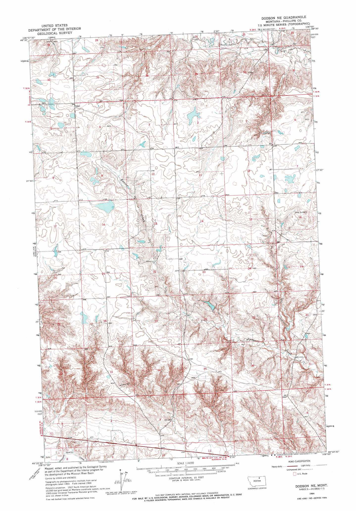
USGS Topo Quad 48108d1 - 1:24,000 scale
| Topo Map Name: | Dodson Ne |
| USGS Topo Quad ID: | 48108d1 |
| Print Size: | ca. 21 1/4" wide x 27" high |
| Southeast Coordinates: | 48.375° N latitude / 108° W longitude |
| Map Center Coordinates: | 48.4375° N latitude / 108.0625° W longitude |
| U.S. State: | MT |
| Filename: | o48108d1.jpg |
| Download Map JPG Image: | Dodson Ne topo map 1:24,000 scale |
| Map Type: | Topographic |
| Topo Series: | 7.5´ |
| Map Scale: | 1:24,000 |
| Source of Map Images: | United States Geological Survey (USGS) |
| Alternate Map Versions: |
Dodson NE MT 1964, updated 1967 Download PDF Buy paper map Dodson NE MT 2011 Download PDF Buy paper map Dodson NE MT 2014 Download PDF Buy paper map |
1:24,000 Topo Quads surrounding Dodson Ne
Down Reservoir Ne |
Emerick Bench |
Hubert Hill |
Lovejoy |
Austin Coulee |
Down Reservoir |
Hubert Hill Sw |
Hubert Hill Se |
Garland Creek |
Fanny Hill |
Dodson Dam |
Dodson |
Dodson Ne |
Malta Nw |
Malta Ne |
Coburg Se |
Cow Creek |
Wagner |
Malta West |
Malta East |
Big Flat East |
Wild Horse Reservoir |
West Alkali Reservoir |
Bennett Lake Nw |
Bennett Lake |
> Back to 48108a1 at 1:100,000 scale
> Back to 48108a1 at 1:250,000 scale
> Back to U.S. Topo Maps home
Dodson Ne topo map: Gazetteer
Dodson Ne: Dams
PR-132 Dam elevation 793m 2601′Dodson Ne: Wells
30N29E06DBBD01 Well elevation 770m 2526′31N28E15BDBD01 Well elevation 827m 2713′
31N29E19AD__01 Well elevation 792m 2598′
32N28E34BA__01 Well elevation 837m 2746′
32N28E34CBD_01 Well elevation 836m 2742′
32N28E34CCAB01 Well elevation 830m 2723′
Dodson Ne digital topo map on disk
Buy this Dodson Ne topo map showing relief, roads, GPS coordinates and other geographical features, as a high-resolution digital map file on DVD: