Hubert Hill Topo Map Montana
To zoom in, hover over the map of Hubert Hill
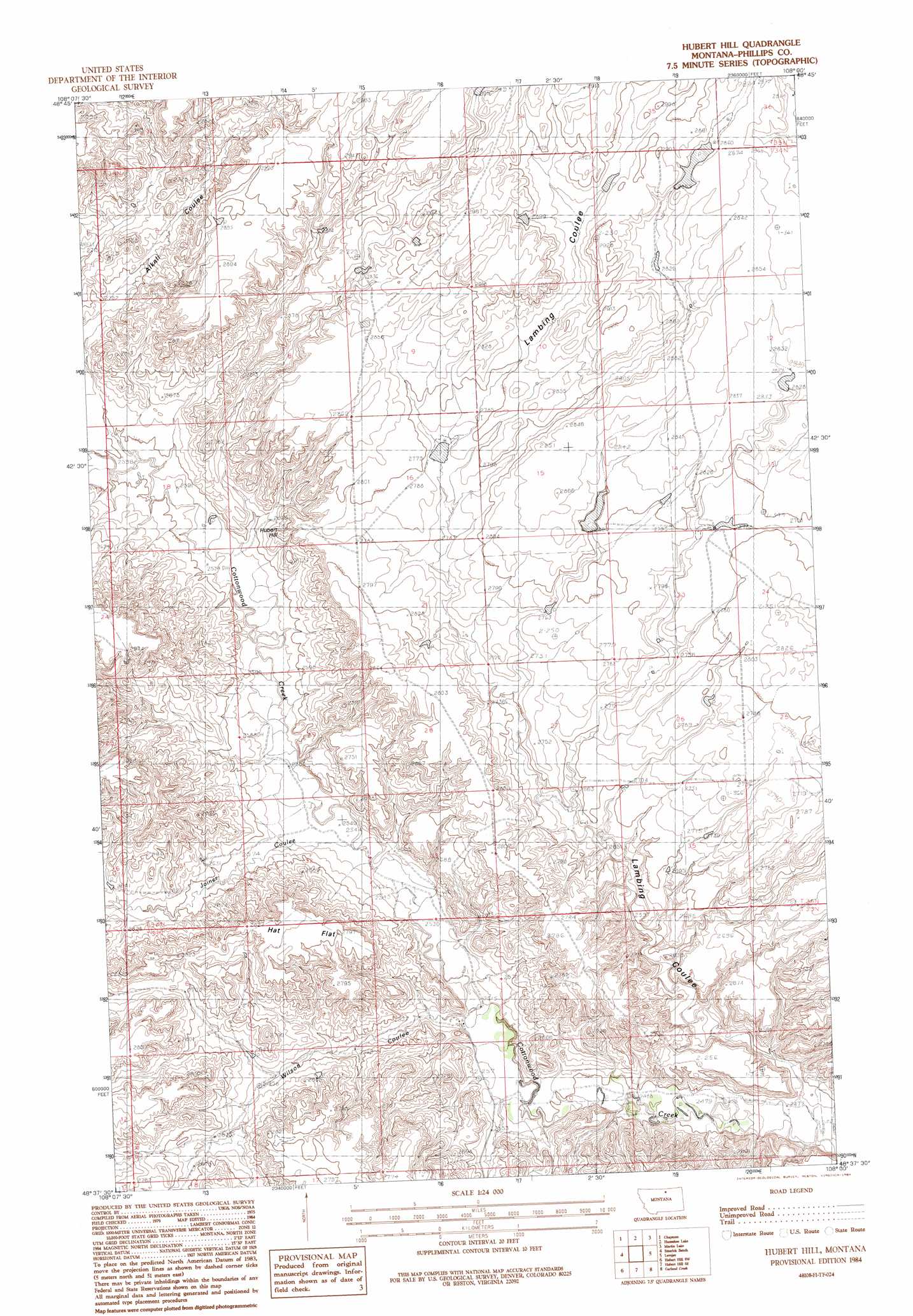
USGS Topo Quad 48108f1 - 1:24,000 scale
| Topo Map Name: | Hubert Hill |
| USGS Topo Quad ID: | 48108f1 |
| Print Size: | ca. 21 1/4" wide x 27" high |
| Southeast Coordinates: | 48.625° N latitude / 108° W longitude |
| Map Center Coordinates: | 48.6875° N latitude / 108.0625° W longitude |
| U.S. State: | MT |
| Filename: | o48108f1.jpg |
| Download Map JPG Image: | Hubert Hill topo map 1:24,000 scale |
| Map Type: | Topographic |
| Topo Series: | 7.5´ |
| Map Scale: | 1:24,000 |
| Source of Map Images: | United States Geological Survey (USGS) |
| Alternate Map Versions: |
Hubert Hill MT 1984, updated 1984 Download PDF Buy paper map Hubert Hill MT 2011 Download PDF Buy paper map Hubert Hill MT 2014 Download PDF Buy paper map |
1:24,000 Topo Quads surrounding Hubert Hill
Turner Ne |
Chapman Nw |
Sunny Slope School |
Loring Nw |
Morgan |
Turner Se |
Chapman |
Horseshoe Lake |
Martin Lake |
Loring |
Down Reservoir Ne |
Emerick Bench |
Hubert Hill |
Lovejoy |
Austin Coulee |
Down Reservoir |
Hubert Hill Sw |
Hubert Hill Se |
Garland Creek |
Fanny Hill |
Dodson Dam |
Dodson |
Dodson Ne |
Malta Nw |
Malta Ne |
> Back to 48108e1 at 1:100,000 scale
> Back to 48108a1 at 1:250,000 scale
> Back to U.S. Topo Maps home
Hubert Hill topo map: Gazetteer
Hubert Hill: Dams
PR-110 Dam elevation 856m 2808′Simple Simon Dam elevation 873m 2864′
Hubert Hill: Flats
Hat Flat elevation 859m 2818′Hubert Hill: Summits
Hubert Hill elevation 836m 2742′Hubert Hill: Valleys
Alkali Coulee elevation 799m 2621′Joiner Coulee elevation 774m 2539′
Lambing Coulee elevation 754m 2473′
Wilson Coulee elevation 768m 2519′
Hubert Hill digital topo map on disk
Buy this Hubert Hill topo map showing relief, roads, GPS coordinates and other geographical features, as a high-resolution digital map file on DVD: