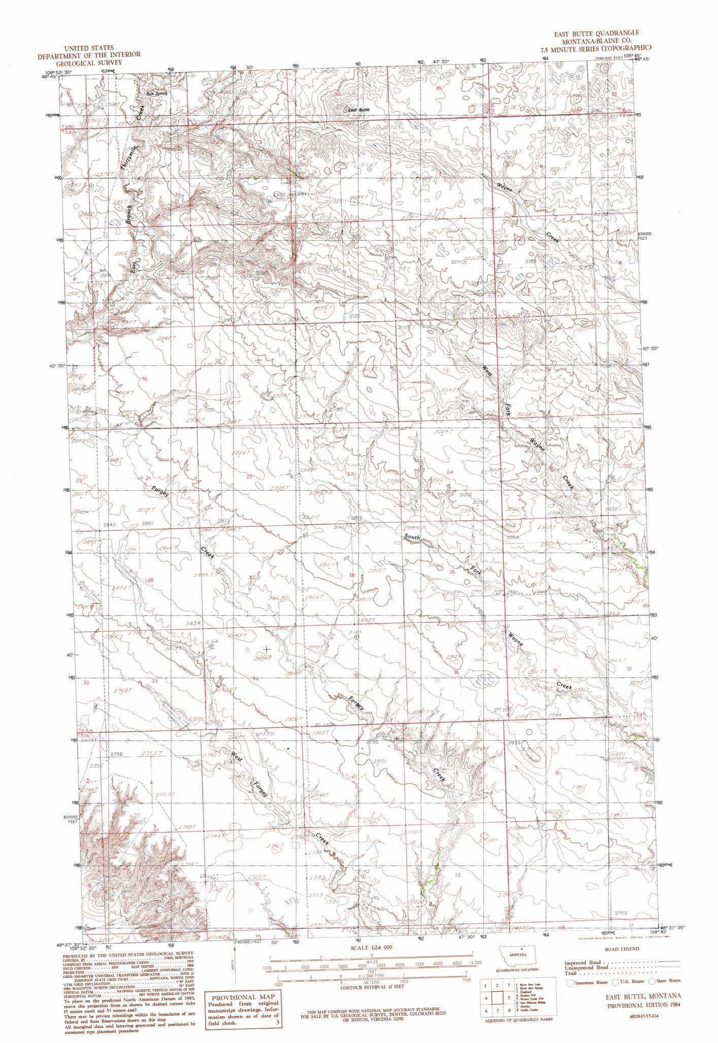
East Butte Topo Map Montana
To zoom in, hover over the map of East Butte
USGS Topo Quad 48108f7 - 1:24,000 scale
| Topo Map Name: | East Butte |
| USGS Topo Quad ID: | 48108f7 |
| Print Size: | ca. 21 1/4" wide x 27" high |
| Southeast Coordinates: | 48.625° N latitude / 108.75° W longitude |
| Map Center Coordinates: | 48.6875° N latitude / 108.8125° W longitude |
| U.S. State: | MT |
| Filename: | o48108f7.jpg |
| Download Map JPG Image: | East Butte topo map 1:24,000 scale |
| Map Type: | Topographic |
| Topo Series: | 7.5´ |
| Map Scale: | 1:24,000 |
| Source of Map Images: | United States Geological Survey (USGS) |
| Alternate Map Versions: |
East Butte MT 1984, updated 1984 Download PDF Buy paper map East Butte MT 2011 Download PDF Buy paper map East Butte MT 2014 Download PDF Buy paper map |
1:24,000 Topo Quads surrounding East Butte
Richmond Reservoir Ne |
Irvins Coulee |
Aubrey Dam |
Hogeland Nw |
Mosquito Springs |
Richmond Reservoir |
Silver Bow Lake |
Silver Bow Spring |
Hogeland |
Hogeland Se |
Tule Lake |
Harlem Nw |
East Butte |
Wayne Creek Nw |
Hornbeck Lake |
Zurich |
Fort Belknap Siding |
Harlem |
Grable Coulee |
Wayne Creek Se |
Cleveland Ne |
Big Coulee |
Fort Belknap Agency |
Threemile Reservoir |
Savoy |
> Back to 48108e1 at 1:100,000 scale
> Back to 48108a1 at 1:250,000 scale
> Back to U.S. Topo Maps home
East Butte topo map: Gazetteer
East Butte: Dams
Fogey Number 1 Dam elevation 836m 2742′Spider One Dam elevation 1007m 3303′
East Butte: Post Offices
Cull Post Office (historical) elevation 908m 2979′East Butte: Springs
Box Spring elevation 904m 2965′East Butte: Summits
East Butte elevation 1007m 3303′East Butte digital topo map on disk
Buy this East Butte topo map showing relief, roads, GPS coordinates and other geographical features, as a high-resolution digital map file on DVD: