Horseshoe Lake Topo Map Montana
To zoom in, hover over the map of Horseshoe Lake
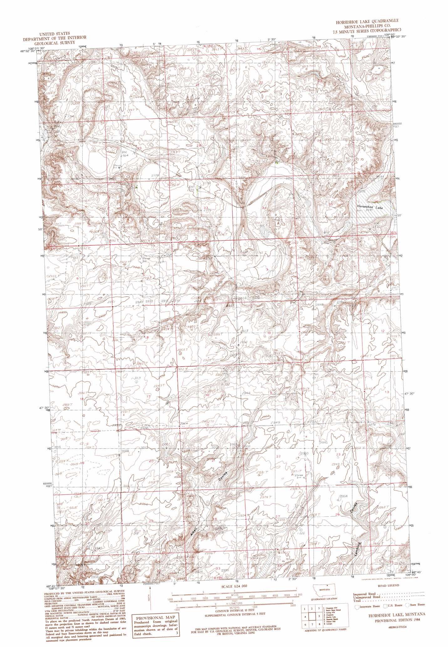
USGS Topo Quad 48108g1 - 1:24,000 scale
| Topo Map Name: | Horseshoe Lake |
| USGS Topo Quad ID: | 48108g1 |
| Print Size: | ca. 21 1/4" wide x 27" high |
| Southeast Coordinates: | 48.75° N latitude / 108° W longitude |
| Map Center Coordinates: | 48.8125° N latitude / 108.0625° W longitude |
| U.S. State: | MT |
| Filename: | o48108g1.jpg |
| Download Map JPG Image: | Horseshoe Lake topo map 1:24,000 scale |
| Map Type: | Topographic |
| Topo Series: | 7.5´ |
| Map Scale: | 1:24,000 |
| Source of Map Images: | United States Geological Survey (USGS) |
| Alternate Map Versions: |
Horseshoe Lake MT 1984, updated 1984 Download PDF Buy paper map Horseshoe Lake MT 2011 Download PDF Buy paper map Horseshoe Lake MT 2014 Download PDF Buy paper map |
1:24,000 Topo Quads surrounding Horseshoe Lake
Turner Ne |
Chapman Nw |
Sunny Slope School |
Loring Nw |
Morgan |
Turner Se |
Chapman |
Horseshoe Lake |
Martin Lake |
Loring |
Down Reservoir Ne |
Emerick Bench |
Hubert Hill |
Lovejoy |
Austin Coulee |
Down Reservoir |
Hubert Hill Sw |
Hubert Hill Se |
Garland Creek |
Fanny Hill |
> Back to 48108e1 at 1:100,000 scale
> Back to 48108a1 at 1:250,000 scale
> Back to U.S. Topo Maps home
Horseshoe Lake topo map: Gazetteer
Horseshoe Lake: Dams
Lang Corners Dam elevation 894m 2933′Horseshoe Lake: Lakes
Horse Shoe Lake elevation 821m 2693′Horseshoe Lake elevation 821m 2693′
Horseshoe Lake: Populated Places
Sumner elevation 920m 3018′Horseshoe Lake: Valleys
Cowie Coulee elevation 832m 2729′Gloyn Coulee elevation 824m 2703′
Horseshoe Lake: Wells
35N28E13AABD01 Well elevation 870m 2854′36N28E31ABC_01 Well elevation 879m 2883′
Horseshoe Lake digital topo map on disk
Buy this Horseshoe Lake topo map showing relief, roads, GPS coordinates and other geographical features, as a high-resolution digital map file on DVD: