Rattlesnake Topo Map Montana
To zoom in, hover over the map of Rattlesnake
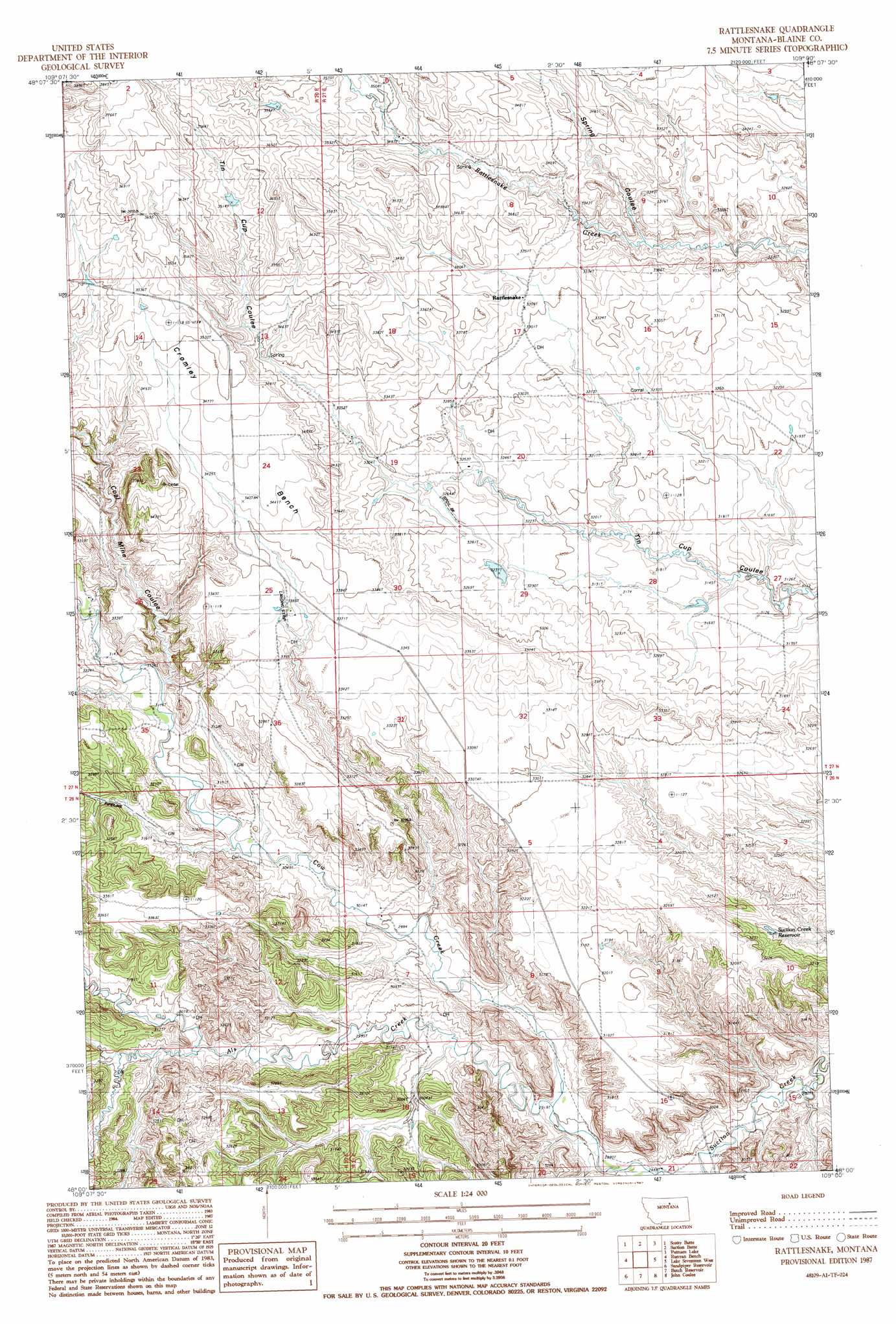
USGS Topo Quad 48109a1 - 1:24,000 scale
| Topo Map Name: | Rattlesnake |
| USGS Topo Quad ID: | 48109a1 |
| Print Size: | ca. 21 1/4" wide x 27" high |
| Southeast Coordinates: | 48° N latitude / 109° W longitude |
| Map Center Coordinates: | 48.0625° N latitude / 109.0625° W longitude |
| U.S. State: | MT |
| Filename: | o48109a1.jpg |
| Download Map JPG Image: | Rattlesnake topo map 1:24,000 scale |
| Map Type: | Topographic |
| Topo Series: | 7.5´ |
| Map Scale: | 1:24,000 |
| Source of Map Images: | United States Geological Survey (USGS) |
| Alternate Map Versions: |
Rattlesnake MT 1987, updated 1987 Download PDF Buy paper map Rattlesnake MT 2011 Download PDF Buy paper map Rattlesnake MT 2014 Download PDF Buy paper map |
1:24,000 Topo Quads surrounding Rattlesnake
Lloyd |
Cleveland |
Miles Butte |
Newhouse Reservoir |
Fort Belknap Agency Se |
Corrigan Mountain |
Scotty Butte |
Suction Butte |
Putnam Lake |
Lake Seventeen Ne |
Williamson Butte |
Runyan Bench |
Rattlesnake |
Lake Seventeen West |
Lake Seventeen East |
Nolan Reservoir |
Sandpiper Reservoir |
Butch Reservoir |
John Coulee |
Crazyman Coulee |
Leroy |
Bird Rapids |
Sturgeon Island |
Cow Island |
Shetland Divide |
> Back to 48109a1 at 1:100,000 scale
> Back to 48108a1 at 1:250,000 scale
> Back to U.S. Topo Maps home
Rattlesnake topo map: Gazetteer
Rattlesnake: Benches
Cromley Bench elevation 1057m 3467′Rattlesnake: Dams
Powell Number 1 Dam elevation 995m 3264′Powell Number 2 Dam elevation 965m 3166′
Rattlesnake: Populated Places
Rattlesnake elevation 1010m 3313′Rattlesnake: Post Offices
Rattlesnake Post Office (historical) elevation 1010m 3313′Rattlesnake: Reservoirs
Suction Creek Reservoir elevation 944m 3097′Rattlesnake: Streams
Als Creek elevation 885m 2903′Sand Creek elevation 951m 3120′
Rattlesnake: Valleys
Coal Mine Coulee elevation 955m 3133′Spring Coulee elevation 994m 3261′
Rattlesnake: Wells
27N21E15AABB01 Well elevation 974m 3195′Rattlesnake digital topo map on disk
Buy this Rattlesnake topo map showing relief, roads, GPS coordinates and other geographical features, as a high-resolution digital map file on DVD: