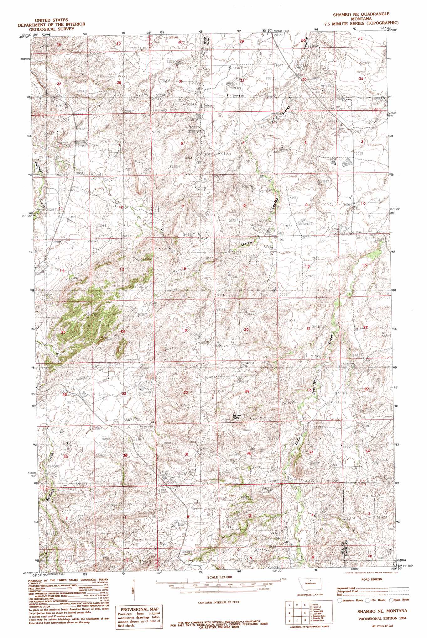
Shambo Ne Topo Map Montana
To zoom in, hover over the map of Shambo Ne
USGS Topo Quad 48109d5 - 1:24,000 scale
| Topo Map Name: | Shambo Ne |
| USGS Topo Quad ID: | 48109d5 |
| Print Size: | ca. 21 1/4" wide x 27" high |
| Southeast Coordinates: | 48.375° N latitude / 109.5° W longitude |
| Map Center Coordinates: | 48.4375° N latitude / 109.5625° W longitude |
| U.S. State: | MT |
| Filename: | o48109d5.jpg |
| Download Map JPG Image: | Shambo Ne topo map 1:24,000 scale |
| Map Type: | Topographic |
| Topo Series: | 7.5´ |
| Map Scale: | 1:24,000 |
| Source of Map Images: | United States Geological Survey (USGS) |
| Alternate Map Versions: |
Shambo NE MT 1984, updated 1984 Download PDF Buy paper map Shambo NE MT 2011 Download PDF Buy paper map Shambo NE MT 2014 Download PDF Buy paper map |
1:24,000 Topo Quads surrounding Shambo Ne
Quigley Coulee |
Havre Nw |
Havre Ne |
Reservoir Coulee |
Telescope Coulee |
Herron Park |
Havre |
Havre Se |
Lohman |
Lohman Se |
Laredo Ne |
Cement Hill |
Shambo Ne |
Lloyd Nw |
Sayer Butte |
Rocky Boy |
Bearpaw Lake |
Shambo Se |
Barber Butte |
Lloyd |
Centennial Mountain |
Bowery Peak |
Big John Butte |
Maddux |
Corrigan Mountain |
> Back to 48109a1 at 1:100,000 scale
> Back to 48108a1 at 1:250,000 scale
> Back to U.S. Topo Maps home
Shambo Ne topo map: Gazetteer
Shambo Ne: Populated Places
Oscar (historical) elevation 1030m 3379′Shambo Ne: Post Offices
Oscar Post Office (historical) elevation 901m 2956′Shambo Ne: Streams
East Fork Bull Hook Creek elevation 1017m 3336′Shambo Ne: Summits
Squaw Butte elevation 1177m 3861′Shambo Ne: Valleys
Niles Coulee elevation 947m 3106′Shambo Ne digital topo map on disk
Buy this Shambo Ne topo map showing relief, roads, GPS coordinates and other geographical features, as a high-resolution digital map file on DVD: