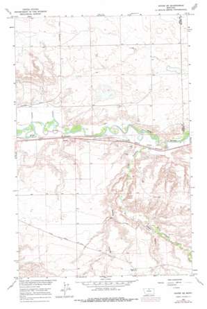
Havre Se Topo Map Montana
To zoom in, hover over the map of Havre Se
USGS Topo Quad 48109e5 - 1:24,000 scale
| Topo Map Name: | Havre Se |
| USGS Topo Quad ID: | 48109e5 |
| Print Size: | ca. 21 1/4" wide x 27" high |
| Southeast Coordinates: | 48.5° N latitude / 109.5° W longitude |
| Map Center Coordinates: | 48.5625° N latitude / 109.5625° W longitude |
| U.S. State: | MT |
| Filename: | o48109e5.jpg |
| Download Map JPG Image: | Havre Se topo map 1:24,000 scale |
| Map Type: | Topographic |
| Topo Series: | 7.5´ |
| Map Scale: | 1:24,000 |
| Source of Map Images: | United States Geological Survey (USGS) |
| Alternate Map Versions: |
Havre SE MT 1964, updated 1967 Download PDF Buy paper map Havre SE MT 1964, updated 1978 Download PDF Buy paper map Havre SE MT 2011 Download PDF Buy paper map Havre SE MT 2014 Download PDF Buy paper map |
1:24,000 Topo Quads surrounding Havre Se
> Back to 48109e1 at 1:100,000 scale
> Back to 48108a1 at 1:250,000 scale
> Back to U.S. Topo Maps home
Havre Se topo map: Gazetteer
Havre Se: Parks
Hurry Honyocker Hurry! Historical Marker elevation 754m 2473′Havre Se: Streams
Little Boxelder Creek elevation 745m 2444′Havre Se: Valleys
Carnal Coulee elevation 758m 2486′Sheep Camp Coulee elevation 754m 2473′
Spring Coulee elevation 760m 2493′
Staten Coulee elevation 783m 2568′
Havre Se: Wells
32N16E02CADB01 Well elevation 756m 2480′32N17E03DBAB01 Well elevation 753m 2470′
Havre Se digital topo map on disk
Buy this Havre Se topo map showing relief, roads, GPS coordinates and other geographical features, as a high-resolution digital map file on DVD:


