Reservoir Coulee Topo Map Montana
To zoom in, hover over the map of Reservoir Coulee
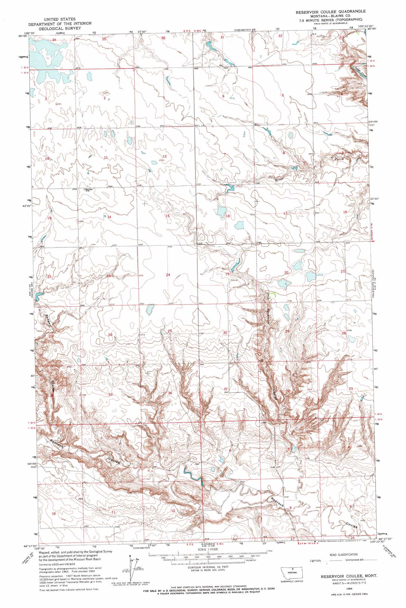
USGS Topo Quad 48109f4 - 1:24,000 scale
| Topo Map Name: | Reservoir Coulee |
| USGS Topo Quad ID: | 48109f4 |
| Print Size: | ca. 21 1/4" wide x 27" high |
| Southeast Coordinates: | 48.625° N latitude / 109.375° W longitude |
| Map Center Coordinates: | 48.6875° N latitude / 109.4375° W longitude |
| U.S. State: | MT |
| Filename: | o48109f4.jpg |
| Download Map JPG Image: | Reservoir Coulee topo map 1:24,000 scale |
| Map Type: | Topographic |
| Topo Series: | 7.5´ |
| Map Scale: | 1:24,000 |
| Source of Map Images: | United States Geological Survey (USGS) |
| Alternate Map Versions: |
Reservoir Coulee MT 1964, updated 1967 Download PDF Buy paper map Reservoir Coulee MT 2011 Download PDF Buy paper map Reservoir Coulee MT 2014 Download PDF Buy paper map |
1:24,000 Topo Quads surrounding Reservoir Coulee
Creedman Coulee East |
Lake Thibadeau Ne |
North Chinook Reservoir Nw |
North Chinook Reservoir Ne |
Richmond Reservoir Nw |
Lake Thibadeau Sw |
Lake Thibadeau |
Mclaren Reservoir |
North Chinook Res. |
Richmond Reservoir Sw |
Havre Nw |
Havre Ne |
Reservoir Coulee |
Telescope Coulee |
Rabbit Hills |
Havre |
Havre Se |
Lohman |
Lohman Se |
Chinook |
Cement Hill |
Shambo Ne |
Lloyd Nw |
Sayer Butte |
Cleveland Nw |
> Back to 48109e1 at 1:100,000 scale
> Back to 48108a1 at 1:250,000 scale
> Back to U.S. Topo Maps home
Reservoir Coulee topo map: Gazetteer
Reservoir Coulee: Dams
Badger Claws Dam elevation 809m 2654′BR-8 Dam elevation 822m 2696′
Reservoir Coulee: Post Offices
Casady Post Office (historical) elevation 762m 2500′Reservoir Coulee: Valleys
Reservoir Coulee elevation 746m 2447′Reservoir Coulee: Wells
34N18E09BBAD01 Well elevation 806m 2644′Reservoir Coulee digital topo map on disk
Buy this Reservoir Coulee topo map showing relief, roads, GPS coordinates and other geographical features, as a high-resolution digital map file on DVD: