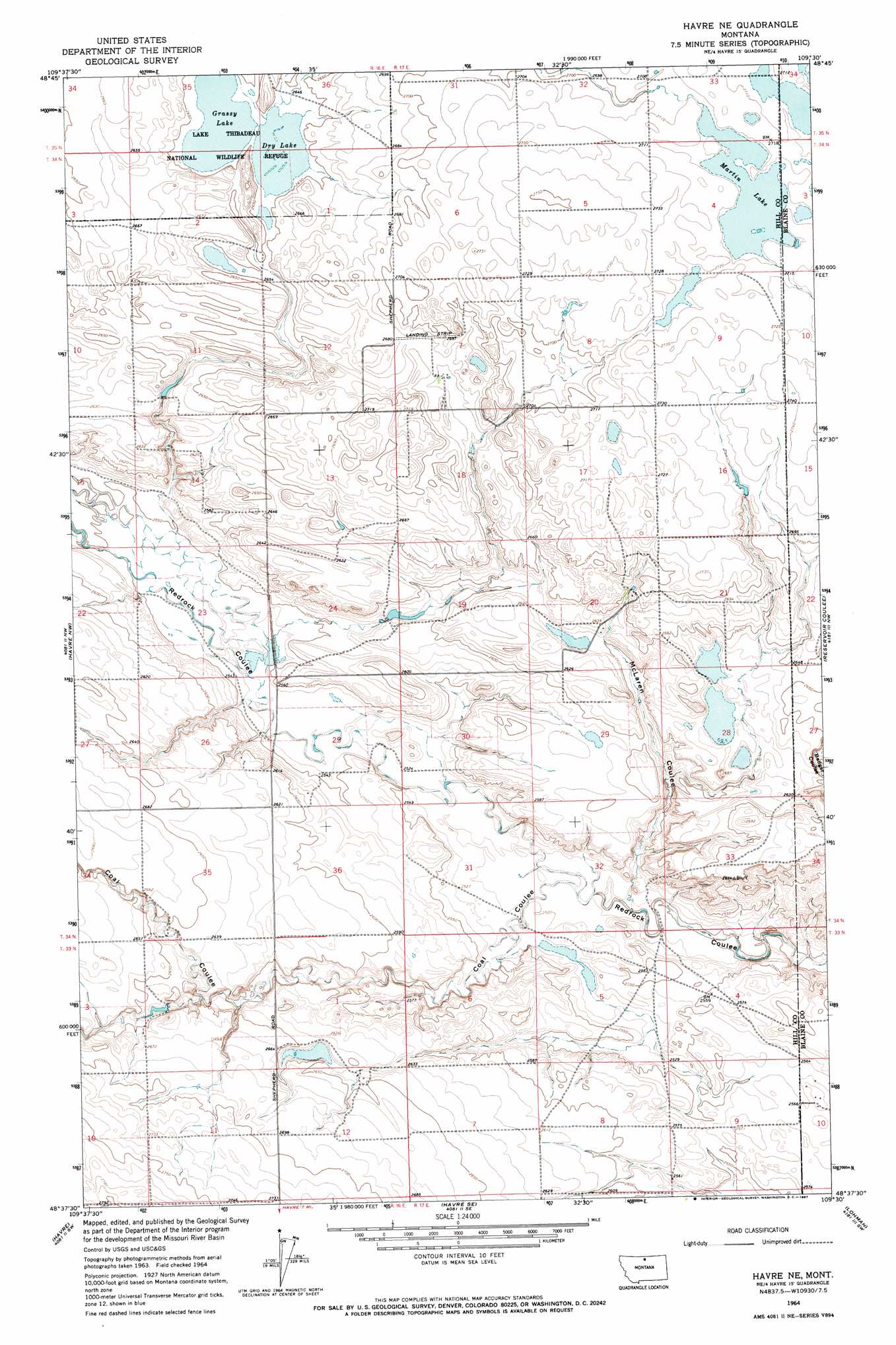
Havre Ne Topo Map Montana
To zoom in, hover over the map of Havre Ne
USGS Topo Quad 48109f5 - 1:24,000 scale
| Topo Map Name: | Havre Ne |
| USGS Topo Quad ID: | 48109f5 |
| Print Size: | ca. 21 1/4" wide x 27" high |
| Southeast Coordinates: | 48.625° N latitude / 109.5° W longitude |
| Map Center Coordinates: | 48.6875° N latitude / 109.5625° W longitude |
| U.S. State: | MT |
| Filename: | o48109f5.jpg |
| Download Map JPG Image: | Havre Ne topo map 1:24,000 scale |
| Map Type: | Topographic |
| Topo Series: | 7.5´ |
| Map Scale: | 1:24,000 |
| Source of Map Images: | United States Geological Survey (USGS) |
| Alternate Map Versions: |
Havre NE MT 1964, updated 1967 Download PDF Buy paper map Havre NE MT 2011 Download PDF Buy paper map Havre NE MT 2014 Download PDF Buy paper map |
1:24,000 Topo Quads surrounding Havre Ne
Creedman Coulee West |
Creedman Coulee East |
Lake Thibadeau Ne |
North Chinook Reservoir Nw |
North Chinook Reservoir Ne |
Hilldale Colony |
Lake Thibadeau Sw |
Lake Thibadeau |
Mclaren Reservoir |
North Chinook Res. |
Quigley Coulee |
Havre Nw |
Havre Ne |
Reservoir Coulee |
Telescope Coulee |
Herron Park |
Havre |
Havre Se |
Lohman |
Lohman Se |
Laredo Ne |
Cement Hill |
Shambo Ne |
Lloyd Nw |
Sayer Butte |
> Back to 48109e1 at 1:100,000 scale
> Back to 48108a1 at 1:250,000 scale
> Back to U.S. Topo Maps home
Havre Ne topo map: Gazetteer
Havre Ne: Dams
Grassy Lake Dam elevation 808m 2650′Mars Dam elevation 801m 2627′
Mister Mito Bars Dam elevation 796m 2611′
Mistress Leader Dam elevation 772m 2532′
Havre Ne: Lakes
Dry Lake elevation 807m 2647′Grassy Lake elevation 806m 2644′
Martin Lake elevation 828m 2716′
Havre Ne: Populated Places
East End Colony elevation 823m 2700′Havre Ne: Reservoirs
Grassy Lake elevation 808m 2650′Havre Ne: Valleys
Badger Coulee elevation 786m 2578′Coal Coulee elevation 764m 2506′
McLaren Coulee elevation 764m 2506′
Havre Ne: Wells
33N17E06DDAD01 Well elevation 767m 2516′Havre Ne digital topo map on disk
Buy this Havre Ne topo map showing relief, roads, GPS coordinates and other geographical features, as a high-resolution digital map file on DVD: