Richmond Reservoir Topo Map Montana
To zoom in, hover over the map of Richmond Reservoir
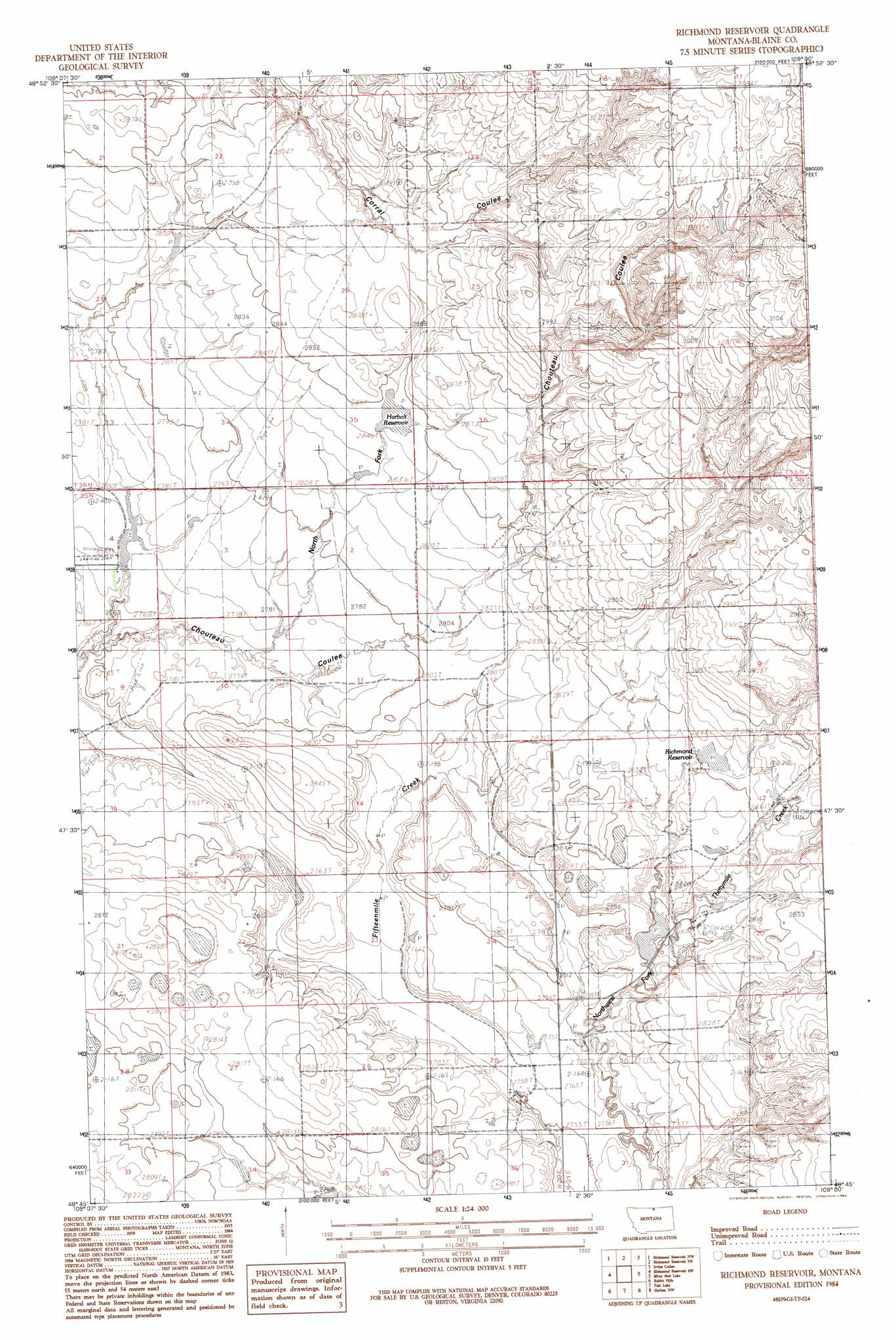
USGS Topo Quad 48109g1 - 1:24,000 scale
| Topo Map Name: | Richmond Reservoir |
| USGS Topo Quad ID: | 48109g1 |
| Print Size: | ca. 21 1/4" wide x 27" high |
| Southeast Coordinates: | 48.75° N latitude / 109° W longitude |
| Map Center Coordinates: | 48.8125° N latitude / 109.0625° W longitude |
| U.S. State: | MT |
| Filename: | o48109g1.jpg |
| Download Map JPG Image: | Richmond Reservoir topo map 1:24,000 scale |
| Map Type: | Topographic |
| Topo Series: | 7.5´ |
| Map Scale: | 1:24,000 |
| Source of Map Images: | United States Geological Survey (USGS) |
| Alternate Map Versions: |
Richmond Reservoir MT 1984, updated 1984 Download PDF Buy paper map Richmond Reservoir MT 2011 Download PDF Buy paper map Richmond Reservoir MT 2014 Download PDF Buy paper map |
1:24,000 Topo Quads surrounding Richmond Reservoir
North Chinook Reservoir Ne |
Richmond Reservoir Nw |
Richmond Reservoir Ne |
Irvins Coulee |
Aubrey Dam |
North Chinook Res. |
Richmond Reservoir Sw |
Richmond Reservoir |
Silver Bow Lake |
Silver Bow Spring |
Telescope Coulee |
Rabbit Hills |
Tule Lake |
Harlem Nw |
East Butte |
Lohman Se |
Chinook |
Zurich |
Fort Belknap Siding |
Harlem |
> Back to 48109e1 at 1:100,000 scale
> Back to 48108a1 at 1:250,000 scale
> Back to U.S. Topo Maps home
Richmond Reservoir topo map: Gazetteer
Richmond Reservoir: Dams
Battle Horse Reservoir Dam elevation 866m 2841′Over the Hill Reservoir Dam elevation 850m 2788′
Richmond Dam elevation 867m 2844′
Richmond Reservoir: Populated Places
Minnesota Settlement (historical) elevation 848m 2782′Richmond Reservoir: Post Offices
Duclair Post Office (historical) elevation 881m 2890′Richmond Reservoir: Reservoirs
Harbolt Reservoir elevation 868m 2847′Richmond Reservoir elevation 867m 2844′
Richmond Reservoir: Valleys
North Fork Chouteau Coulee elevation 845m 2772′Richmond Reservoir digital topo map on disk
Buy this Richmond Reservoir topo map showing relief, roads, GPS coordinates and other geographical features, as a high-resolution digital map file on DVD: