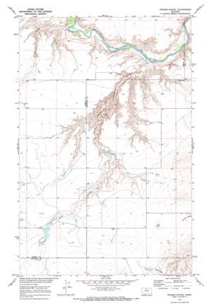
Penzer School Topo Map Montana
To zoom in, hover over the map of Penzer School
USGS Topo Quad 48110b7 - 1:24,000 scale
| Topo Map Name: | Penzer School |
| USGS Topo Quad ID: | 48110b7 |
| Print Size: | ca. 21 1/4" wide x 27" high |
| Southeast Coordinates: | 48.125° N latitude / 110.75° W longitude |
| Map Center Coordinates: | 48.1875° N latitude / 110.8125° W longitude |
| U.S. State: | MT |
| Filename: | o48110b7.jpg |
| Download Map JPG Image: | Penzer School topo map 1:24,000 scale |
| Map Type: | Topographic |
| Topo Series: | 7.5´ |
| Map Scale: | 1:24,000 |
| Source of Map Images: | United States Geological Survey (USGS) |
| Alternate Map Versions: |
Penzer School MT 1970, updated 1973 Download PDF Buy paper map Penzer School MT 2011 Download PDF Buy paper map Penzer School MT 2014 Download PDF Buy paper map |
1:24,000 Topo Quads surrounding Penzer School
> Back to 48110a1 at 1:100,000 scale
> Back to 48110a1 at 1:250,000 scale
> Back to U.S. Topo Maps home
Penzer School topo map: Gazetteer
Penzer School: Dams
Night Fever School Dam elevation 933m 3061′Penzer Dam elevation 908m 2979′
Romain Dam elevation 949m 3113′
Squiggles Number 2 Dam elevation 945m 3100′
Penzer School: Lakes
Lees Lake elevation 954m 3129′Penzer School: Post Offices
Goose Bill Post Office (historical) elevation 956m 3136′Penzer School: Reservoirs
Romain Reservoir elevation 949m 3113′Penzer School: Valleys
Dead Indian Coulee elevation 828m 2716′Horse Coulee elevation 830m 2723′
Penzer School digital topo map on disk
Buy this Penzer School topo map showing relief, roads, GPS coordinates and other geographical features, as a high-resolution digital map file on DVD:


