Bailey Reservoir Topo Map Montana
To zoom in, hover over the map of Bailey Reservoir
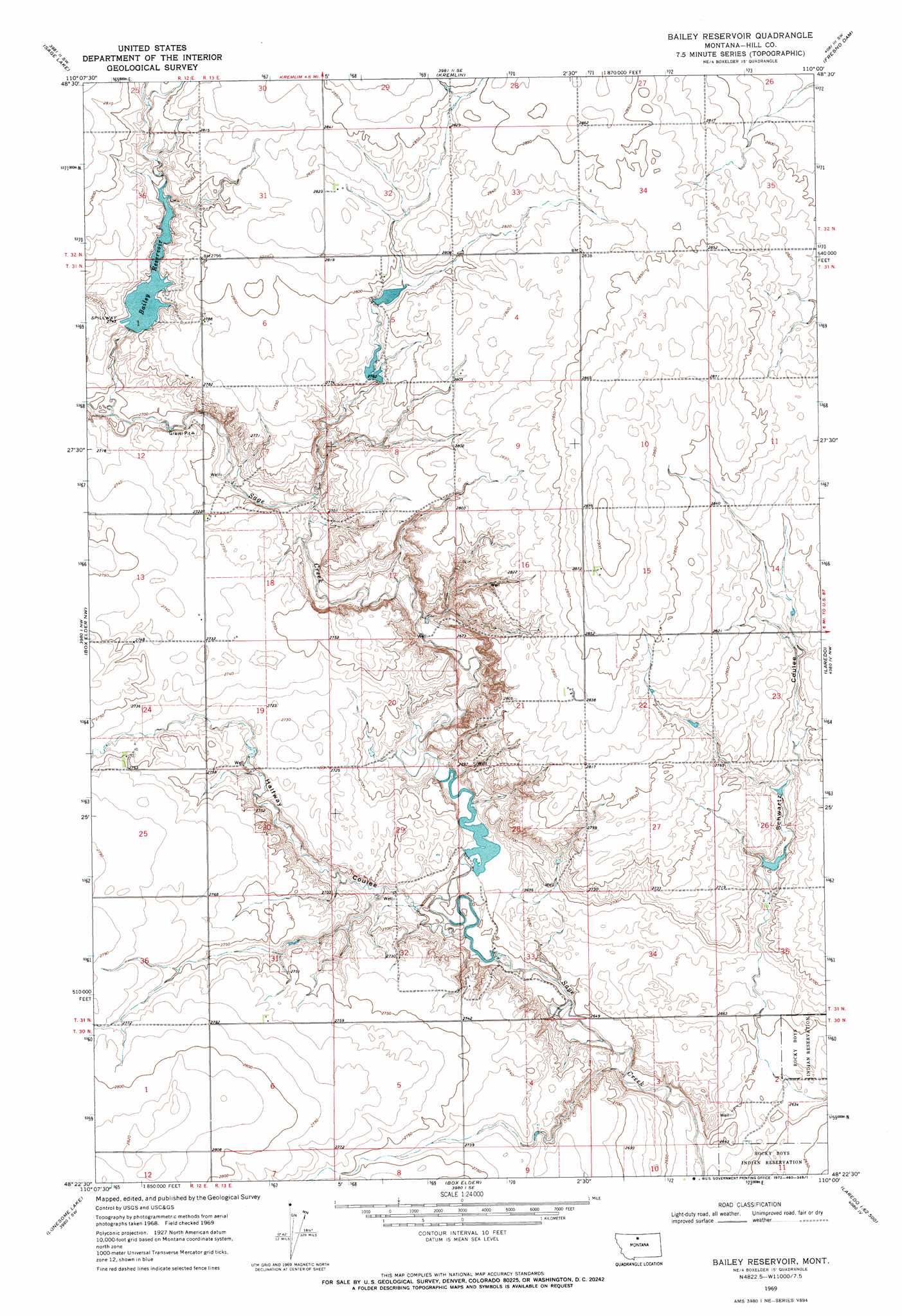
USGS Topo Quad 48110d1 - 1:24,000 scale
| Topo Map Name: | Bailey Reservoir |
| USGS Topo Quad ID: | 48110d1 |
| Print Size: | ca. 21 1/4" wide x 27" high |
| Southeast Coordinates: | 48.375° N latitude / 110° W longitude |
| Map Center Coordinates: | 48.4375° N latitude / 110.0625° W longitude |
| U.S. State: | MT |
| Filename: | o48110d1.jpg |
| Download Map JPG Image: | Bailey Reservoir topo map 1:24,000 scale |
| Map Type: | Topographic |
| Topo Series: | 7.5´ |
| Map Scale: | 1:24,000 |
| Source of Map Images: | United States Geological Survey (USGS) |
| Alternate Map Versions: |
Bailey Reservoir MT 1969, updated 1972 Download PDF Buy paper map Bailey Reservoir MT 2011 Download PDF Buy paper map Bailey Reservoir MT 2014 Download PDF Buy paper map |
1:24,000 Topo Quads surrounding Bailey Reservoir
Gildford Ne |
Dry Lake |
Saddle Butte |
Kiehns Coulee |
Quigley Coulee |
Gildford |
Sage Lake |
Kremlin |
Fresno Dam |
Herron Park |
Fourteenmile Coulee Ne |
Box Elder Nw |
Bailey Reservoir |
Laredo |
Laredo Ne |
Fourteenmile Coulee Se |
Lonesome Lake |
Box Elder |
Cowan Reservoir |
Rocky Boy |
Kenilworth Ne |
Ihmsen Well |
Big Sandy |
Table Butte |
Centennial Mountain |
> Back to 48110a1 at 1:100,000 scale
> Back to 48110a1 at 1:250,000 scale
> Back to U.S. Topo Maps home
Bailey Reservoir topo map: Gazetteer
Bailey Reservoir: Dams
Bailey-Dees-Frey Dam elevation 838m 2749′Dees Brothers Dam elevation 845m 2772′
Hilldale Colony Dam elevation 848m 2782′
Howard Goodian Dam elevation 810m 2657′
Kiemle Dam elevation 823m 2700′
Bailey Reservoir: Reservoirs
Bailey Reservoir elevation 838m 2749′Bailey Reservoir elevation 838m 2749′
Kiemle Reservoir elevation 823m 2700′
Bailey Reservoir: Valleys
Halfway Coulee elevation 809m 2654′Bailey Reservoir: Wells
31N13E32BAAA01 Well elevation 804m 2637′Bailey Reservoir digital topo map on disk
Buy this Bailey Reservoir topo map showing relief, roads, GPS coordinates and other geographical features, as a high-resolution digital map file on DVD: