Fourteenmile Coulee Ne Topo Map Montana
To zoom in, hover over the map of Fourteenmile Coulee Ne
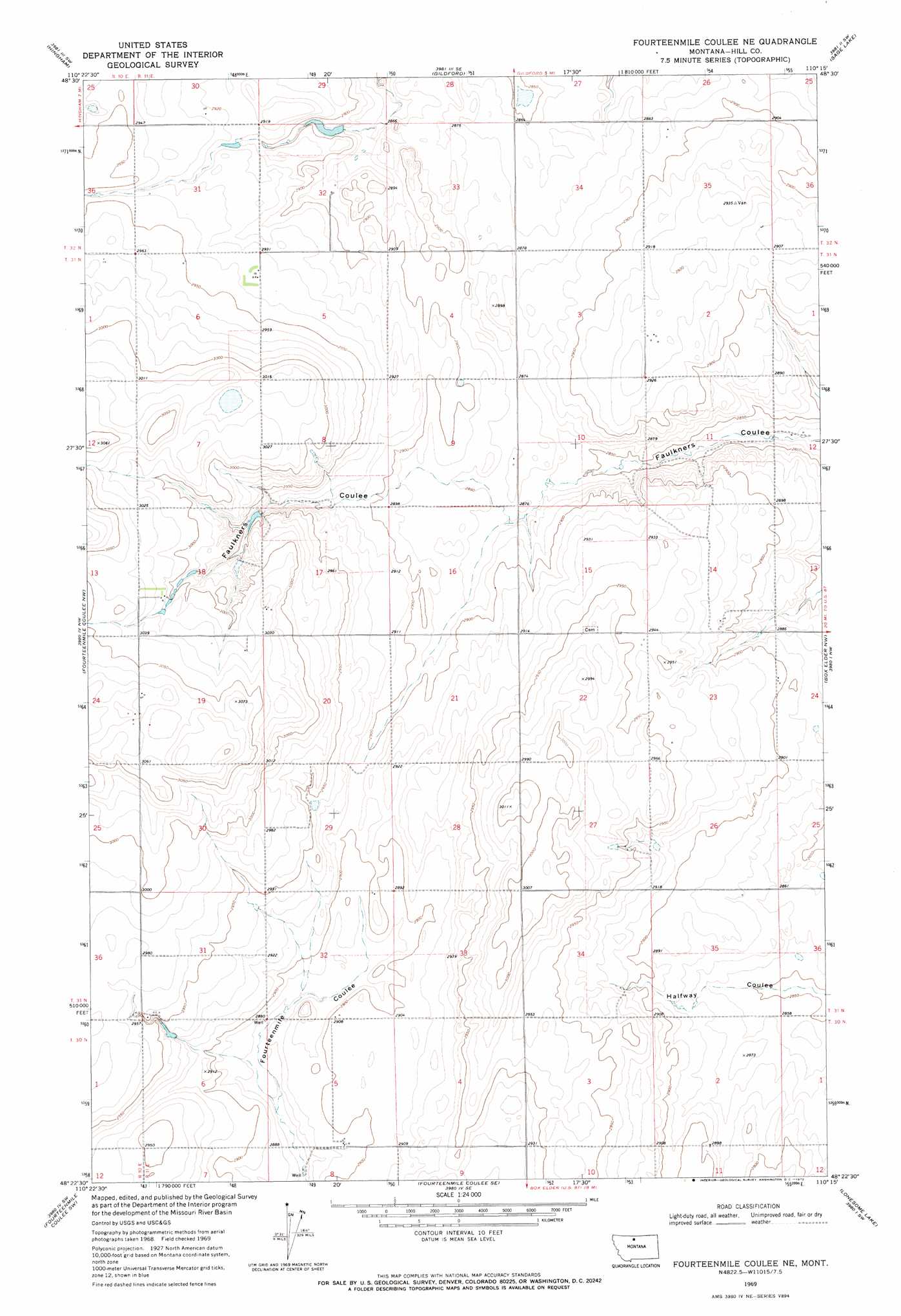
USGS Topo Quad 48110d3 - 1:24,000 scale
| Topo Map Name: | Fourteenmile Coulee Ne |
| USGS Topo Quad ID: | 48110d3 |
| Print Size: | ca. 21 1/4" wide x 27" high |
| Southeast Coordinates: | 48.375° N latitude / 110.25° W longitude |
| Map Center Coordinates: | 48.4375° N latitude / 110.3125° W longitude |
| U.S. State: | MT |
| Filename: | o48110d3.jpg |
| Download Map JPG Image: | Fourteenmile Coulee Ne topo map 1:24,000 scale |
| Map Type: | Topographic |
| Topo Series: | 7.5´ |
| Map Scale: | 1:24,000 |
| Source of Map Images: | United States Geological Survey (USGS) |
| Alternate Map Versions: |
Fourteenmile Coulee NE MT 1969, updated 1972 Download PDF Buy paper map Fourteenmile Coulee NE MT 2011 Download PDF Buy paper map Fourteenmile Coulee NE MT 2014 Download PDF Buy paper map |
1:24,000 Topo Quads surrounding Fourteenmile Coulee Ne
Rudyaro Ne |
Gildford Nw |
Gildford Ne |
Dry Lake |
Saddle Butte |
Rudyard |
Hingham |
Gildford |
Sage Lake |
Kremlin |
Een School |
Fourteenmile Coulee Nw |
Fourteenmile Coulee Ne |
Box Elder Nw |
Bailey Reservoir |
Rocky Coulee Se |
Fourteenmile Coulee Sw |
Fourteenmile Coulee Se |
Lonesome Lake |
Box Elder |
Discovery Butte |
Kenilworth |
Kenilworth Ne |
Ihmsen Well |
Big Sandy |
> Back to 48110a1 at 1:100,000 scale
> Back to 48110a1 at 1:250,000 scale
> Back to U.S. Topo Maps home
Fourteenmile Coulee Ne topo map: Gazetteer
Fourteenmile Coulee Ne: Dams
Narcissus Dam elevation 883m 2896′Fourteenmile Coulee Ne digital topo map on disk
Buy this Fourteenmile Coulee Ne topo map showing relief, roads, GPS coordinates and other geographical features, as a high-resolution digital map file on DVD: