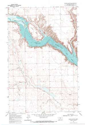
Saddle Butte Topo Map Montana
To zoom in, hover over the map of Saddle Butte
USGS Topo Quad 48110f1 - 1:24,000 scale
| Topo Map Name: | Saddle Butte |
| USGS Topo Quad ID: | 48110f1 |
| Print Size: | ca. 21 1/4" wide x 27" high |
| Southeast Coordinates: | 48.625° N latitude / 110° W longitude |
| Map Center Coordinates: | 48.6875° N latitude / 110.0625° W longitude |
| U.S. State: | MT |
| Filename: | o48110f1.jpg |
| Download Map JPG Image: | Saddle Butte topo map 1:24,000 scale |
| Map Type: | Topographic |
| Topo Series: | 7.5´ |
| Map Scale: | 1:24,000 |
| Source of Map Images: | United States Geological Survey (USGS) |
| Alternate Map Versions: |
Saddle Butte MT 1969, updated 1972 Download PDF Buy paper map Saddle Butte MT 2011 Download PDF Buy paper map Saddle Butte MT 2014 Download PDF Buy paper map |
1:24,000 Topo Quads surrounding Saddle Butte
> Back to 48110e1 at 1:100,000 scale
> Back to 48110a1 at 1:250,000 scale
> Back to U.S. Topo Maps home
Saddle Butte topo map: Gazetteer
Saddle Butte: Lakes
Chain of Lakes elevation 794m 2604′Saddle Butte: Summits
Saddle Butte elevation 825m 2706′Saddle Butte: Valleys
Alkali Lakes Coulee elevation 808m 2650′Cottonwood Coulee elevation 789m 2588′
Dry Lake Coulee elevation 799m 2621′
Little Dane Coulee elevation 796m 2611′
Spring Coulee elevation 802m 2631′
Watson Coulee elevation 787m 2582′
Wild Rose Coulee elevation 801m 2627′
Saddle Butte: Wells
33N05E01CDCC01 Well elevation 807m 2647′34N05E26AABA01 Well elevation 824m 2703′
34N13E03CBBB01 Well elevation 838m 2749′
Saddle Butte digital topo map on disk
Buy this Saddle Butte topo map showing relief, roads, GPS coordinates and other geographical features, as a high-resolution digital map file on DVD:


