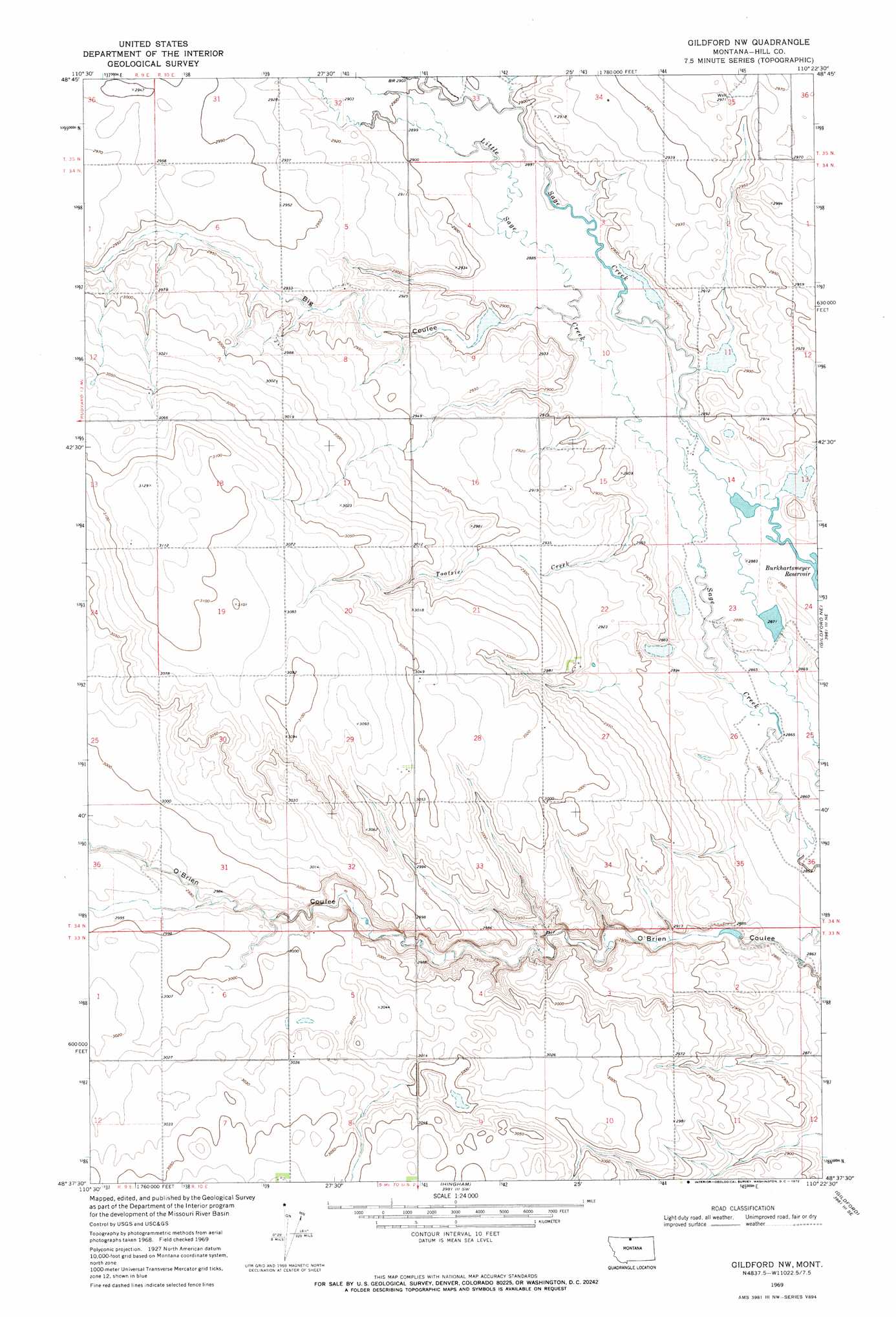
Gildford Nw Topo Map Montana
To zoom in, hover over the map of Gildford Nw
USGS Topo Quad 48110f4 - 1:24,000 scale
| Topo Map Name: | Gildford Nw |
| USGS Topo Quad ID: | 48110f4 |
| Print Size: | ca. 21 1/4" wide x 27" high |
| Southeast Coordinates: | 48.625° N latitude / 110.375° W longitude |
| Map Center Coordinates: | 48.6875° N latitude / 110.4375° W longitude |
| U.S. State: | MT |
| Filename: | o48110f4.jpg |
| Download Map JPG Image: | Gildford Nw topo map 1:24,000 scale |
| Map Type: | Topographic |
| Topo Series: | 7.5´ |
| Map Scale: | 1:24,000 |
| Source of Map Images: | United States Geological Survey (USGS) |
| Alternate Map Versions: |
Gildford NW MT 1969, updated 1972 Download PDF Buy paper map Gildford NW MT 2011 Download PDF Buy paper map Gildford NW MT 2014 Download PDF Buy paper map |
1:24,000 Topo Quads surrounding Gildford Nw
Laird Lake |
Goldstone |
Lost River |
Lost River Ne |
Simpson |
Goldstone Sw |
Mckinnsey Reservoir West |
Mckinnsey Reservoir East |
Ninemile Coulee West |
Ninemile Coulee East |
Rudyard Nw |
Rudyaro Ne |
Gildford Nw |
Gildford Ne |
Dry Lake |
Inverness |
Rudyard |
Hingham |
Gildford |
Sage Lake |
Rocky Coulee |
Een School |
Fourteenmile Coulee Nw |
Fourteenmile Coulee Ne |
Box Elder Nw |
> Back to 48110e1 at 1:100,000 scale
> Back to 48110a1 at 1:250,000 scale
> Back to U.S. Topo Maps home
Gildford Nw topo map: Gazetteer
Gildford Nw: Dams
Big Sage Hen Dam elevation 880m 2887′Burkhartsmeyer Too Dam elevation 876m 2874′
Mustapha Dam elevation 881m 2890′
O'Brien Coulee Dam elevation 917m 3008′
Gildford Nw: Streams
Little Sage Creek elevation 877m 2877′Tootsie Creek elevation 879m 2883′
Gildford Nw: Valleys
Big Coulee elevation 881m 2890′Schultz Coulee elevation 882m 2893′
Gildford Nw: Wells
33N10E07DACC01 Well elevation 932m 3057′34N10E14BCAA01 Well elevation 878m 2880′
34N10E14BCAB01 Well elevation 878m 2880′
Gildford Nw digital topo map on disk
Buy this Gildford Nw topo map showing relief, roads, GPS coordinates and other geographical features, as a high-resolution digital map file on DVD: