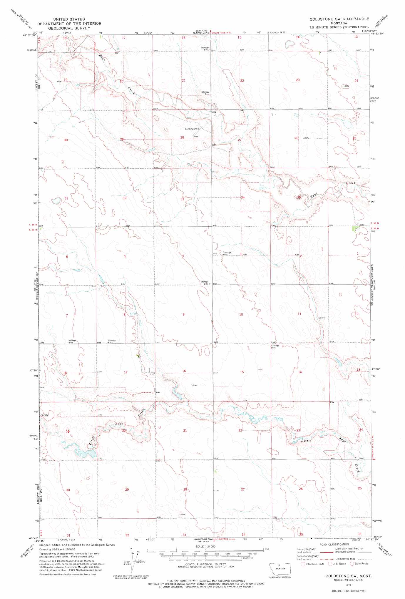
Goldstone Sw Topo Map Montana
To zoom in, hover over the map of Goldstone Sw
USGS Topo Quad 48110g6 - 1:24,000 scale
| Topo Map Name: | Goldstone Sw |
| USGS Topo Quad ID: | 48110g6 |
| Print Size: | ca. 21 1/4" wide x 27" high |
| Southeast Coordinates: | 48.75° N latitude / 110.625° W longitude |
| Map Center Coordinates: | 48.8125° N latitude / 110.6875° W longitude |
| U.S. State: | MT |
| Filename: | o48110g6.jpg |
| Download Map JPG Image: | Goldstone Sw topo map 1:24,000 scale |
| Map Type: | Topographic |
| Topo Series: | 7.5´ |
| Map Scale: | 1:24,000 |
| Source of Map Images: | United States Geological Survey (USGS) |
| Alternate Map Versions: |
Goldstone SW MT 1972, updated 1975 Download PDF Buy paper map Goldstone SW MT 2011 Download PDF Buy paper map Goldstone SW MT 2014 Download PDF Buy paper map |
1:24,000 Topo Quads surrounding Goldstone Sw
Laird School |
Bobcat Coulee Ne |
Laird Lake |
Goldstone |
Lost River |
Vaver Reservoir |
Bobcat Coulee Se |
Goldstone Sw |
Mckinnsey Reservoir West |
Mckinnsey Reservoir East |
Chester Nw |
Chester Ne |
Rudyard Nw |
Rudyaro Ne |
Gildford Nw |
Chester |
Joplin |
Inverness |
Rudyard |
Hingham |
> Back to 48110e1 at 1:100,000 scale
> Back to 48110a1 at 1:250,000 scale
> Back to U.S. Topo Maps home
Goldstone Sw topo map: Gazetteer
Goldstone Sw: Dams
Gritty Milk Dam elevation 963m 3159′Ostrich Egg Dam elevation 943m 3093′
Goldstone Sw: Post Offices
Sage Post Office (historical) elevation 935m 3067′Taylor Post Office (historical) elevation 956m 3136′
Goldstone Sw: Valleys
Strode Coulee elevation 930m 3051′Goldstone Sw: Wells
35N08E01ABBB01 Well elevation 931m 3054′36N08E26BBBC01 Well elevation 938m 3077′
Goldstone Sw digital topo map on disk
Buy this Goldstone Sw topo map showing relief, roads, GPS coordinates and other geographical features, as a high-resolution digital map file on DVD: