Laird School Topo Map Montana
To zoom in, hover over the map of Laird School
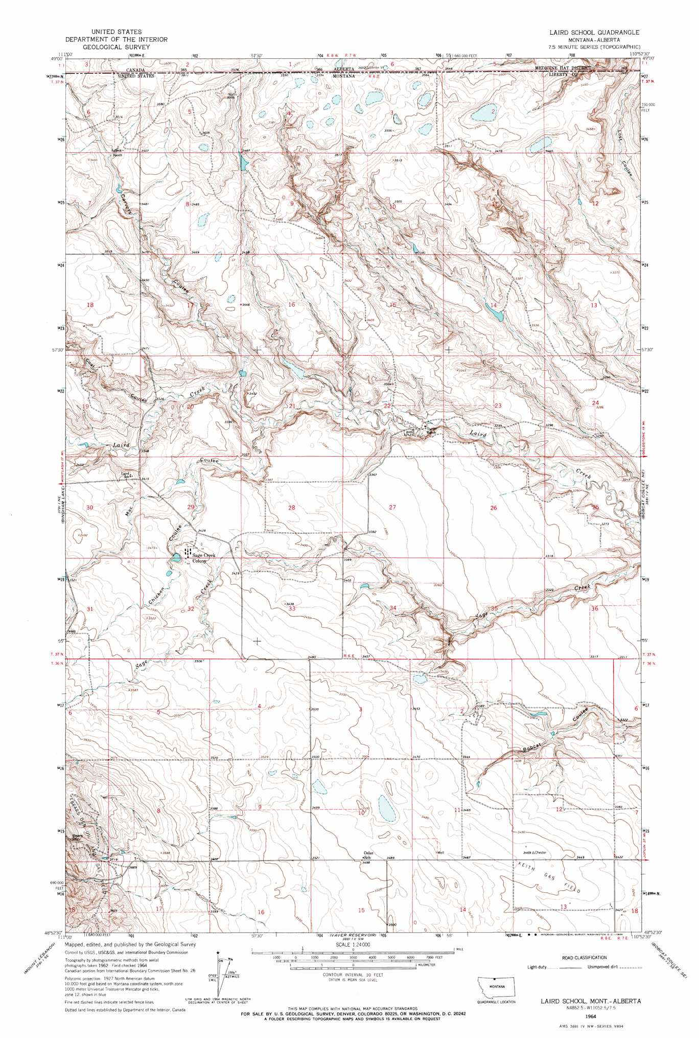
USGS Topo Quad 48110h8 - 1:24,000 scale
| Topo Map Name: | Laird School |
| USGS Topo Quad ID: | 48110h8 |
| Print Size: | ca. 21 1/4" wide x 27" high |
| Southeast Coordinates: | 48.875° N latitude / 110.875° W longitude |
| Map Center Coordinates: | 48.9375° N latitude / 110.9375° W longitude |
| U.S. State: | MT |
| Filename: | o48110h8.jpg |
| Download Map JPG Image: | Laird School topo map 1:24,000 scale |
| Map Type: | Topographic |
| Topo Series: | 7.5´ |
| Map Scale: | 1:24,000 |
| Source of Map Images: | United States Geological Survey (USGS) |
| Alternate Map Versions: |
Laird School MT 1964, updated 1966 Download PDF Buy paper map Laird School MT 2011 Download PDF Buy paper map Laird School MT 2014 Download PDF Buy paper map |
1:24,000 Topo Quads surrounding Laird School
Hawley Hill |
Bingham Lake |
Laird School |
Bobcat Coulee Ne |
Laird Lake |
Haystack Butte |
Mount Lebanon |
Vaver Reservoir |
Bobcat Coulee Se |
Goldstone Sw |
Blair Ranch |
Lakey Ranch |
Chester Nw |
Chester Ne |
Rudyard Nw |
> Back to 48110e1 at 1:100,000 scale
> Back to 48110a1 at 1:250,000 scale
> Back to U.S. Topo Maps home
Laird School topo map: Gazetteer
Laird School: Basins
Bears Den elevation 1160m 3805′Laird School: Dams
Sister Sledge Dam elevation 1050m 3444′Turner Dam elevation 1014m 3326′
Laird School: Oilfields
Keith Gas Field elevation 1049m 3441′Laird School: Populated Places
Sage Creek Colony elevation 1055m 3461′Laird School: Reservoirs
Turner Reservoir elevation 1014m 3326′Laird School: Streams
Simminook Creek elevation 974m 3195′Laird School: Valleys
Carvers Coulee elevation 1006m 3300′Chicken Coulee elevation 1024m 3359′
Coal Coulee elevation 1015m 3330′
Mac Coulee elevation 1002m 3287′
Laird School: Wells
36N06E02DBAC01 Well elevation 1038m 3405′36N06E06AACC01 Well elevation 1095m 3592′
36N06E13ADDD01 Well elevation 1045m 3428′
36N14E18ADAB01 Well elevation 1073m 3520′
37N06E06DDDB01 Well elevation 1062m 3484′
37N06E18DCCA01 Well elevation 1063m 3487′
Laird School digital topo map on disk
Buy this Laird School topo map showing relief, roads, GPS coordinates and other geographical features, as a high-resolution digital map file on DVD: