Mcbridy Spring Topo Map Montana
To zoom in, hover over the map of Mcbridy Spring
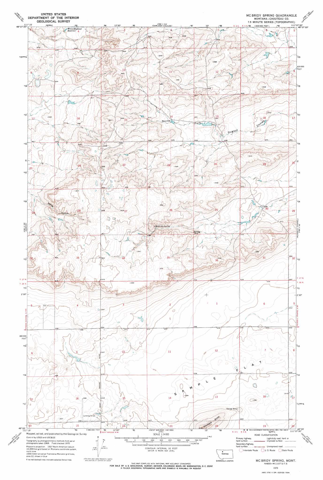
USGS Topo Quad 48111a2 - 1:24,000 scale
| Topo Map Name: | Mcbridy Spring |
| USGS Topo Quad ID: | 48111a2 |
| Print Size: | ca. 21 1/4" wide x 27" high |
| Southeast Coordinates: | 48° N latitude / 111.125° W longitude |
| Map Center Coordinates: | 48.0625° N latitude / 111.1875° W longitude |
| U.S. State: | MT |
| Filename: | o48111a2.jpg |
| Download Map JPG Image: | Mcbridy Spring topo map 1:24,000 scale |
| Map Type: | Topographic |
| Topo Series: | 7.5´ |
| Map Scale: | 1:24,000 |
| Source of Map Images: | United States Geological Survey (USGS) |
| Alternate Map Versions: |
Mc Bridy Spring MT 1970, updated 1973 Download PDF Buy paper map McBridy Spring MT 2011 Download PDF Buy paper map McBridy Spring MT 2014 Download PDF Buy paper map |
1:24,000 Topo Quads surrounding Mcbridy Spring
Denson Ranch |
Pondera School |
Lothair Sw |
Tiber Dam |
Circle Bridge |
Sollid School |
Knees Ne |
Carlson Coulee |
Uphill Creek |
Goose Bill Butte Nw |
Faris School |
Knees |
Mcbridy Spring |
Russell Chapel |
Dorner School |
Timber Coulee North |
Shannon Bridge |
Dent Bridge |
Dent Bridge Ne |
Apple School |
Timber Coulee South |
Sheep Coulee Springs |
Antelope Flat |
Antelope Lake |
Carter |
> Back to 48111a1 at 1:100,000 scale
> Back to 48110a1 at 1:250,000 scale
> Back to U.S. Topo Maps home
Mcbridy Spring topo map: Gazetteer
Mcbridy Spring: Dams
Three Pronged Fork Dam elevation 1012m 3320′Mcbridy Spring: Flats
Sample Flat elevation 1004m 3293′Mcbridy Spring: Pillars
Haystack Butte elevation 1085m 3559′Mcbridy Spring: Reservoirs
White Elephant Reservoir elevation 1009m 3310′Mcbridy Spring: Springs
McBridy Spring elevation 1065m 3494′Mcbridy Spring: Summits
Hay Stack Coulee elevation 1085m 3559′Mcbridy Spring: Valleys
Hells Gulch elevation 1026m 3366′Mcbridy Spring: Wells
26N04E03DBAC01 Well elevation 1027m 3369′Mcbridy Spring digital topo map on disk
Buy this Mcbridy Spring topo map showing relief, roads, GPS coordinates and other geographical features, as a high-resolution digital map file on DVD: