Lothair Topo Map Montana
To zoom in, hover over the map of Lothair
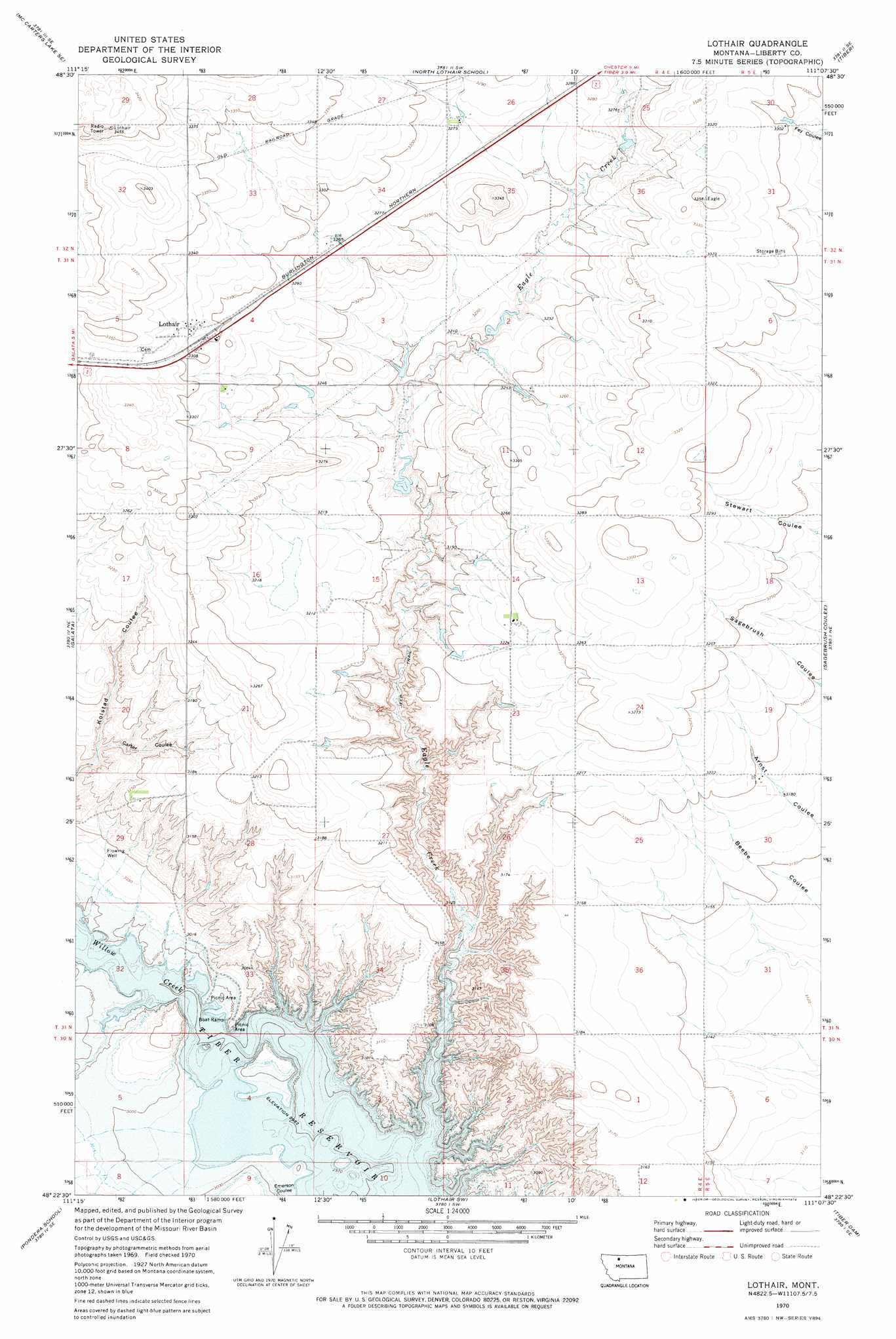
USGS Topo Quad 48111d2 - 1:24,000 scale
| Topo Map Name: | Lothair |
| USGS Topo Quad ID: | 48111d2 |
| Print Size: | ca. 21 1/4" wide x 27" high |
| Southeast Coordinates: | 48.375° N latitude / 111.125° W longitude |
| Map Center Coordinates: | 48.4375° N latitude / 111.1875° W longitude |
| U.S. State: | MT |
| Filename: | o48111d2.jpg |
| Download Map JPG Image: | Lothair topo map 1:24,000 scale |
| Map Type: | Topographic |
| Topo Series: | 7.5´ |
| Map Scale: | 1:24,000 |
| Source of Map Images: | United States Geological Survey (USGS) |
| Alternate Map Versions: |
Lothair MT 1970, updated 1974 Download PDF Buy paper map Lothair MT 2011 Download PDF Buy paper map Lothair MT 2014 Download PDF Buy paper map |
1:24,000 Topo Quads surrounding Lothair
Hawthorne School |
Berkholder Reservoir |
Blair Ranch |
Lakey Ranch |
Chester Nw |
Mccarters Lake |
Mccarters Lake Se |
North Lothair School |
Tiber |
Chester |
Devon |
Galata |
Lothair |
Sagebrush Coulee |
Poverty Coulee |
Denson Ranch |
Pondera School |
Lothair Sw |
Tiber Dam |
Circle Bridge |
Sollid School |
Knees Ne |
Carlson Coulee |
Uphill Creek |
Goose Bill Butte Nw |
> Back to 48111a1 at 1:100,000 scale
> Back to 48110a1 at 1:250,000 scale
> Back to U.S. Topo Maps home
Lothair topo map: Gazetteer
Lothair: Dams
Bourne and Hamilton Number 2 Dam elevation 973m 3192′Lothair: Populated Places
Lothair elevation 1012m 3320′Lothair: Post Offices
Lothair Post Office (historical) elevation 1012m 3320′Lothair: Reservoirs
Bourne and Hamilton Reservoir elevation 973m 3192′Lothair: Streams
Eagle Creek elevation 910m 2985′Lothair: Valleys
Carter Coulee elevation 935m 3067′Emerson Coulee elevation 910m 2985′
Lothair: Wells
31N05E07BABC01 Well elevation 1007m 3303′Lothair digital topo map on disk
Buy this Lothair topo map showing relief, roads, GPS coordinates and other geographical features, as a high-resolution digital map file on DVD: