South Devon School Topo Map Montana
To zoom in, hover over the map of South Devon School
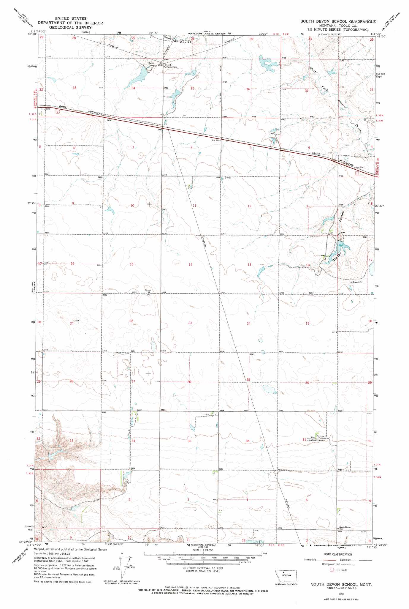
USGS Topo Quad 48111d5 - 1:24,000 scale
| Topo Map Name: | South Devon School |
| USGS Topo Quad ID: | 48111d5 |
| Print Size: | ca. 21 1/4" wide x 27" high |
| Southeast Coordinates: | 48.375° N latitude / 111.5° W longitude |
| Map Center Coordinates: | 48.4375° N latitude / 111.5625° W longitude |
| U.S. State: | MT |
| Filename: | o48111d5.jpg |
| Download Map JPG Image: | South Devon School topo map 1:24,000 scale |
| Map Type: | Topographic |
| Topo Series: | 7.5´ |
| Map Scale: | 1:24,000 |
| Source of Map Images: | United States Geological Survey (USGS) |
| Alternate Map Versions: |
South Devon School MT 1967, updated 1970 Download PDF Buy paper map South Devon School MT 2011 Download PDF Buy paper map South Devon School MT 2014 Download PDF Buy paper map |
1:24,000 Topo Quads surrounding South Devon School
Oilmont |
Antelope Coulee Nw |
Johannson Coulee |
Hawthorne School |
Berkholder Reservoir |
Shelby |
Antelope Coulee Sw |
Antelope Coulee Se |
Mccarters Lake |
Mccarters Lake Se |
Naismith |
Dunkirk |
South Devon School |
Devon |
Galata |
Ledger |
Conrad Butte |
Central School |
Denson Ranch |
Pondera School |
Letz Lake |
Fowler Coulee Nw |
Fowler Coulee Ne |
Sollid School |
Knees Ne |
> Back to 48111a1 at 1:100,000 scale
> Back to 48110a1 at 1:250,000 scale
> Back to U.S. Topo Maps home
South Devon School topo map: Gazetteer
South Devon School: Dams
Bar Z F Ranch Incorporated Number 1 Dam elevation 1004m 3293′Johnson Dam elevation 977m 3205′
Sagittaurius Dam elevation 964m 3162′
Three Dollar Bill Dam elevation 968m 3175′
Westermark Dam elevation 980m 3215′
White Dam elevation 981m 3218′
South Devon School: Post Offices
Telstad Post Office (historical) elevation 982m 3221′South Devon School digital topo map on disk
Buy this South Devon School topo map showing relief, roads, GPS coordinates and other geographical features, as a high-resolution digital map file on DVD: