Dunkirk Topo Map Montana
To zoom in, hover over the map of Dunkirk
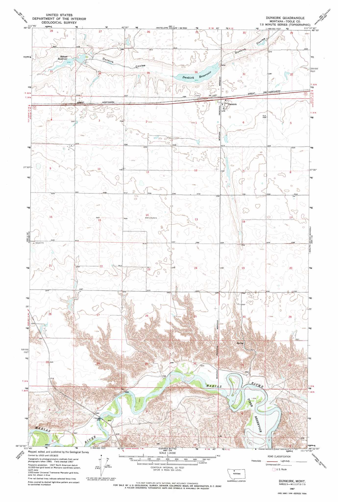
USGS Topo Quad 48111d6 - 1:24,000 scale
| Topo Map Name: | Dunkirk |
| USGS Topo Quad ID: | 48111d6 |
| Print Size: | ca. 21 1/4" wide x 27" high |
| Southeast Coordinates: | 48.375° N latitude / 111.625° W longitude |
| Map Center Coordinates: | 48.4375° N latitude / 111.6875° W longitude |
| U.S. State: | MT |
| Filename: | o48111d6.jpg |
| Download Map JPG Image: | Dunkirk topo map 1:24,000 scale |
| Map Type: | Topographic |
| Topo Series: | 7.5´ |
| Map Scale: | 1:24,000 |
| Source of Map Images: | United States Geological Survey (USGS) |
| Alternate Map Versions: |
Dunkirk MT 1967, updated 1971 Download PDF Buy paper map Dunkirk MT 2011 Download PDF Buy paper map Dunkirk MT 2014 Download PDF Buy paper map |
1:24,000 Topo Quads surrounding Dunkirk
Kevin South |
Oilmont |
Antelope Coulee Nw |
Johannson Coulee |
Hawthorne School |
Virden |
Shelby |
Antelope Coulee Sw |
Antelope Coulee Se |
Mccarters Lake |
Ledger Nw |
Naismith |
Dunkirk |
South Devon School |
Devon |
Pioneer School |
Ledger |
Conrad Butte |
Central School |
Denson Ranch |
Conrad |
Letz Lake |
Fowler Coulee Nw |
Fowler Coulee Ne |
Sollid School |
> Back to 48111a1 at 1:100,000 scale
> Back to 48110a1 at 1:250,000 scale
> Back to U.S. Topo Maps home
Dunkirk topo map: Gazetteer
Dunkirk: Bridges
F Bridge elevation 921m 3021′Dunkirk: Dams
G N R R Dunkirk Reservoir Dam elevation 992m 3254′German Reservoir Dam elevation 1021m 3349′
Melcott Dam elevation 1004m 3293′
Wilson Number 1 Dam elevation 1016m 3333′
Wilson Number 2 Dam elevation 1022m 3353′
Dunkirk: Populated Places
Dunkirk elevation 1007m 3303′Dunkirk: Post Offices
Dunkirk Post Office (historical) elevation 1007m 3303′Dunkirk: Reservoirs
Dunkirk Reservoir elevation 992m 3254′Melcott Reservoir elevation 1004m 3293′
Wilson Reservoir elevation 1022m 3353′
Wilson Reservoir elevation 1016m 3333′
Dunkirk digital topo map on disk
Buy this Dunkirk topo map showing relief, roads, GPS coordinates and other geographical features, as a high-resolution digital map file on DVD: