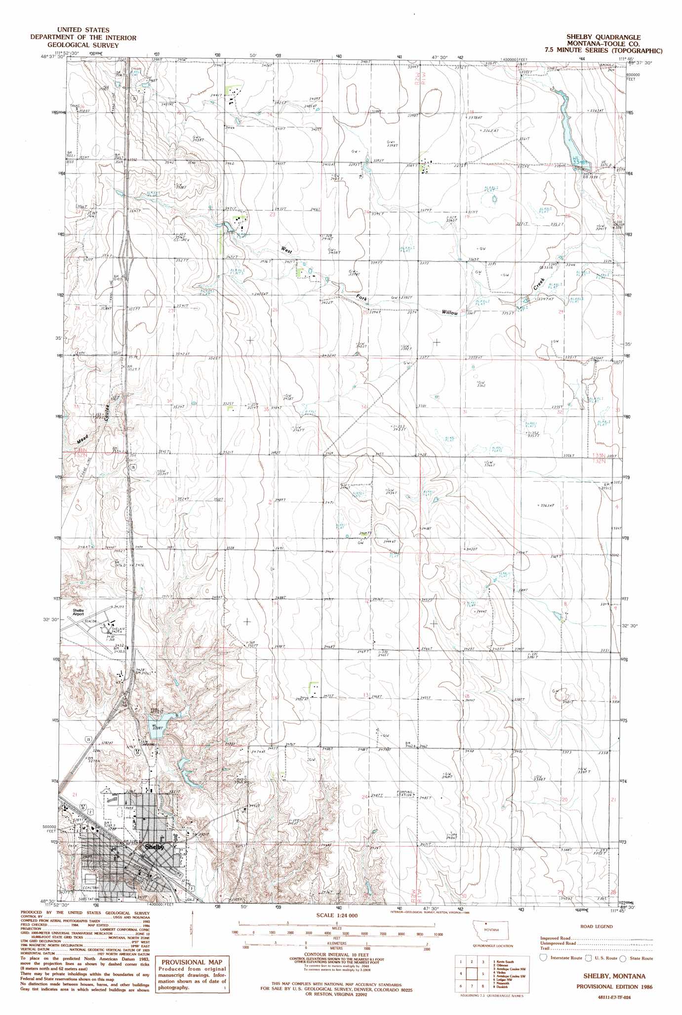
Shelby Topo Map Montana
To zoom in, hover over the map of Shelby
USGS Topo Quad 48111e7 - 1:24,000 scale
| Topo Map Name: | Shelby |
| USGS Topo Quad ID: | 48111e7 |
| Print Size: | ca. 21 1/4" wide x 27" high |
| Southeast Coordinates: | 48.5° N latitude / 111.75° W longitude |
| Map Center Coordinates: | 48.5625° N latitude / 111.8125° W longitude |
| U.S. State: | MT |
| Filename: | o48111e7.jpg |
| Download Map JPG Image: | Shelby topo map 1:24,000 scale |
| Map Type: | Topographic |
| Topo Series: | 7.5´ |
| Map Scale: | 1:24,000 |
| Source of Map Images: | United States Geological Survey (USGS) |
| Alternate Map Versions: |
Shelby MT 1986, updated 1986 Download PDF Buy paper map Shelby MT 2011 Download PDF Buy paper map Shelby MT 2014 Download PDF Buy paper map |
1:24,000 Topo Quads surrounding Shelby
Mountain View School |
Kevin North |
Ferdig |
Fivemile Coulee West |
Fivemile Coulee East |
Aloe |
Kevin South |
Oilmont |
Antelope Coulee Nw |
Johannson Coulee |
Ethridge |
Virden |
Shelby |
Antelope Coulee Sw |
Antelope Coulee Se |
Cactus Flat |
Ledger Nw |
Naismith |
Dunkirk |
South Devon School |
Belgian Hill |
Pioneer School |
Ledger |
Conrad Butte |
Central School |
> Back to 48111e1 at 1:100,000 scale
> Back to 48110a1 at 1:250,000 scale
> Back to U.S. Topo Maps home
Shelby topo map: Gazetteer
Shelby: Airports
Shelby Airport elevation 1044m 3425′Shelby: Bridges
Great Northern Railway Overpass elevation 1002m 3287′Shelby: Crossings
Interchange 364 elevation 1034m 3392′Interchange 369 elevation 1086m 3562′
Shelby: Dams
Cowpath Dam elevation 1040m 3412′H E Benjamin Junior Dam elevation 1029m 3375′
Sullivan Dam elevation 1027m 3369′
Shelby: Parks
Andy Anderson Park elevation 1010m 3313′Aronow Park elevation 1003m 3290′
Cleveland Park elevation 1026m 3366′
Johnson Memorial Park elevation 1016m 3333′
Lake Shel-oole Baseball Complex elevation 1027m 3369′
Mary Allison Blue Sky Park elevation 1004m 3293′
Shelby City Park elevation 1005m 3297′
Shel-oole Park elevation 1027m 3369′
Shelby: Populated Places
Shelby elevation 1005m 3297′Shelby: Post Offices
Shelby Post Office elevation 1005m 3297′Shelby: Reservoirs
Lake Shel-oole elevation 1018m 3339′Shelby: Valleys
Hall Coulee elevation 1029m 3375′Shelby digital topo map on disk
Buy this Shelby topo map showing relief, roads, GPS coordinates and other geographical features, as a high-resolution digital map file on DVD: