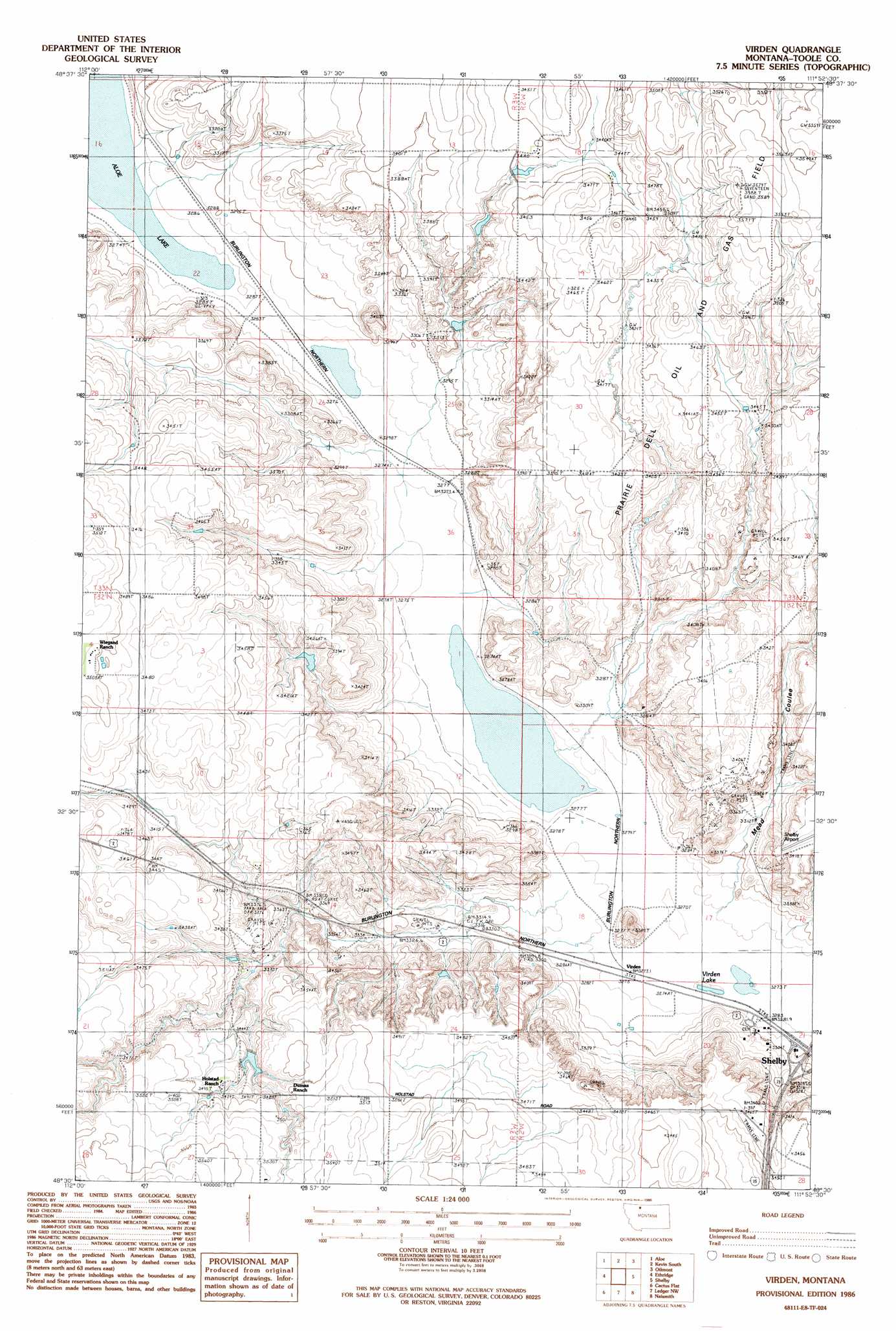
Virden Topo Map Montana
To zoom in, hover over the map of Virden
USGS Topo Quad 48111e8 - 1:24,000 scale
| Topo Map Name: | Virden |
| USGS Topo Quad ID: | 48111e8 |
| Print Size: | ca. 21 1/4" wide x 27" high |
| Southeast Coordinates: | 48.5° N latitude / 111.875° W longitude |
| Map Center Coordinates: | 48.5625° N latitude / 111.9375° W longitude |
| U.S. State: | MT |
| Filename: | o48111e8.jpg |
| Download Map JPG Image: | Virden topo map 1:24,000 scale |
| Map Type: | Topographic |
| Topo Series: | 7.5´ |
| Map Scale: | 1:24,000 |
| Source of Map Images: | United States Geological Survey (USGS) |
| Alternate Map Versions: |
Virden MT 1986, updated 1986 Download PDF Buy paper map Virden MT 2011 Download PDF Buy paper map Virden MT 2014 Download PDF Buy paper map |
1:24,000 Topo Quads surrounding Virden
Glacier Colony |
Mountain View School |
Kevin North |
Ferdig |
Fivemile Coulee West |
Ethridge Nw |
Aloe |
Kevin South |
Oilmont |
Antelope Coulee Nw |
Boru Spring |
Ethridge |
Virden |
Shelby |
Antelope Coulee Sw |
Abbott Lake |
Cactus Flat |
Ledger Nw |
Naismith |
Dunkirk |
Valier East |
Belgian Hill |
Pioneer School |
Ledger |
Conrad Butte |
> Back to 48111e1 at 1:100,000 scale
> Back to 48110a1 at 1:250,000 scale
> Back to U.S. Topo Maps home
Virden topo map: Gazetteer
Virden: Crossings
Interchange 363 elevation 1006m 3300′Virden: Dams
Alkali Flat Dam elevation 995m 3264′Flesch Number 1 Dam elevation 1037m 3402′
Virden: Lakes
Verden Lake elevation 995m 3264′Virden Lake elevation 999m 3277′
Virden: Populated Places
Virden elevation 1000m 3280′Virden: Valleys
Dumas Coulee elevation 1033m 3389′Gavagain Coulee elevation 997m 3270′
Mead Coulee elevation 1000m 3280′
Reservoir Coulee elevation 1000m 3280′
Watson Coulee elevation 1002m 3287′
Virden digital topo map on disk
Buy this Virden topo map showing relief, roads, GPS coordinates and other geographical features, as a high-resolution digital map file on DVD: