Oilmont Topo Map Montana
To zoom in, hover over the map of Oilmont
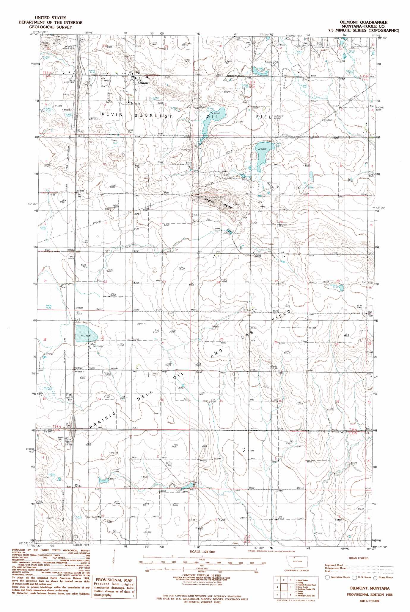
USGS Topo Quad 48111f7 - 1:24,000 scale
| Topo Map Name: | Oilmont |
| USGS Topo Quad ID: | 48111f7 |
| Print Size: | ca. 21 1/4" wide x 27" high |
| Southeast Coordinates: | 48.625° N latitude / 111.75° W longitude |
| Map Center Coordinates: | 48.6875° N latitude / 111.8125° W longitude |
| U.S. State: | MT |
| Filename: | o48111f7.jpg |
| Download Map JPG Image: | Oilmont topo map 1:24,000 scale |
| Map Type: | Topographic |
| Topo Series: | 7.5´ |
| Map Scale: | 1:24,000 |
| Source of Map Images: | United States Geological Survey (USGS) |
| Alternate Map Versions: |
Oilmont MT 1986, updated 1986 Download PDF Buy paper map Oilmont MT 2011 Download PDF Buy paper map Oilmont MT 2014 Download PDF Buy paper map |
1:24,000 Topo Quads surrounding Oilmont
Hillside Colony |
Sunburst |
Willshaw Flats |
Beaupre Coulee |
West Butte |
Mountain View School |
Kevin North |
Ferdig |
Fivemile Coulee West |
Fivemile Coulee East |
Aloe |
Kevin South |
Oilmont |
Antelope Coulee Nw |
Johannson Coulee |
Ethridge |
Virden |
Shelby |
Antelope Coulee Sw |
Antelope Coulee Se |
Cactus Flat |
Ledger Nw |
Naismith |
Dunkirk |
South Devon School |
> Back to 48111e1 at 1:100,000 scale
> Back to 48110a1 at 1:250,000 scale
> Back to U.S. Topo Maps home
Oilmont topo map: Gazetteer
Oilmont: Crossings
Interchange 373 elevation 1053m 3454′Interchange 379 elevation 1054m 3458′
Oilmont: Dams
Flesch Number 2 Dam elevation 1036m 3398′Kelleher Dam elevation 1083m 3553′
Oilmont: Populated Places
Oilmont elevation 1067m 3500′Oilmont: Post Offices
Oilmont Post Office elevation 1067m 3500′Oilmont: Summits
Raglan Butte elevation 1092m 3582′Oilmont: Wells
33N02W01CDCD01 Well elevation 1031m 3382′33N02W02DACD01 Well elevation 1044m 3425′
33N02W02DCAA01 Well elevation 1037m 3402′
33N02W02DCAA02 Well elevation 1044m 3425′
Oilmont digital topo map on disk
Buy this Oilmont topo map showing relief, roads, GPS coordinates and other geographical features, as a high-resolution digital map file on DVD: